Hot with increasing humidity in North Texas this week


Monday marked North Texas' 37th triple-digit day of the year, with a high temperature of 102°.
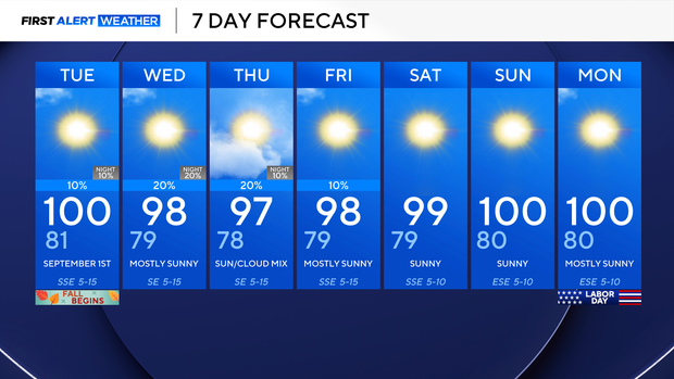
DFW will hang onto the heat this week, but air temperatures dip back into the upper 90s for much of the workweek. This is thanks to some increased cloud cover and increasing humidity, especially as we head into the middle of this week.
That means that while air temperatures are in the upper 90s, it will actually feel a smidge hotter, thanks to increased humidity. Expect renewed heat alerts by the middle of the week.
This increased moisture is all thanks to an area we're watching in the tropics.
Tropical Storm Edouard has formed in the Gulf. We expect landfall sometime Tuesday afternoon or evening somewhere between Houston and the Louisiana border.
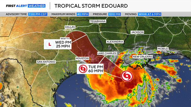
This looks to bring heavy rain from Houston to Galveston and up into Beaumont, as well as portions of Southwestern Louisiana.
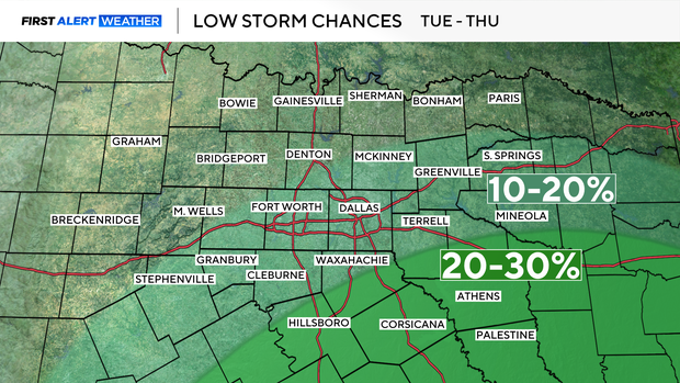
For North Texas, we're looking at increased humidity and isolated shower chances Tuesday through Thursday.
Areas of North Texas with the greatest potential for showers will be our far southern and southeastern counties, where we could see as much as 0.25"-1", in scattered spots.
That system should fizzle midweek due to land interaction, as well as the strong ridge of high pressure to our north, which remains the dominating forecast force.
This sees North Texas into Labor Day weekend with hot and dry conditions.