North Texas temperatures still dangerously hot for Saturday

There is no heat advisory or extreme heat warning for North Texas on Saturday. However, temperatures will remain dangerously high for anyone spending extended periods outdoors.
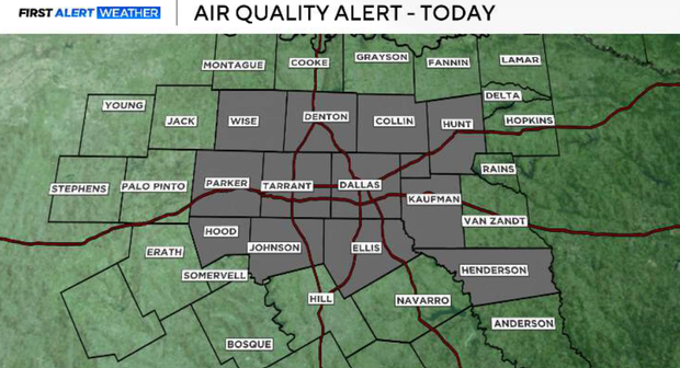
An ozone action day is also in effect today. Those with asthma or other respiratory sensitivities should consider limiting prolonged outdoor activity.
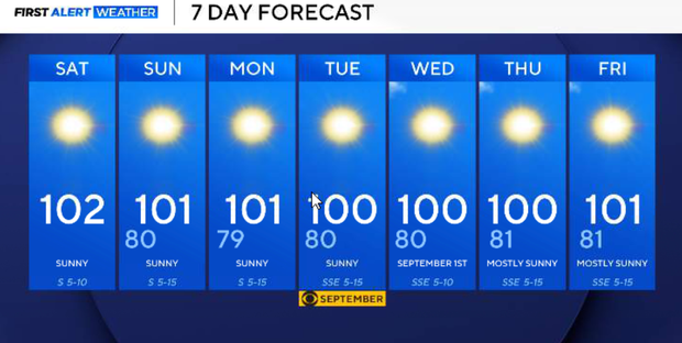
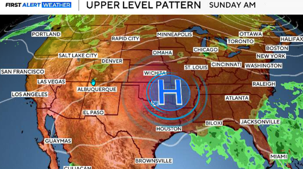
The large upper-level ridge that has dominated our weather for much of August is shifting east and becoming centered over Oklahoma and North Texas this weekend. That keeps us locked into a hot and overwhelmingly dry pattern, with highs generally between 97° and 104° through the weekend and much of next week.
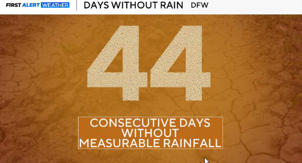
The lack of rainfall is becoming an increasingly important part of the forecast. DFW has now gone 44 days without measurable rainfall, dating back to July 15. Only a trace has been recorded so far this August.
For the rest of Saturday, there will be plenty of sunshine with temperatures heating up quickly. We started this morning in the 70s and low 80s, then climbed into the mid-90s by lunchtime. Afternoon highs will be near 100°F, with DFW at 102°F. The good news is that lower-level moisture should mix out during the afternoon. That will keep heat index values below the 105° Heat Advisory threshold, so no heat advisory is planned today. Winds remain relatively light, generally from the south to southeast around 5–10 mph.
For Saturday night, mostly clear and warm conditions continue, with temperatures falling into the upper 70s around the Metroplex. No meaningful rainfall is expected.
Sunday brings more of the same: sunshine, dry conditions, and triple-digit heat. The upper ridge remains firmly established over Oklahoma and North Texas, keeping meaningful rain chances out of the forecast.
There is very little meaningful change through much of next week. Highs remain between roughly 98° and 104° each afternoon. The ridge may weaken slightly around midweek, allowing temperatures to come down a degree or two, but this is not a significant cooldown. Humidity may begin increasing by the middle or latter part of the week. Even if actual temperatures don't rise much, the added moisture could push heat index values high enough for Heat Advisories to return.
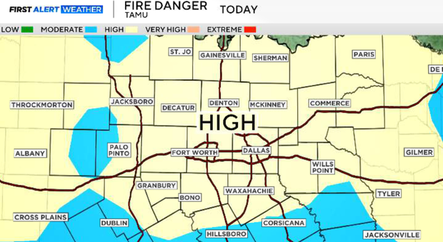
The combination of persistent heat, low afternoon humidity, worsening drought, and little to no rainfall will keep the wildfire threat elevated through next week. The drought has expanded significantly over the past month, and without widespread wetting rainfall in the forecast, vegetation will continue to dry. That means even though winds are relatively light this weekend, conditions remain favorable for new fire starts.
Unfortunately, there is currently no meaningful heat relief showing up for Labor Day weekend. Both major global forecast models indicate the upper ridge may strengthen and build west again late next week. If that happens, temperatures would begin nudging upward again while the dry pattern continues.