DFW rain-free streak hits 57 days as September heat sets triple-digit record


The rain-free streak continues. We are now at 57 days without measurable rain for DFW. The line fizzled just upon approach Thursday night.
While areas west of I-35 got a good soaking rain, areas to the east of I-35 were much more spotty, with no rain at DFW, where records are kept. We'll go another week without any widespread rain chances.
Isolated showers and storm chances will be possible throughout the day on Friday, but coverage will be very localized.
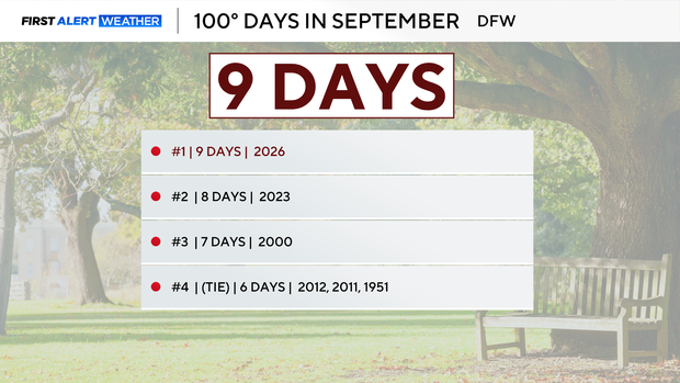
DFW hits record 9 triple-digit days in September
There's no heat advisory in place for Thursday, although we hit 100 ahead of the rain, marking the most triple-digit days during the month of September in DFW history, beating 2023, which had 8 days. Thursday marks 9 days for DFW.