Fire danger threat remains for North Texas as temperatures hit triple-digits to end week

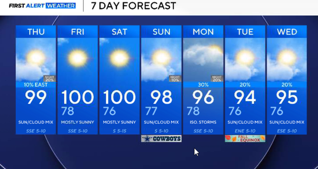
There is no heat advisory on Thursday; however, North Texas will still be very hot, with highs near 100°. The elevated fire-weather concerns also continue into the weekend.
A look at your Thursday
Temperatures will reach the upper 90s to around 100° by Thursday afternoon.
There is a very small chance for a brief storm or shower east of I-35 as somewhat deeper moisture moves into eastern North Texas. Coverage should be extremely limited.
The strong ridge continues to promote sinking and drying air aloft, making it difficult for thunderstorms to develop or survive.
For most of North Texas, Thursday remains dry.
However, by Thursday night, any isolated afternoon thunderstorm east of DFW will quickly fade with the loss of daytime heating. Otherwise, expect another warm and predominantly clear night. Lows will be in the mid to upper 70s.
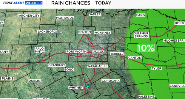
Very little changes on Friday. The upper ridge remains strong enough to keep North Texas hot and predominantly dry, with highs again approaching 100°. The fire threat also remains elevated.
Grass fire threat continues
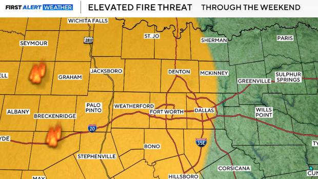
Elevated fire-weather concerns continue along and west of I-35. The combination of temperatures near 100°, low afternoon humidity and increasingly drought-stressed vegetation will continue to make grassfires a concern.
The elevated fire threat is expected to persist into the weekend.
What's expected for this weekend?
The ridge finally begins showing more meaningful weakening as a trough moves out of the western U.S. and into the Plains. Unfortunately, that doesn't translate into immediate relief at the surface.
Saturday will remain hot and predominantly dry, with highs near 100°. The elevated grass-fire threat continues.
Sunday is likely the last day near 100° before at least some modest improvement. A frontal boundary begins sagging south toward North Texas Sunday night as the upper trough swings through the Southern Plains.
Showers and thunderstorms should initially be concentrated more northwest of North Texas, with rain chances increasing as the boundary approaches Sunday night.
Next week
The pattern will finally begin changing next Monday.
The front should sag into North Texas, but there is still uncertainty regarding how far south it ultimately gets. Rather than a clean frontal passage, the boundary may linger somewhere across the region.
Moisture pooling along the boundary should support widely scattered showers and thunderstorms. This does not currently look like widespread soaking rain, but it should be a noticeable improvement over the virtually rain-free pattern we've experienced.
The stalled or nearby boundary, deeper moisture and disturbances moving through the larger-scale flow should keep at least some rain and thunderstorm opportunities around into the middle of next week. Cloud cover and occasional rain should also help lower temperatures. Instead of near 100°, highs should fall into the low to mid-90s.
However, significantly cooler air remains well north of North Texas. So, this is not the arrival of fall.
Looking Ahead
There are indications that the ridge begins strengthening again during the latter half of next week. That would favor temperatures remaining above normal while rain chances eventually decrease.
So, the early-next-week change currently looks like a temporary break from the extreme September heat, not a permanent transition into fall.