Dangerous cold continues across North Texas with subzero wind chills
A First Alert Weather Day remains in effect on Thursday as wind chills dip to dangerous levels, making it feel like below zero across the Metroplex.
Watch CBS News
A First Alert Weather Day remains in effect on Thursday as wind chills dip to dangerous levels, making it feel like below zero across the Metroplex.

An extreme cold warning is in effect until 9 a.m. Thursday. It includes all of North Texas.
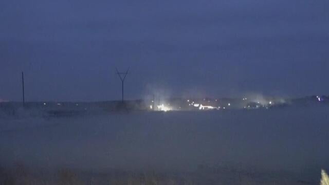
First Alert Weather meteorologist Scott Padgett breaks down lake-effect snow, a rare phenomenon in North Texas, as cold winds blow over area lakes.
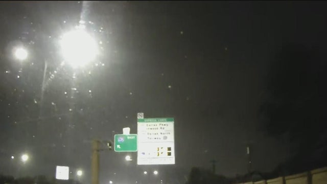
While no major accumulation has been reported, the express lanes on 635 are closed due to light snowfall across North Texas on Wednesday morning.
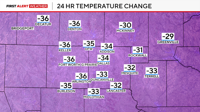
An extreme cold warning is in place through Thursday morning as North Texas faces the coldest temperatures since January of last year, with wind chills dropping as low as -12 degrees.
A handful of school districts canceled classes for Wednesday and others have issued a delayed start.

Dangerous cold remains a threat through Thursday.
An extreme cold weather warning is in place from Tuesday night into Thursday morning for temperatures in the teens.

CBS News Texas meteorologists have issued First Alert Weather Days for Tuesday–Thursday for potentially dangerous conditions.
There is a risk of ice on bridges and overpasses Tuesday night, with the coldest air of winter expected on Wednesday and Thursday morning.

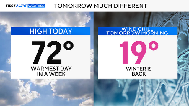
Enjoy a warm Saturday with temperatures near 72 degrees before a cold front drops temperatures into the 20s overnight.
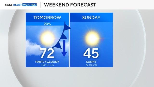
Spotty showers are expected overnight tonight, followed by a warm and breezy Saturday. A cool-down is anticipated on Sunday.
A First Alert Weather Day is issued when high-impact weather conditions are forecast for a specific day.

With highs Saturday in the low 70s to then highs Sunday in the mid 40s, North Texas is getting another weekend with a tale of two seasons.
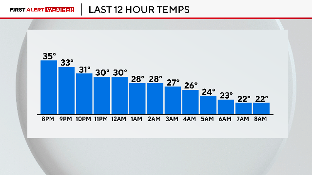
Dangerous wind chills dropped "feels-like" temperatures to the teens and single digits in DFW.
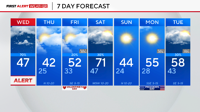
Rain will taper out by the end of the morning commute.
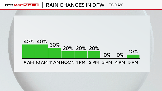
Grab an umbrella and be cautious on the roadways across North Texas.

First Alert Weather Days are in place on Tuesday and Wednesday for disruptive rain in the forecast.

A First Alert Weather Day is in effect as a cold front drops temperatures into the 40s, with breezy winds and the chance of isolated showers.
Indoors will be the place to be on Sunday for your Super Bowl watch party.

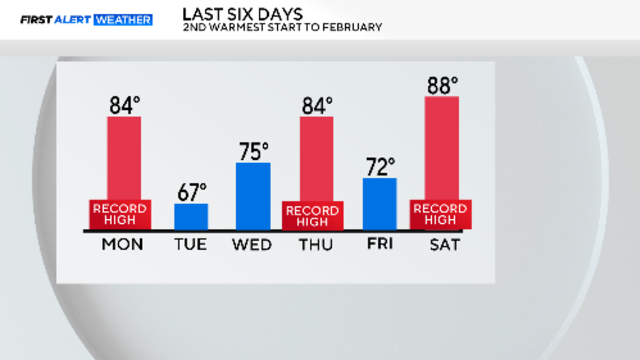
DFW is set for a rollercoaster of temperatures this weekend, with a record high of 85 degrees giving way to a cold front by Sunday.
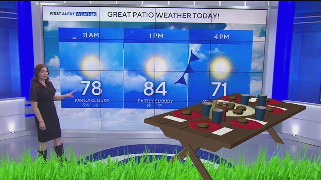
Expect warm highs in the 80s before a cold front sweeps through North Texas, plummeting temps into the 50s by Saturday evening.
A First Alert Weather Day is in place for Sunday as temperatures in North Texas are set to drop by nearly 30 degrees.

North Texas is seeing muggy conditions this morning, with a stalled front causing varied temperatures.

Thursday will be another tricky day with the temperature forecast.