Weather rollercoaster hits North Texas with record high Saturday and chilly Super Bowl Sunday
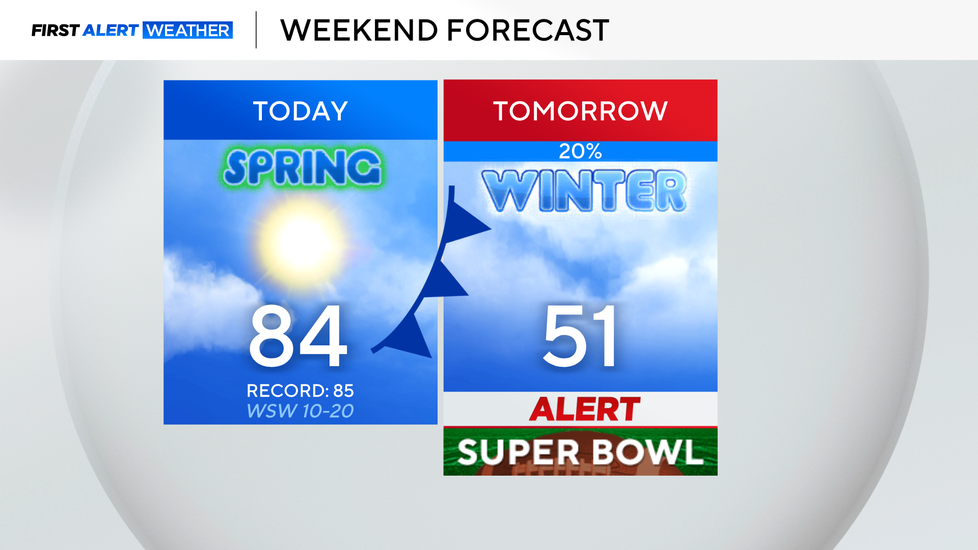
Who is ready for a rollercoaster weekend? The record high today for Dallas-Fort Worth is 85 and it will be close.
A warm, muggy and breezy Saturday morning is underway with temperatures in the 60s and 70s.
Strong southerly winds will boost temperatures into the 80s ahead of a cold front.
High temperatures will occur around 1 to 2 p.m. in the Metroplex before the cold front arrives, plunging temperatures for the rest of the afternoon.
Northwest areas will already be in the 60s by midday behind the front. Jackets will ne needed for any evening plans.
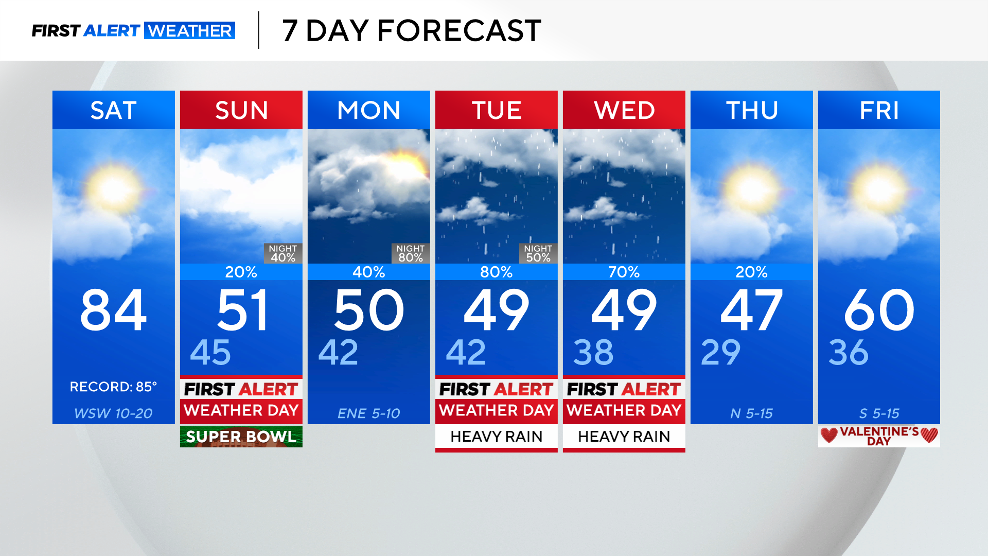
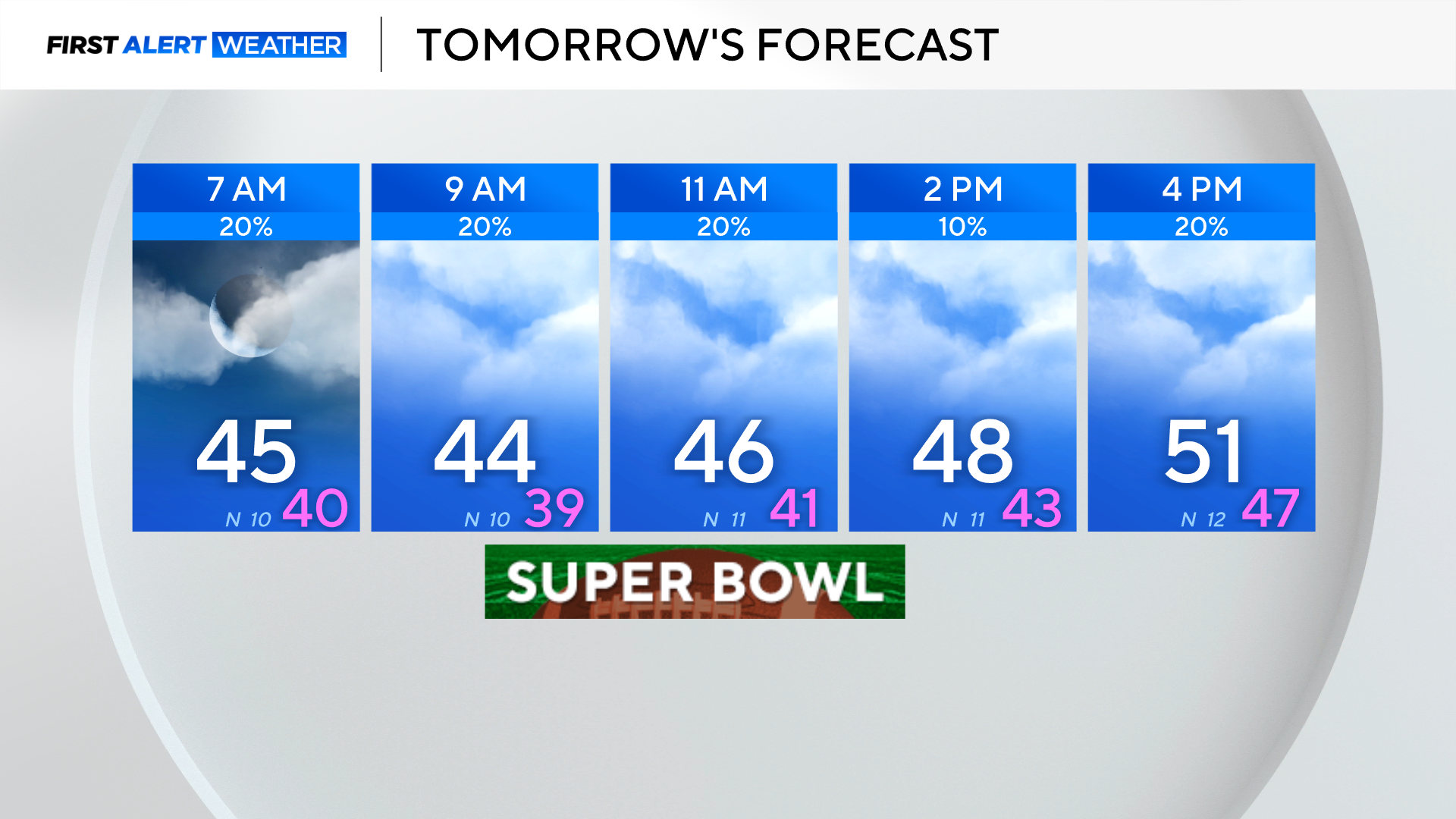
Tomorrow is a First Alert Weather Day for the drastically colder temperatures.
Temperatures won't warm much tomorrow as breezy northerly winds continue to draw in cold air.
Most of the day will be spent in the 40s with an isolated shower possible.
The colder air remains in place keeping temperatures below normal through the upcoming week with highs mainly in the 40s.
An unsettled pattern develops next week, and the CBS News Texas Weather Team will be tracking two disturbances.
First Alert Weather Days have been issued for Tuesday and Wednesday due to widespread disruptive rain arriving in North Texas.
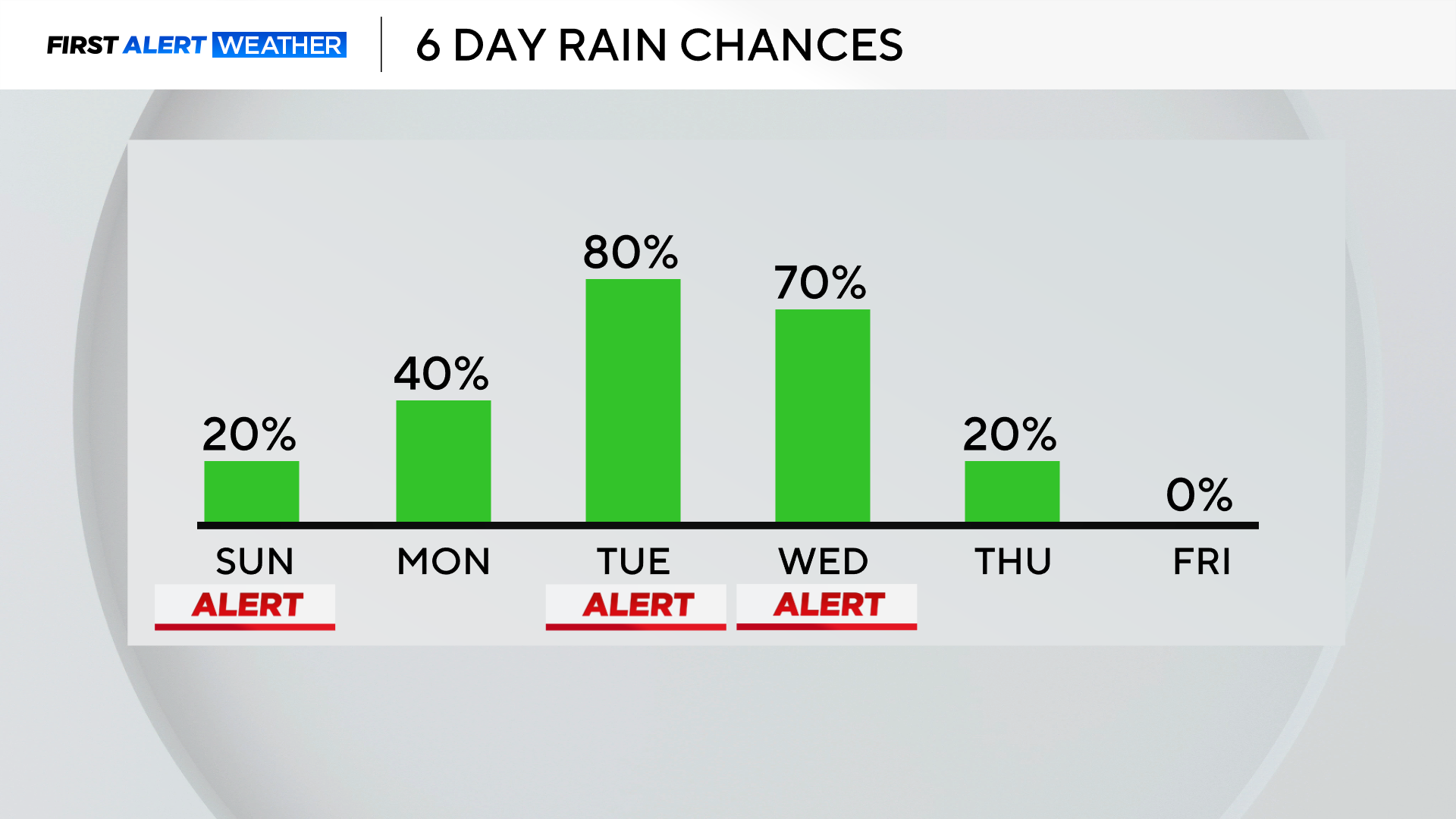
Widespread 1 to 2 inches of rainfall totals are likely next week with the highest totals focused east of I-35.
Enjoy today's spring temperatures because jackets and rain gear will be needed next week.