North Texas prepares for disruptive rain Tuesday and Wednesday


North Texas woke up to wet and dreary conditions Monday morning thanks to moist and cool air over the region. The gray skies continued throughout the day and will worsen over the next few days.
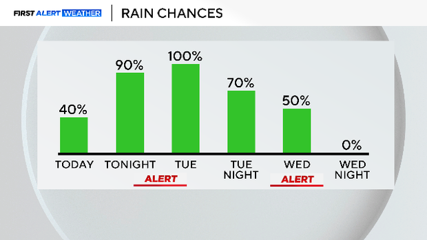
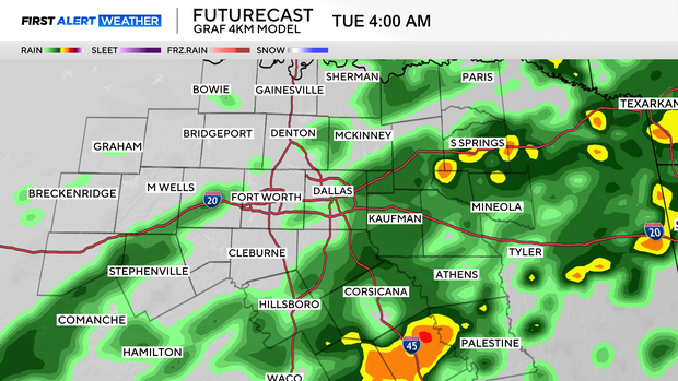
More rain will develop Monday night, with coverage increasing to 100% overnight.
Heavy rain expected in North Texas on Tuesday and Wednesday
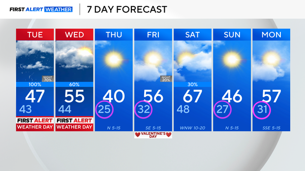
First Alert Weather Days are in place on Tuesday and Wednesday for disruptive rain in the forecast.
Rain coverage starts to build Monday night, and overnight into Tuesday morning. Widespread scattered shower activity is expected through the Tuesday morning drive, with some heavier pockets of rain at times.
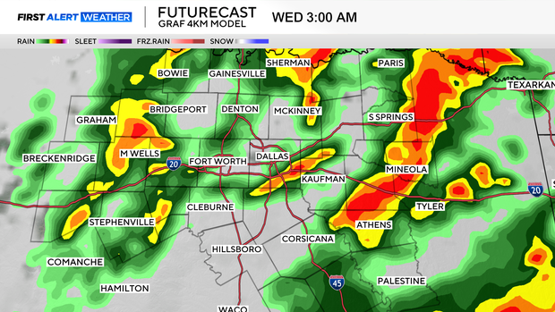
Rain coverage starts to decrease Tuesday afternoon, before the next disturbance rolls in overnight and into Wednesday morning.
Once again heavy showers are expected into early Wednesday morning, with a few rumbles of thunder.
This looks to clear up by about late-morning Wednesday, which is likely when that First Alert Weather Day will end. But back behind that, a cold front rolls through into Thursday, and even colder temperatures arrive. Feels-like temps will start off in the teens Thursday morning, with highs only in the upper 30s and lower 40s.
Temperatures warm up a little on Friday, with highs back into the middle 50s. Saturday will be a bit cloudier, with isolated shower chances, mainly east. Highs warm to the upper 60s ahead of another cold front that cools off the area again on Sunday.