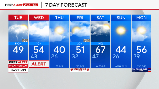
Disruptive, heavy rain across North Texas prompts First Alert Weather Day

NORTH TEXAS – A First Alert Weather Day is in effect on Tuesday due to disruptive rain and isolated storms that could be heavy at times. Storms will redevelop overnight, leading to another First Alert Weather Day on Wednesday.
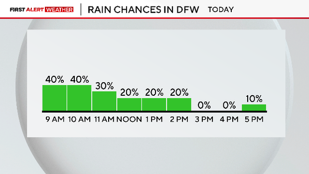
Rain chances were the highest in the early morning hours as the first shortwave moved over North Texas on Tuesday. The clearing is happening a bit earlier than forecast but there will still be some drizzle or light rain through the afternoon hours.
A cold front moving in will increase rain chances in the overnight and early Wednesday morning hours.
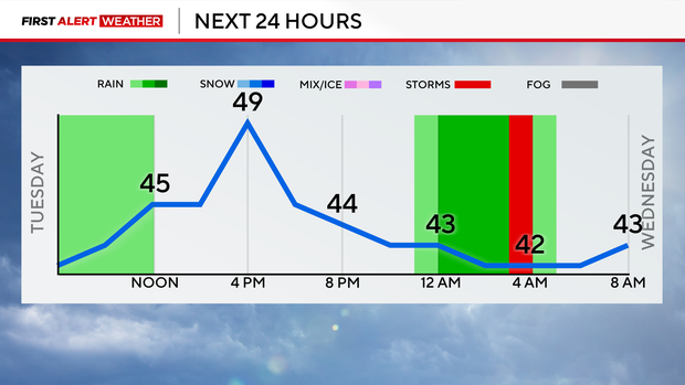
As of 5 a.m. Tuesday, it was 42 degrees at Dallas-Fort Worth International Airport with the wind chill dropping the "feels-like" temperature to 38 degrees.
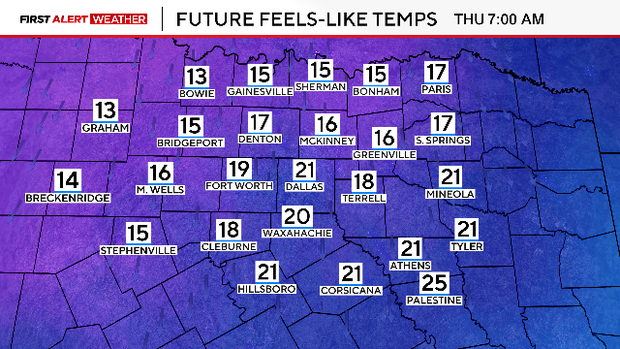
The cold air will stick around, with the high temperature reaching near 49 degrees on Tuesday. A cold front on Wednesday will bring arctic air back to North Texas and temperatures will plummet into the 20s by Thursday morning with the "feels-like" temperatures in the teens.
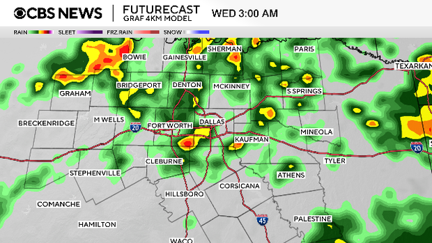
A First Alert Weather Day will remain in effect on Wednesday due to the continued rain.
Another round of rain is on the way Friday night into Saturday but it won't be a complete washout with the rain ending near midday Saturday, mainly in East Texas.