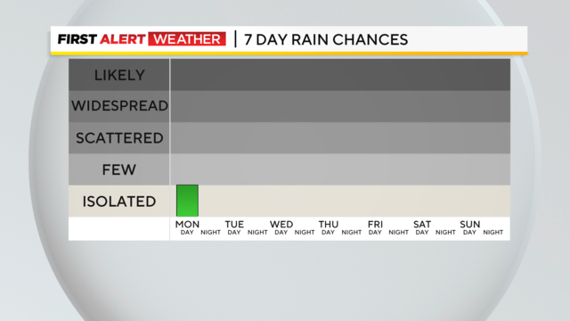
Pittsburgh Weather: Memorial Day shaping up to be sunny, warm
Overnight into Memorial Day, showers will linger south, and clouds clear through the day, leaving us with a dry, sunny, and hot day with highs in the low 80s.
Watch CBS News
Overnight into Memorial Day, showers will linger south, and clouds clear through the day, leaving us with a dry, sunny, and hot day with highs in the low 80s.
Saturday has been gorgeous, with highs in the mid-70s with plenty of sunshine. Clouds will increase by the evening.
Smoke from the Western Canada wildfires is leading to high particulate levels in the upper atmosphere and haze across our region.
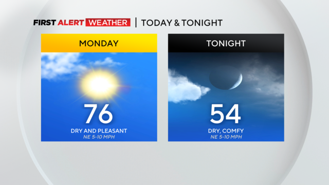
It's going to be a sunny day with blue skies across Western Pennsylvania.

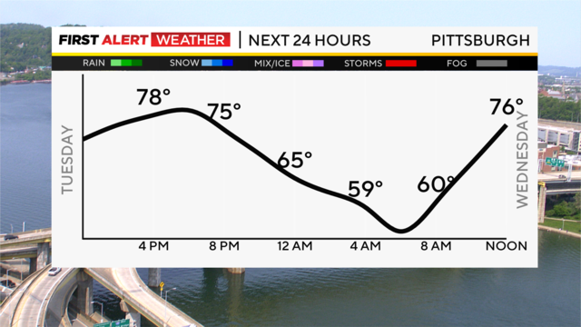
Sunshine and warm temperatures stick around through Wednesday, with highs in the upper 70s and close to 80 by midweek.
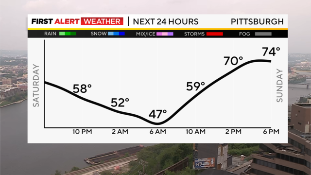
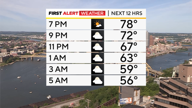
Clouds will gradually break overnight, giving us a pleasant evening and eventually partly cloudy skies by morning.

How big hail can get is all about wind!
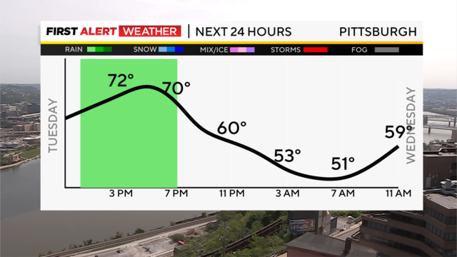
The best chance for rain occurs from noon to around 6 p.m.
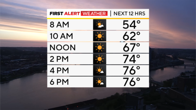
Highs today should remain in the mid-70s, but if anything today will actually be more pleasant than yesterday
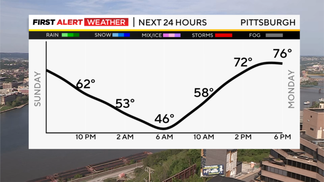
After a sunny Sunday, we'll watch a few clouds roll in overnight, but temperatures will be cooler, with lower humidity levels.

Pollen will be on the very high side this Mother's Day thanks to the tree pollen.
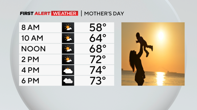
After a damp and dreary Saturday, we'll see showers ending north to south this evening and dry conditions overnight.
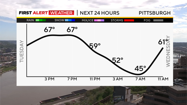
We are just a little over a week into May, and it's already been a heck of a month.

Today will see rain chances both early and late but the afternoon is looking good.
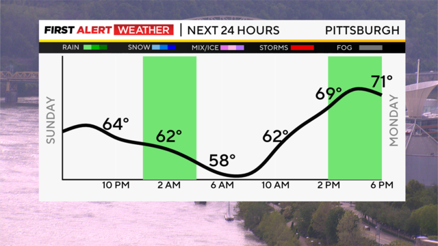
A few isolated showers are moving out to our east this evening, and we'll be in for a mild, quiet Sunday night.

We're off to a gorgeous, mild start to the weekend, with highs Saturday hitting the lower to mid-70s, which is very seasonable for early May.

Get the latest weather updates with meteorologist Ron Smiley's Tuesday forecast.

Rain chances stick around today, but unlike the weekend rain, today's rain will be fairly continuous throughout the day.

A dreary Sunday has given way to showers, and now cooler air is invading behind a cold front passing to our east this evening.

Cloudy skies stick around Saturday night, with showers moving in and even a steadier rain for areas to the east overnight.

The chilly mornings will continue through the workweek.

The cold weather continues today with the worst being felt on Tuesday morning.

It's looking like sweater weather for the week ahead.

Today will be the best day of the week when it comes to comfort levels and being outside.

Light rain and snow have wrapped up for most of the viewing area, but it will remain windy.