Pittsburgh Weather: Dry morning conditions ahead of two rounds of expected storms
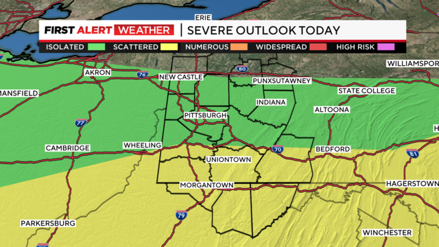
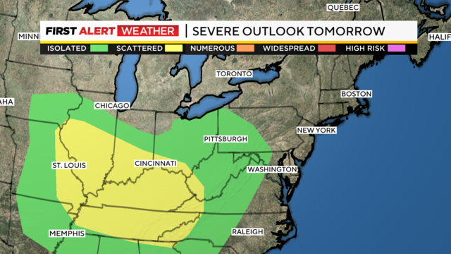
Places along and south of I-70 have by far the highest chance for severe weather.
Watch CBS News
Places along and south of I-70 have by far the highest chance for severe weather.
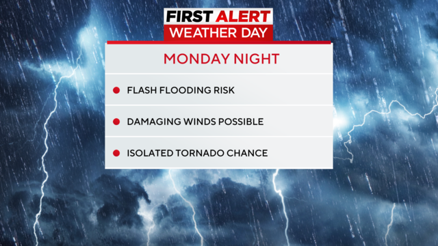
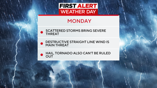
After a quiet Sunday, we turn our attention to the potential for more strong to severe storms later Monday. Because of that, Monday is a First Alert Weather Day.
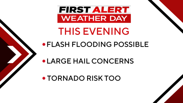
Severe storms with hail and wind and even a tornado are possible today.
We were lucky on Monday, with very few local storm reports due to severe weather.
Much of the region is under a 'slight risk' (2 out of 5) meaning isolated strong to severe storms are possible with frequent lightning, hail and damaging winds.
Heavy rains, lightning, hail, and damaging winds are all possible.
Severe storms are possible on Sunday and Monday, and a First Alert Weather Day has already been issued for Monday, with the possibility of Sunday being added.
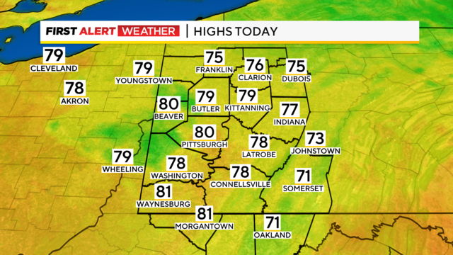
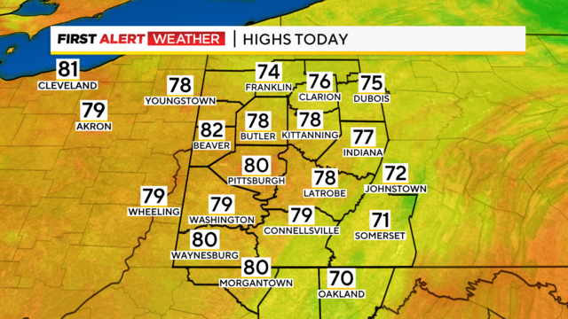
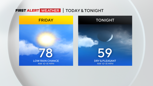
Pleasant weather will remain in place for the first day of August, with highs today near 80 degrees.
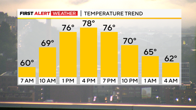
Highs today will hit the upper 70s with morning temps dipping down to the 50s in most communities.
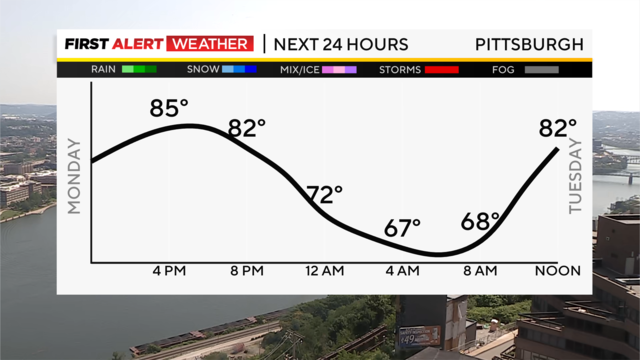
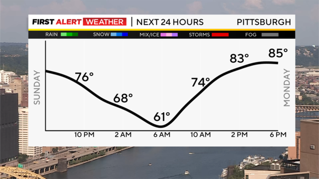
Rain chances dwindle late tonight, and lows will hover near 60, with some patchy fog possible again in valleys and low-lying areas.
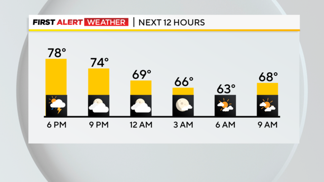
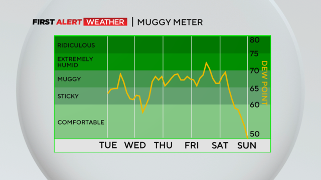
Our intense heat and humidity have broken!
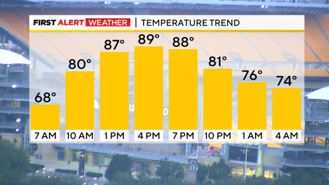
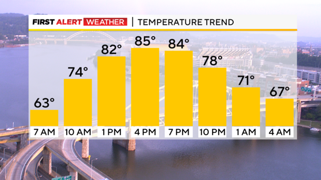
Temperatures are set to soar, with morning lows in the 60s.
What has all the makings of being one of the hottest stretches of weather for the year could be 'cooled' by rain chances.
This is a sneaky busy weather week with a couple of things to talk about.
July will end on a hot, humid note as temperatures this week begin to creep back into the mid to upper 80s and will end near or at 90 by late week.
After a night of heavy storms, we're in for a sunny and warm weekend.

With smoky skies, higher temperatures, and floods, what's going on with these extreme weather events?
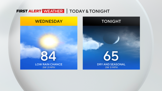
Skies will be cloudy to start off with us seeing partly cloudy skies overall today.
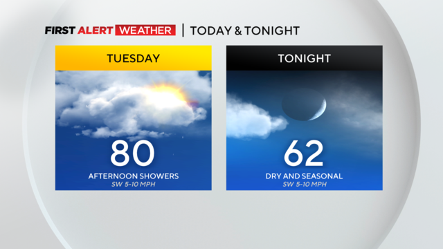
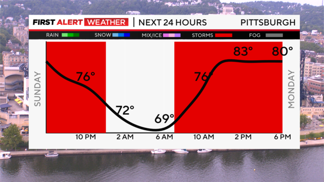
At this point, it appears that the best chance for rain will be before 7 a.m along with after 1 p.m.
Strong and destructive straight-line winds are the main concern followed by the chance for large hail.
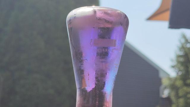
You may have heard that the atmosphere is a fluid, we'll show you how to make a mini model of the atmosphere!
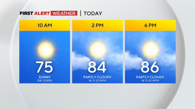
We should get one more pleasant day today before the rain and storm chances are set to return on Wednesday.
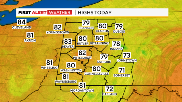
Today is looking fantastic with humidity levels on the low side and temperatures returning back to the 80s.
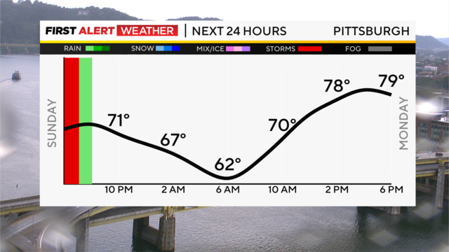
A cool front swinging through our region is sparking a few isolated, heavy downpours, and they'll slowly slide east through mid-evening.
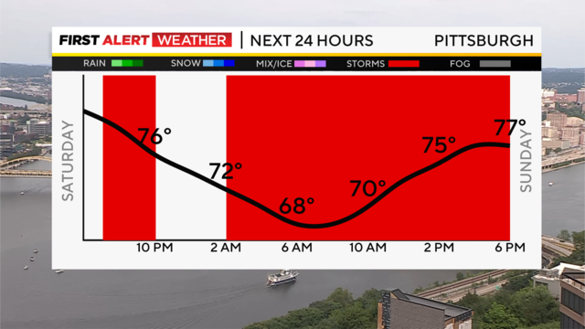
It's been a warm, humid Saturday with some sunshine, but now clouds build, with a few isolated showers trying to move in from the west with a passing disturbance.