Hey Ray: Now, that's impossible!
Certain things just seem impossible but with science? They become possible.
Watch CBS News
Certain things just seem impossible but with science? They become possible.

The afternoon and evening hours are looking dry, sunny, and a little humid.

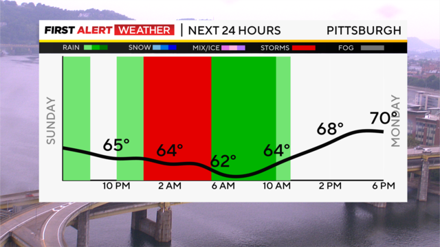
Today's storm chance picks up as soon as 10:00 this morning and will continue through the rest of the day.

Our gloomy Sunday continues, but that's a good tool for keeping any severe storm development at bay.
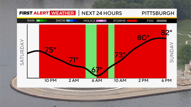
Scattered showers and thunderstorm chances stick around the rest of tonight, tomorrow, and Monday.
Temperatures will be cooler Tuesday, with highs near 70 and morning lows in the low 60s.
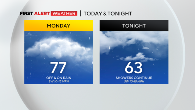
While rain totals today won't be very big, every little bit helps when it comes to alleviating drought conditions.
The KDKA-TV First Alert Weather Team is issuing a First Alert Weather Day for Sunday night for the possibility that severe storms could hold together across our area.
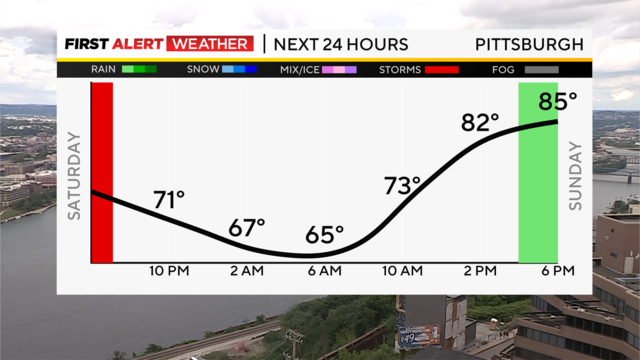
Sunday will start mainly dry until the mid-to-late afternoon when a chance of scattered showers returns.

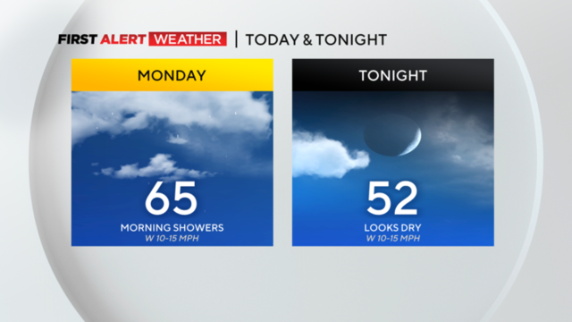
Showers will be more widespread this morning then become more isolated under cloudy skies this afternoon.
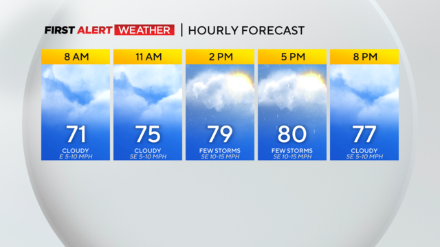
. Most of the activity will be south of the city, but some showers could creep northward.

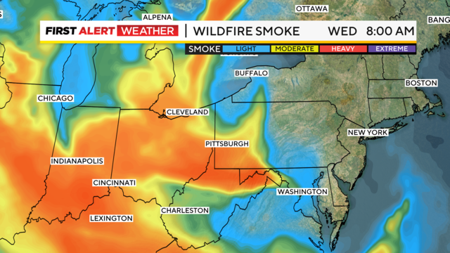
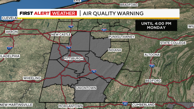
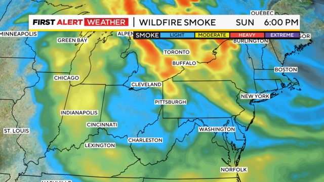
Air quality isn't the best today, and there is an active alert through this evening.
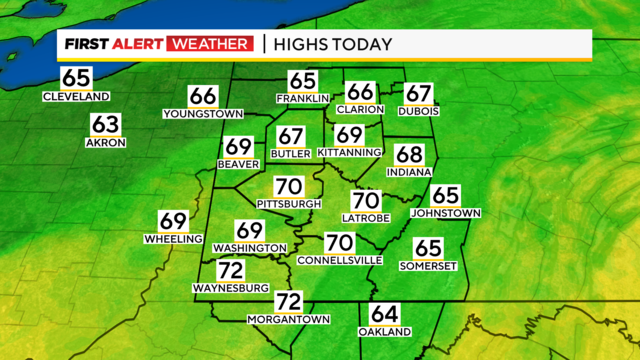
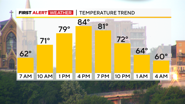
It was a gorgeous day with highs in the upper 70s and some in the low 80s.
Even though summer does not officially start until 10:58 a.m. on Wednesday, it will feel like summer, starting on Father's Day.

I often get asked why the temperatures we report are different from what you see on your home thermometer.
The rain will be nice and much-needed.
While the rain by itself probably won't constitute a 'drought buster', conditions will help to make this rain a 'soaking' shower with little in the way lost due to downpours or evaporation.
After 21 days of no measurable rain at the airport, we have recorded 0.02 inches of rain, with more showers and even a few storms on the way later tonight.
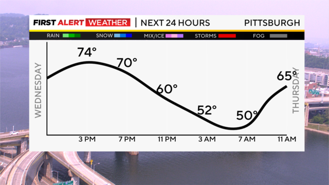
We will still have a Code Yellow air quality status for Sunday for some of the haze and smoke in the upper levels of the atmosphere.
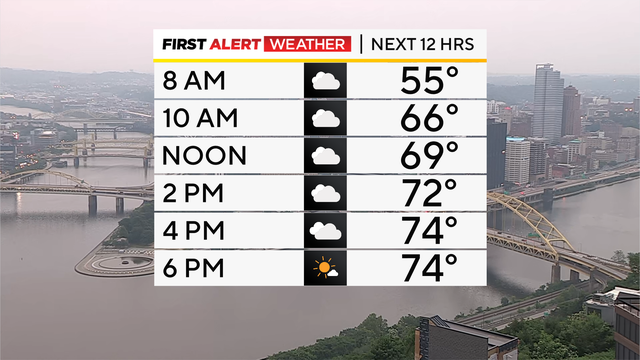
The interesting week continues, with several unusual things all coming together, giving us mets plenty of things to discuss.
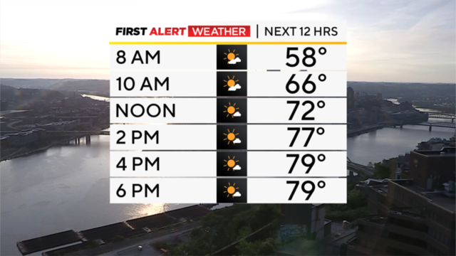
This is such an interesting week.
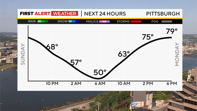
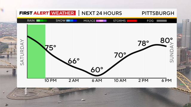
Relief from the heat finally arrived with the cold front Saturday, and the high Sunday was 10 degrees cooler than Saturday in Pittsburgh.
After the driest May in Pittsburgh since 1986 and 12 days with no rain, we finally saw a few raindrops today and a few strong storms across the region.
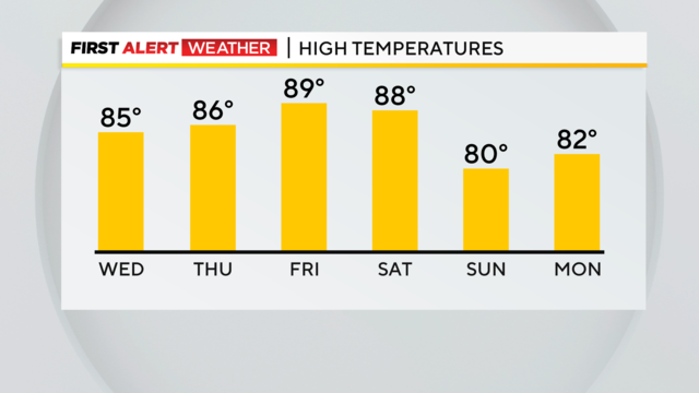
The hottest temperatures of the year are expected to arrive tomorrow afternoon.
We could be looking at one of the hottest stretches of weather on record for the period starting yesterday and going through June 7.