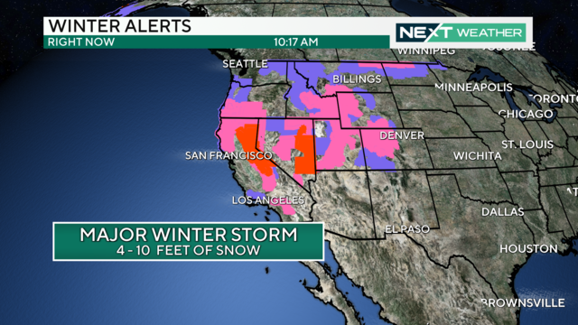
Monster California storm heading our way but will it bring relief to wildfires in Texas first?
This is the latest in a series of storms to pound California. The California storm will arrive in the Delaware Valley on Wednesday and Thursday.
Watch CBS News
This is the latest in a series of storms to pound California. The California storm will arrive in the Delaware Valley on Wednesday and Thursday.
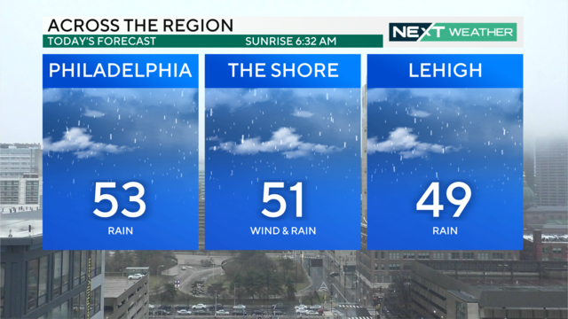
Saturday will have periods of heavy rain and cloud coverage with mild temperatures peaking at 53 degrees with a low of 43 degrees.
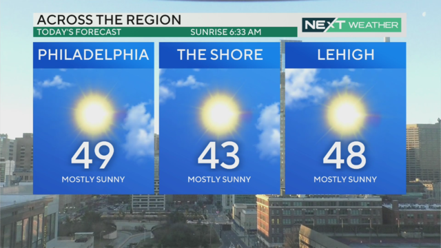
There's a bit of a morning chill in the Philadelphia region Friday before temperatures increase to nearly 50 degrees - with highs in the 60s coming.
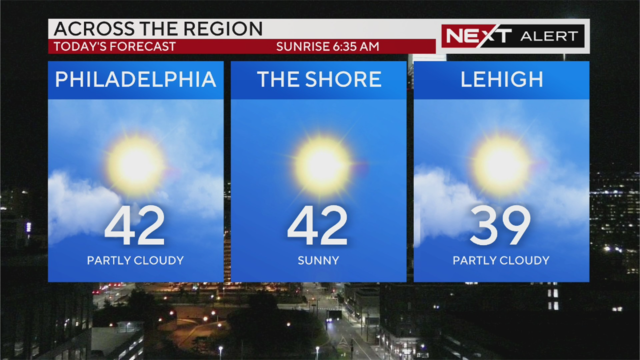
Thursday's weather in Philadelphia will be sunny with highs near 42 degrees, but wind chills will make it really feel like the 20s and mid-30s.
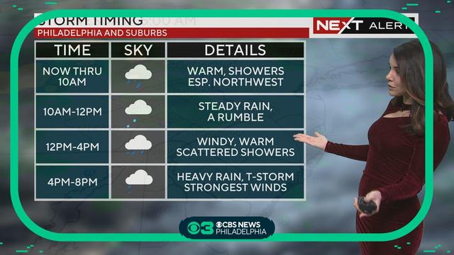
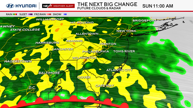
Temperatures will reach the 60s again Wednesday, but scattered showers move in for the morning commute. Heavy rain and gusty thunderstorms are possible later in the evening, and a Wind Advisory will be in effect from 10 a.m. to 4 a.m. Thursday.
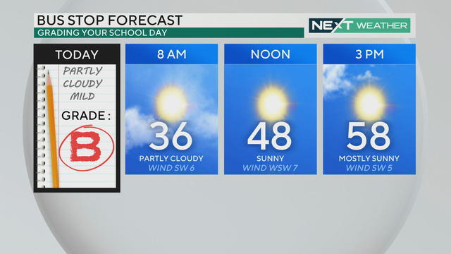
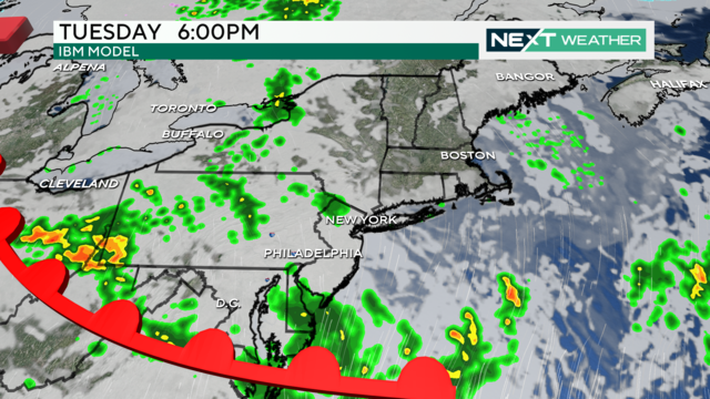
Monday starts chilly but you'll be able to ditch the jacket this afternoon when temperatures warm to the 50s. Clouds increase Tuesday and rain develops, but temps climb even higher into the 60s.
As February winds down, we'll see a big warm-up over the next few days, with highs in the 60s for many locations across the Philadelphia region.
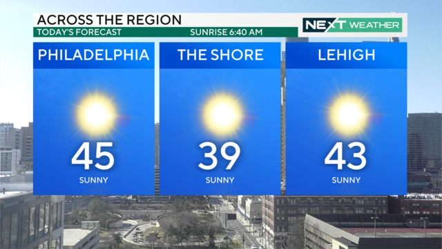
Sunday is quiet and sunny with crystal clear skies during the day. Temps are boosted into the 50s Monday, and it's looking like we could see our first 60-degree day of the year by midweek.
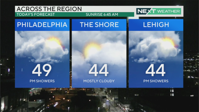
Expect a few light showers Thursday afternoon and evening, then we'll see a lull before rain picks up again Friday for the morning commute.
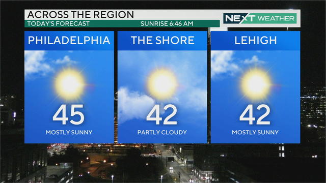
Temps will warm to the mid-40s by Wednesday afternoon. Thursday starts sunny but turns cloudy later in the day as the region's next chance for rain moves in from the west.
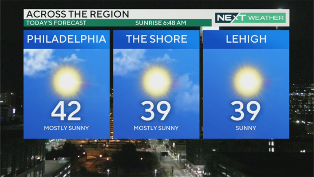
High temperatures will top out in the low-to-mid-40s Tuesday and the weather will remain relatively calm before the next chance for rain at the end of the week.
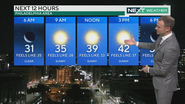
While actual high temperatures will warm into the low 40s Monday, wind chills will keep the feels-like temps in the 30s for a sunny and seasonable Presidents Day.
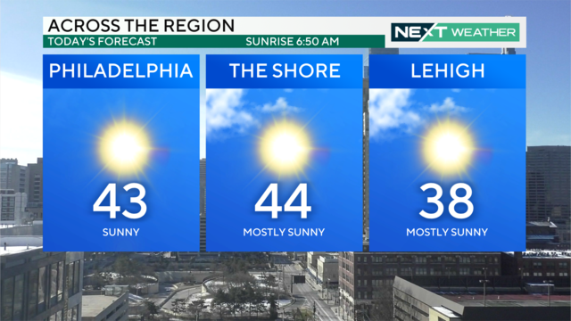
The first half of the week will be sunny and seasonable with high temperatures hovering in the low-to-mid-40s. Warmer temps in the 50s arrive Wednesday ahead of our next chance for rain.
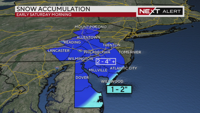
A quick-moving system will bring most of the Philadelphia area between 2-4 inches of snow by Saturday morning.
A quick-moving system will bring some light rain and snow to the region Thursday, and another chance for 1-2 inches of snow in Philadelphia comes overnight Friday into Saturday.
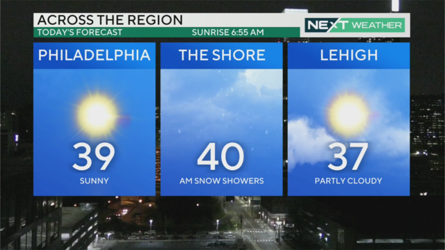
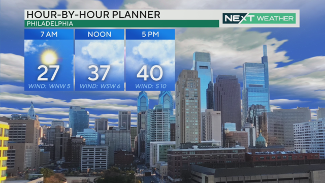
Temperatures stay on the chilly side Wednesday with highs in the mid-to-upper 30s, though blustery winds will keep feels-like temps in the 20s for most of the day.
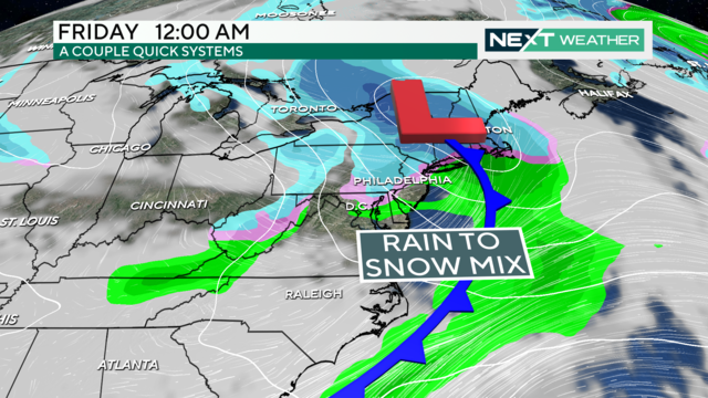
Sunshine returns Wednesday afternoon in the Philadelphia region before two back-to-back systems bring another chance for winter weather.
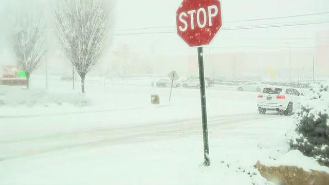
Rain changed over to snow this morning, creating a messy AM commute and delays and cancellations at Philadelphia International Airport.
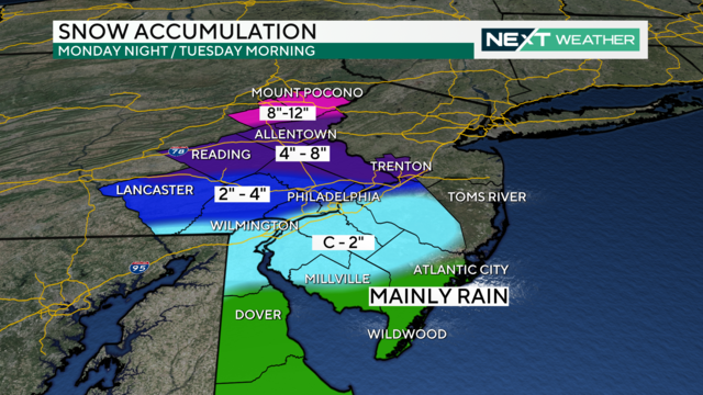
Philadelphia is expected to get about 2 to 4 inches of snow due to the winter storm.
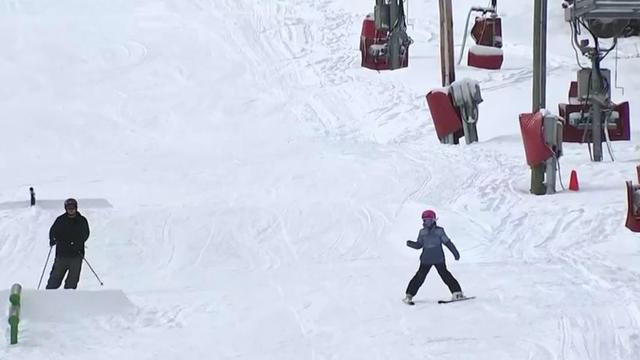
Business at Buckman's Ski and Snowboard Shop in King of Prussia has been better this winter compared to the last few seasons.
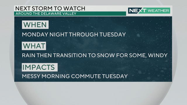
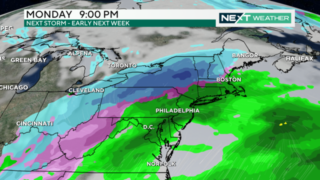
Mild conditions will continue through the weekend but a NEXT Weather Alert has been issued for Tuesday for rain and potential snow.
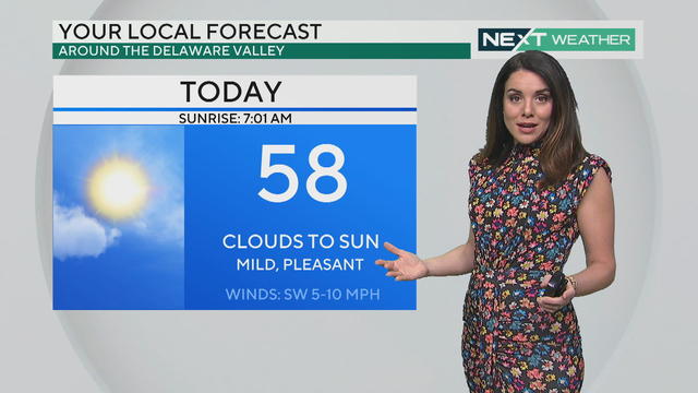
Friday's weather starts cloudy in Philadelphia, but the sun should return quickly. Expect above-average temps into the weekend.
The dry and mild stretch in the Philadelphia region will continue on Thursday with highs in the low 50s under mostly sunny skies, but an end is in sight.
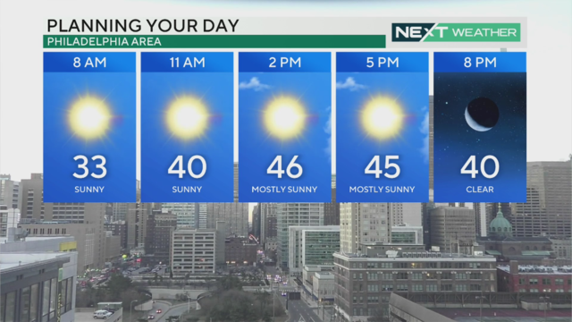
The week's warming trend continues Wednesday with a high of 47 degrees in Philadelphia - and we could reach the 50s Thursday.
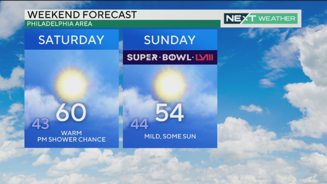
Weather in Philadelphia is seasonable with a high temperature of 42 before a warmer week and potential temps in the 60s by the weekend.