Potentially severe storms threaten Philadelphia region Sunday
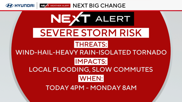
The main threats from potentially severe storms Sunday evening are damaging wind gusts, heavy rain and some large hail.
Watch CBS News
The main threats from potentially severe storms Sunday evening are damaging wind gusts, heavy rain and some large hail.
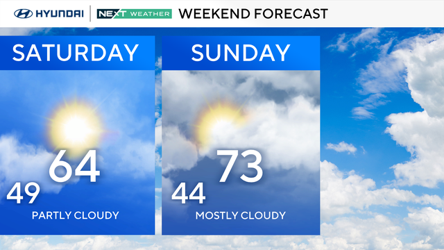
The first full weekend of spring in the Delaware Valley brings sunshine and highs in the 60s before possible storms arrive Sunday evening.
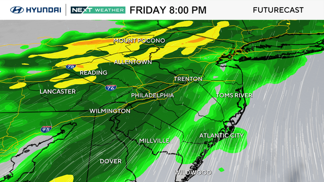
Spring officially begins Friday morning in the Philadelphia region ahead of a warmer weekend.
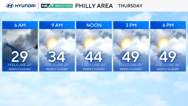
After a cold start to the morning in the Philadelphia region Thursday, we will finally get back to normal highs in the low 50s.
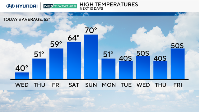
Wednesday in Philadelphia will be frigid but a warm-up is on the way for this weekend.
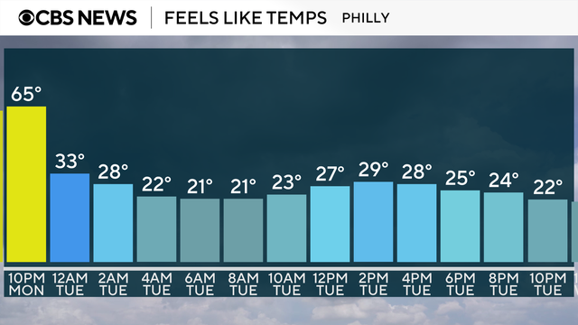
The Philadelphia area can expect a cold and windy St. Patrick's Day with wind chills in the teens and 20s.
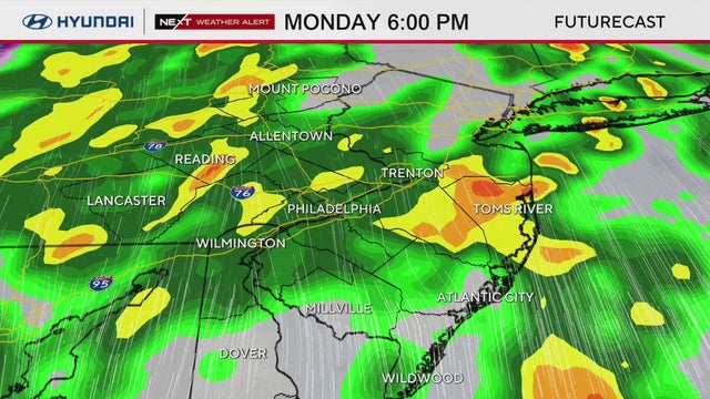
Strong storms caused power outages in some parts of the Philadelphia region Tuesday night.
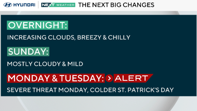
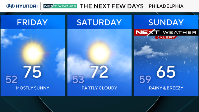
It will be a pleasant Sunday with mild temperatures in the Delaware Valley before severe storms arrive Monday, the NEXT Weather team says.
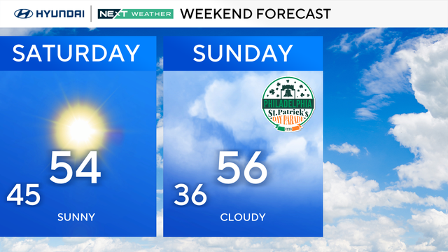
A mild, mostly quiet weekend gives way to the possibility of severe storms Monday in the Philadelphia area.
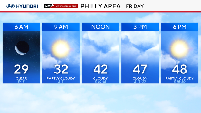
People in the Philadelphia region will need winter gear on Friday morning because of the temperatures dropping into the 20s.

After an early taste of summer in Philadelphia, temperatures are expected to drop more than 50 degrees.
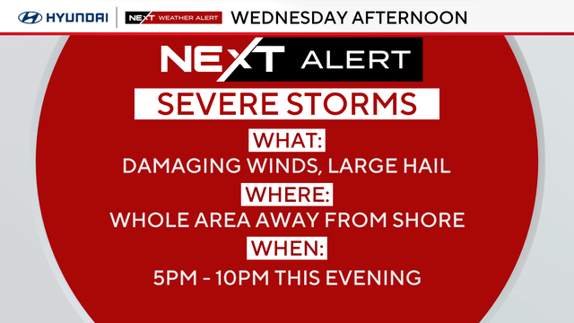
A severe thunderstorm watch for the Philadelphia region was canceled Wednesday night.
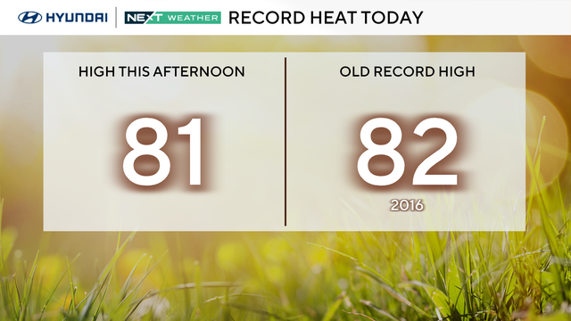
Philadelphia has hit 80 degrees for the first time in 2026, the earliest the city has reached the mark since March 9, 2016.
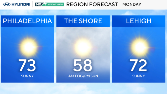
Monday will be a gorgeous day in the Philadelphia region with mostly clear skies and sunny skies throughout the day.
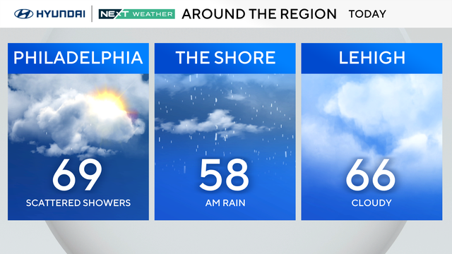
Patchy dense fog and cloudy skies rule the day Sunday with the chance for spotty showers, but temperatures will be warmer with highs in the mid and upper 60s.
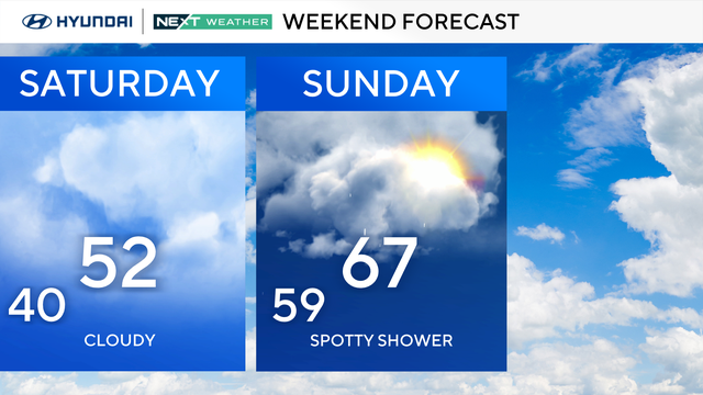
Saturday starts out with some fog and could end with showers and rumbles of thunder in the Philly area.
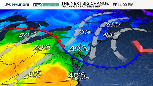
Dreary and damp conditions will persist for yet another day on Friday in the Philadelphia region.
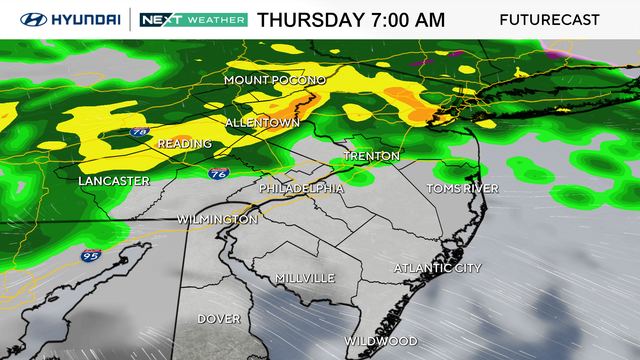
Keep the umbrella nearby again Thursday, as off-and-on showers will blanket the Philadelphia area.
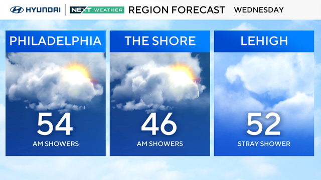
On-and-off showers will continue throughout the day Wednesday, but on the plus side, high temperatures will climb into the 40s and 50s.
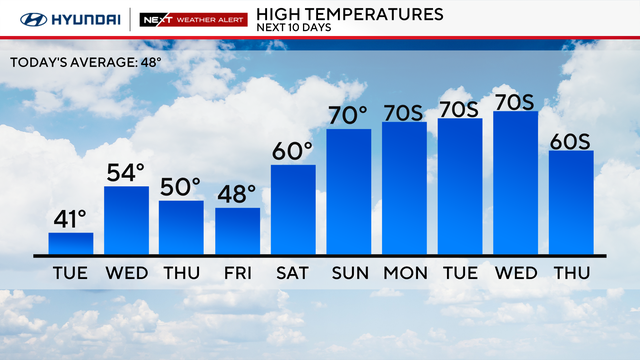
After the freezing rain in the city ended Tuesday morning, the rest of the day will still be cold, cloudy and rainy.
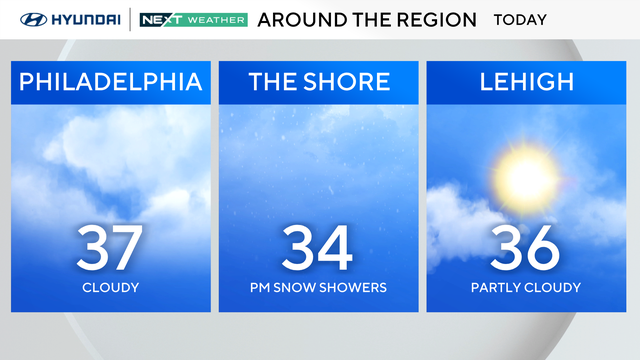
Temperatures will only reach the 30s on Monday around the Delaware Valley, but by midweek, it'll feel more like spring with highs in the 50s and 60s.
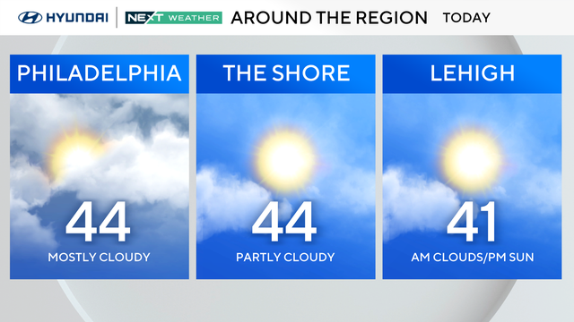
Some late-day sunshine is possible Sunday, but another blast of Arctic air pushes in this evening. Temperatures Monday morning will feel like the teens and low 20s.
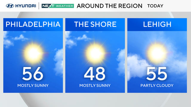
Expect temps in the mid-upper 50s with tons of sunshine on Saturday with a very nice spring feel to it.
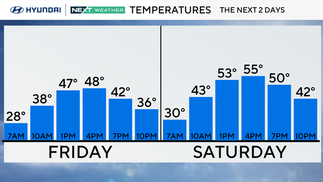
Friday starts below freezing in the Philadelphia region, but it will be sunny once we hit the afternoon as the temperatures will be warmer this weekend.
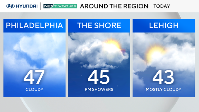
Thursday starts cool before temperatures reach the 40s, with some rain chances in the southern parts of our area.