Cloudy and cool weather in Philadelphia Sunday before late-day sun, temps warm up this week


Rain moved out of the Delaware Valley Sunday morning, but skies will stay cloudy and gray for most of the day before some late-afternoon sunshine peaks through.
Highs will be about 10 degrees below average in the 50s with clouds and breezy winds from the east and northeast gusting to 25 mph.
The average high this time of year is around 68 degrees.
NEXT big weather changes
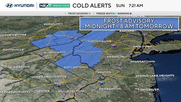
A frost advisory is in effect for parts of the region until 8 a.m. Monday. Temperatures will be close to freezing, and clear skies and light winds will be favorable for frost in low lying areas.
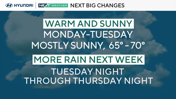
Monday will be the pick day of the week with plenty of sun and highs near 70. Tuesday is another pleasant day with increasing clouds and highs in the upper 60s.
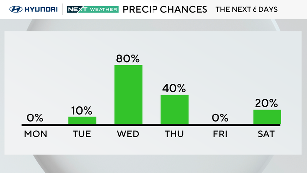
Our next chance for showers arrives Tuesday evening. Then Wednesday afternoon through Thursday morning, another round of steady and much needed rain is possible.
We end the week with sunshine and 60s on Friday – a perfect start to the month of May.
Drought
Conditions have worsened and most of the Philadelphia area is in a moderate drought to severe drought conditions with over a foot deficit in rainfall since August. Any rain will be welcome.
Here's the 7-day forecast
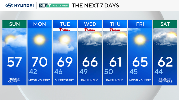
Sunday: Mostly cloudy. High 57.
Monday: Mostly sunny. High 70, low 42.
Tuesday: Sunny start. High 69, low 46.
Wednesday: Rain likely. High 66, low 49.
Thursday: Rain likely. High 61, low 50.
Friday: Mostly sunny. High 65, low 45.
Saturday: Chance for showers. High 62, low 44.


