Storms move out of Philly region Monday night, tracking stronger storms Tuesday
Storms are moving out of the Philadelphia region Monday night after triggering multiple weather alerts.
Watch CBS News
Storms are moving out of the Philadelphia region Monday night after triggering multiple weather alerts.
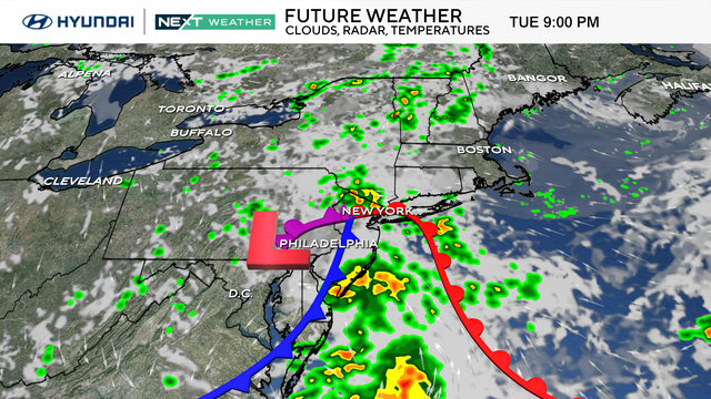
Mostly sunny skies and very seasonable and comfortable temperatures across the Delaware Valley.
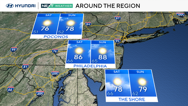
Whether you're staying in the city, heading "down the Shore," or escaping to the Poconos, Mother Nature couldn't have planned it any better.
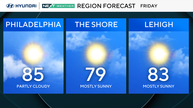
This beautiful stretch of weather isn't going anywhere anytime soon.
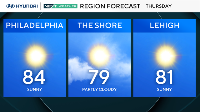
Our delightful mid-summer break begins today with dry air, a light northerly breeze and plenty of sunshine in the Delaware Valley.
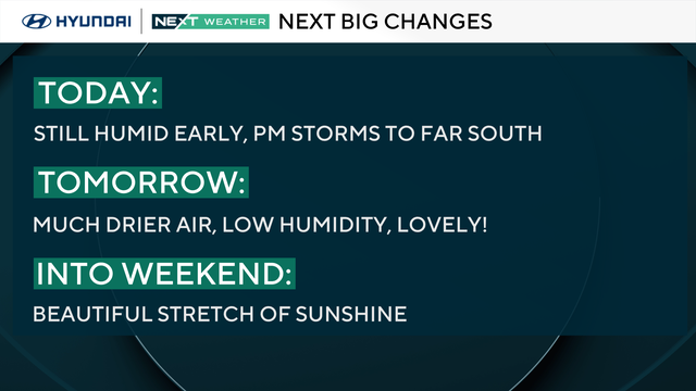
Wednesday will be a noticeably better weather day than Tuesday in the Philadelphia region, with stray showers possible early in the day.
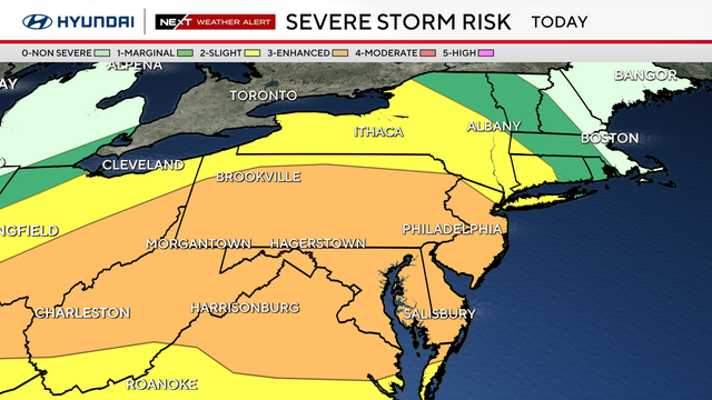
A tornado watch for the Philadelphia region expired Tuesday night after severe storms moved across the Delaware Valley.
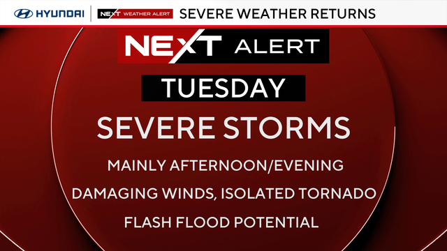
Monday will be seasonable in the Philadelphia area before severe storms bring the threat of damaging winds and flash flooding Tuesday.
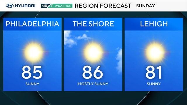
Sunday brings low humidity, comfy temps and tons of sunshine, but storm chances return this week.
Air quality has reached unhealthy levels in the Philadelphia region, leading to a Code Red alert being issued.
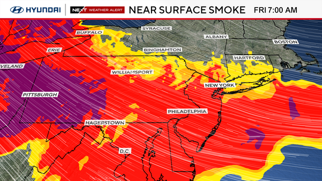
Wildfire smoke from Canada and Minnesota is causing hazardous air quality in the Philadelphia region and has prompted warnings from health officials.
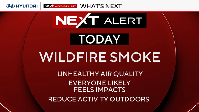
A code red air quality alert is in effect for the Philadelphia region as Canadian wildfire smoke hits the area.
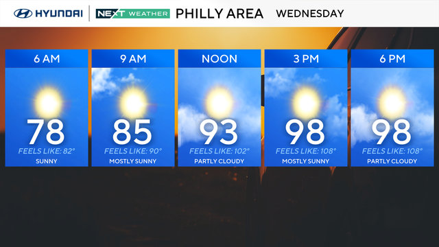
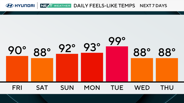
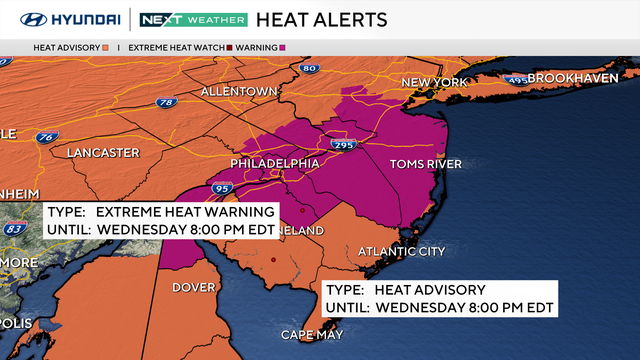
Wednesday in the Philadelphia region will likely be the hottest day of the heat wave, with high temps pushing the 100-degree mark across most of the area.
The MLB All-Star Game in South Philadelphia will be toasty, but no storms are expected.
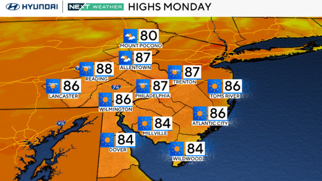
Monday will be a beautiful day in the Philadelphia area with sunny skies and lower humidity.
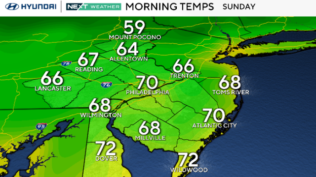
The Philadelphia area can expect sunny and warm weather Sunday before temperatures heat up later this week.
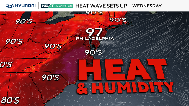
Saturday will bring partly sunny weather to the Philadelphia area, with temperatures reaching the low to mid-80s with isolated storms.
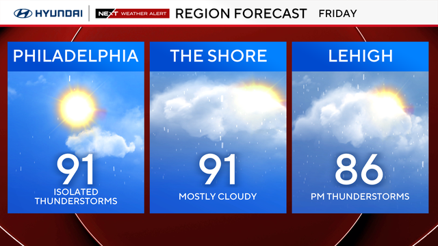
After the torrential rain Thursday afternoon, the hot and humid air will remain in place for Friday in the Philadelphia region.
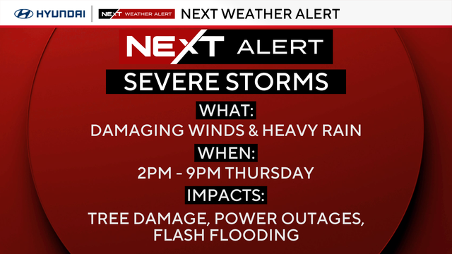
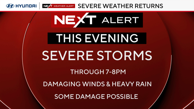
A NEXT Weather Alert is in effect for the Philadelphia region due to storms capable of producing damaging winds and heavy rain.
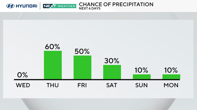
The clouds will clear through early Wednesday morning in the Philadelphia region and give way to great conditions for the remainder of the day.
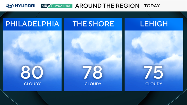
Relatively calm but muggy conditions are in store for Tuesday in the Philadelphia region.
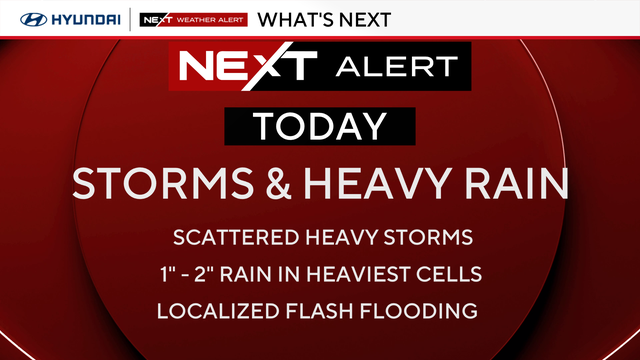
Showers and storms were scattered in nature Monday in the Philadelphia region.
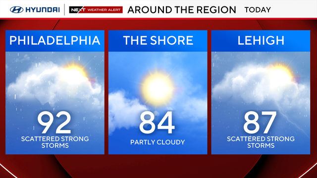
With another round of severe storms Sunday night, expect damaging winds and downpours that could lead to power outages, travel delays and downed trees.
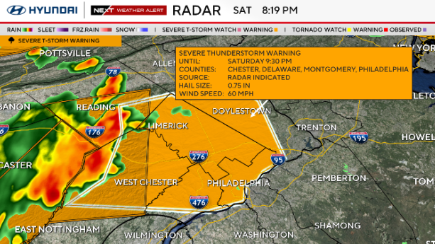
Strong storms hit the Philadelphia area Saturday night, disrupting July Fourth events and knocking down power lines.
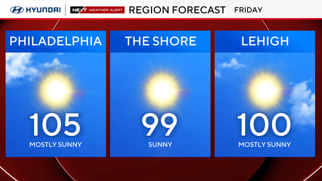
The heat wave in the Philadelphia region is going into Day 5 Friday, and it's only getting hotter.