Mostly sunny Tuesday in Philadelphia region, tracking storms this week. Here's the weather forecast.

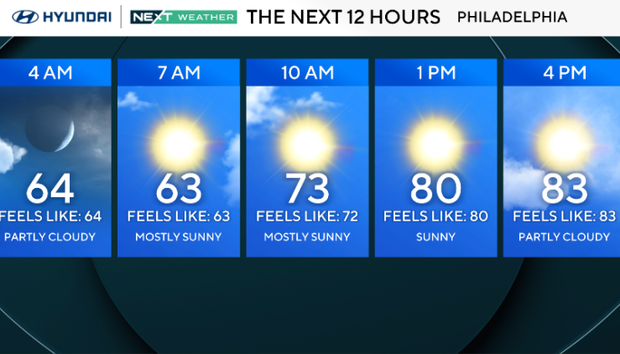
It's an A+ day for the kiddos to head back into school, with a crisp start to the day along with a sunny and warm afternoon on Tuesday in the Philadelphia region.
We're continuing the beautiful stretch of weather from Labor Day weekend, with mostly sunny skies and highs in the upper 70s to low 80s. Expect the humidity to stay in check, with just a few clouds this afternoon.
You won't need an umbrella today, and the evening looks slightly warmer, with a bit more humidity and partly cloudy with lows in the 60s.
NEXT big weather changes
Heat and humidity return with temperatures reaching the mid-to-upper 80s for Wednesday and Thursday.
The NEXT big change will be the return of a chance for some showers and even a few thunderstorms on Thursday as a cold front approaches the area.
At this point, the morning drive on Thursday is trending dry, with showers starting mid-to-late morning and increasing by the evening. Flooding doesn't look like a concern, as the total rainfall is expected to be less than an inch.
The cold front will clear by Thursday night and bring cooler temperatures and another stretch of sunshine into the upcoming weekend.
Here's your 7-day forecast:
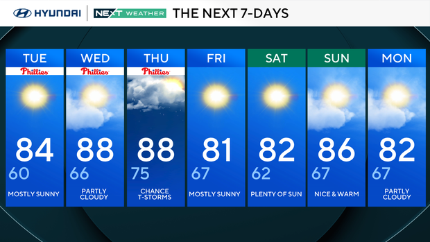
Tuesday: Mostly sunny. High 84, Low 61
Wednesday: Partly cloudy. High 88, Low 66
Thursday: Chance of thunderstorms. High 88, Low 75
Friday: Mostly sunny. High 81, Low 67
Saturday: Plenty of sun. High 82, Low 62
Sunday: Nice and warm. High 86, Low 67
Monday: Partly cloudy. High 82, Low 62
Get the latest weather info on the CBS News Philadelphia app.


