Another warm and dry day in Philadelphia region Wednesday before chance of rain. Here's the weather forecast.
Wednesday will be another warm and dry day in the Philadelphia region, with no weather issues to deal with if you are going outside.
Humidity levels in the region will be a bit higher than the past few days, so it may feel a touch warmer than the 88 degrees in the afternoon, but it's still pretty nice.
It'll also turn breezy in the afternoon with southwest winds gusting 20–25 mph.
NEXT big weather changes
The NEXT big change will be the return of a chance of some showers and even a few thunderstorms Thursday as a cold front approaches the area.
Thursday doesn't look like a washout, and right now the threat for widespread severe weather appears fairly low.
At some point, it looks like a wave of early showers may pass by for the morning bus stop forecast and commute-cast. Then, a lull comes in mid-to-late morning into the early afternoon, followed by a better chance for showers and storms during the evening.
Flooding does not look like a concern, as the total rainfall is expected to be in the .25 to .75 inch range, nor do severe thunderstorms.
The cold front will clear by Thursday night and bring cooler temps and drier humidity for Friday and Saturday. However, lingering showers may persist into the first part of Friday.
Saturday still looks like the better weekend day, with another round of showers and storms possible Saturday night into Sunday.
We will be keeping an eye out for showers impacting the Eagles' game, so stay tuned for any updates as we get closer.
Here's your 7-day forecast:
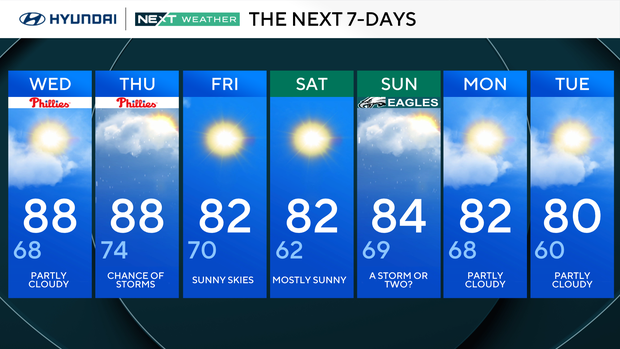
Wednesday: Partly cloudy. High 88, Low 68
Thursday: Chance of storms. High 88, Low 74
Friday: Sunny skies. High 82, Low 70
Saturday: Mostly sunny. High 82, Low 62
Sunday: A storm or two. High 84, Low 69
Monday: Partly cloudy. High 82, Low 68
Tuesday: Partly cloudy. High 80, Low 60
Get the latest weather info on the CBS News Philadelphia app.


