Friday offers break from rain before another storm moves into Philadelphia region. Here's the forecast.

After an active Thursday filled with severe storms, flooding rain and tornado warnings, Friday will be a nice end to the workweek. Grab the sunglasses and leave the umbrella at home. Gone are last night's storms and now this will be a quiet start to end our week.
Skies will turn partly cloudy, it will be less humid, and highs will hover in the low 80s.
Enjoy it as our NEXT Weather maker arrives Saturday.
NEXT big weather changes
We can expect a return of showers and isolated storms toward sunrise on Saturday followed by scattered showers and storms throughout the day. Another ½ inches or more of rain will be possible in some areas.
Isolated showers and storms are also possible Sunday, but Sunday will be the nicer of the two weekend days.
Both days will hover in the upper 70s to low 80s.
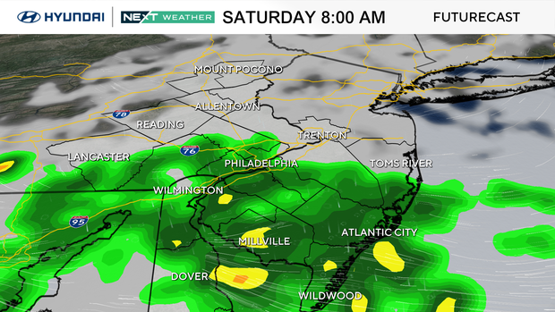
Total rainfall Saturday may exceed an inch in spots, and the Weather Prediction Center has our region at a level 1 for flood risks.
As of Thursday evening, the severe risk for Saturday looks low, with just a non-severe thunderstorm outlook, but we'll keep watch.
Sunday is trending a bit drier, so it looks like the better of the two weekend days for planning purposes.
Here's your 7-day forecast:
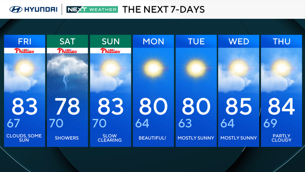
Friday: Clouds, some sun. High 83, Low 67
Saturday: Showers. High 78, Low 70
Sunday: Slower clearing. High 83, Low 70
Monday: Beautiful. High 80, Low 64
Tuesday: Mostly sunny. High 80, Low 63
Wednesday: Mostly sunny. High 85, Low 64
Thursday: Partly cloudy. High 84, Low 69
Get the latest weather info on the CBS News Philadelphia app.


