Nice start to Sunday in Philadelphia area, tracking storms this week. Here's the weather forecast.

Sunday got off to a great start with temperatures in the 60s and plenty of sunshine to start the day for the Philadelphia Cycling Classic. Scattered clouds will develop through Sunday afternoon as the winds begin to shift from the north to out of the east and southeast. This will begin to draw in a little more humidity, and scattered showers are possible in the afternoon and evening.
The final day of August on Monday will be cloudy with scattered showers and possible thunder.
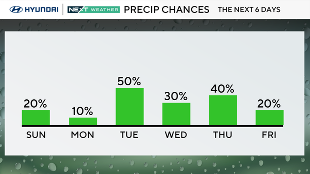
NEXT big changes: heat, humidity, storms
Tuesday, Wednesday and Thursday will be hotter and more humid with a high-pressure ridge just to our south and a southerly wind delivering plenty of moisture to the region.
Storms will form each day and drop southeast around that ridge of high pressure and across our region.
Severe storms are possible each day.
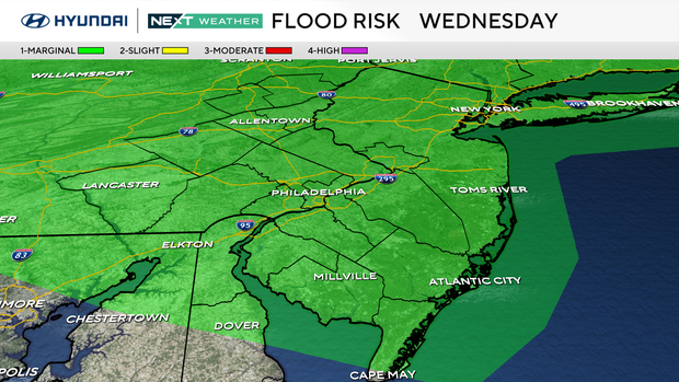
The ridge will slowly sink southward and by Thursday a strong cold front will be able to cross the area with what may be the greatest severe threat.
The Storm Prediction Center has already placed us in a risk all three days.
The NEXT Weather team is monitoring atmospheric conditions and will keep you updated with timing and impacts throughout the week.
Here's your 7-day forecast:
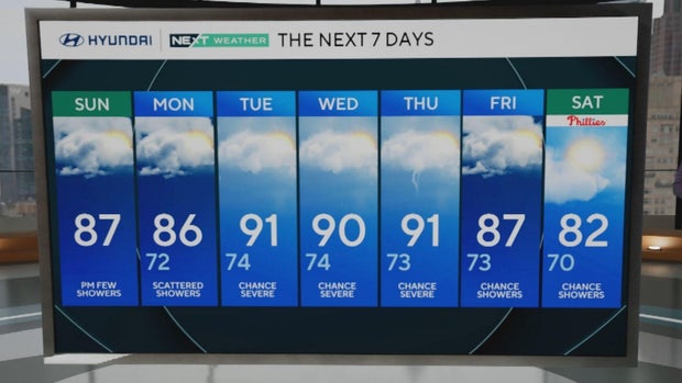
Sunday: Spotty evening showers. High 87, Low 66
Monday: Scattered showers. High 86, Low 72
Tuesday: Chance of severe storms. High 91, Low 73
Wednesday: Chance of severe storms. High 90, Low 74
Thursday: Chance of severe storms. High 91, Low 75
Friday: Chance of showers. High 87, Low 71
Saturday: Chance of showers. High 82, Low 70
Get the latest weather info on the CBS News Philadelphia app.


