Quieter weather, pop-up showers still possible Friday evening in Philadelphia region. Here's the forecast.
After yesterday's wild weather, Friday is thankfully a much quieter day.
We're starting out mostly cloudy and still pretty muggy — Philadelphia was 75 degrees with a dew point of 68 at 9 a.m. Clouds should gradually break for some sunshine with temperatures climbing into the mid 80s.
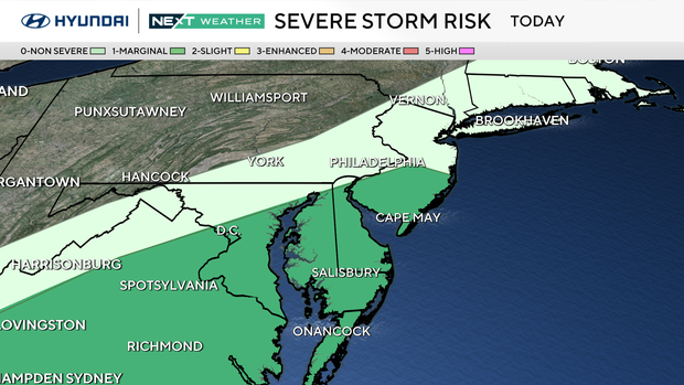
A cold front is crossing the region today, and that could still spark a spotty shower or thunderstorm this afternoon, mainly south and east of Philadelphia across South Jersey and Delaware. Most of the area will stay dry, so I wouldn't cancel any outdoor plans. Sunglasses will get more use than the umbrella, but it's worth keeping an eye on the radar if you're headed south or east.
Pool plans look pretty good overall. If you're headed to the shore, there is a moderate risk for dangerous rip currents along the Jersey Shore, so use extra caution in the water.
The front clears tonight and opens the door to a much more comfortable air mass just in time for the weekend.
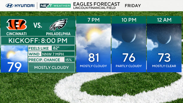
Remember, you can get sunburned on overcast days, so lather up the sunblock. If you are headed out to the Linc on Friday night for the Eagles' last and only home preseason game, dress for warm and humid weather, but it's unlikely showers will ruin your plans.
NEXT big weather changes
The next big change is a good one: lower humidity and a beautiful start to the weekend.
Today's cold front will gradually sweep the leftover humidity offshore. There may be enough instability ahead of it for a few thunderstorms this afternoon, especially across southern New Jersey and Delmarva.
There is a marginal risk for a storm to become severe in those areas, but the widespread severe and flooding threat we dealt with yesterday is over.
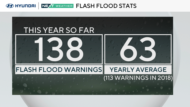
And yesterday adds another remarkable chapter to what has been an exceptionally active flash-flood year for our region. NWS Mount Holly issued 10 new flash flood warnings Thursday, bringing the 2026 total to 138. The annual average is just 63, and the previous full-year record was 113 in 2018. Even more remarkable: the first flash flood warning of this year wasn't issued until May 20. That means we've now had more than twice an average full year's worth of flash flood warnings in just over three months.
The May 20 start date is confirmed in the warning archive; no newer warnings have been issued since Thursday night.
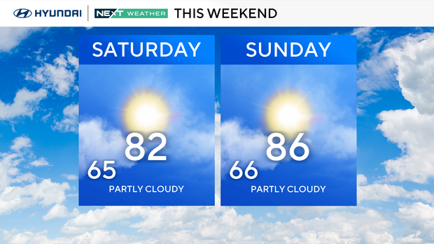
Once Friday's front clears, the weekend looks great. Saturday should be mostly sunny with highs in the mid 80s and noticeably lower humidity. Sunday stays mostly sunny and turns a little warmer, with highs in the upper 80s.
Then summer comes roaring back. Upper-level ridging builds across the East early next week, sending temperatures back toward 90 Monday and Tuesday while dew points climb into the lower 70s. That means the heat and humidity return.
Rain chances also begin to increase again Tuesday into Wednesday, but for now the weekend is looking like a winner.
Here's your 7-day forecast:
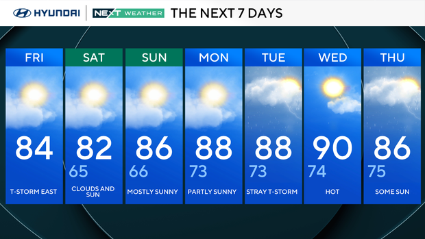
Friday: Thunderstorms to the east. High 84
Saturday: Clouds and sun. High 82, Low 65
Sunday: Mostly sunny. High 88, Low 73
Monday: Partly cloudy. High 88, Low 73
Tuesday: Stray thunderstorm. High 88, Low 73
Wednesday: Hot. High 90, Low 74
Thursday: Some sun. High 86, Low 75
Get the latest weather info on the CBS News Philadelphia app.


