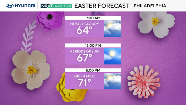
Mix of sun and clouds for Easter Sunday in Philadelphia
Easter Sunday is mainly dry, with mixed skies and a trend toward a bit more sunshine by the afternoon.
Watch CBS News
Easter Sunday is mainly dry, with mixed skies and a trend toward a bit more sunshine by the afternoon.
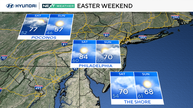
Saturday will be a warm day across the Philadelphia area with upper 70s to lower 80s under mostly cloudy skies.
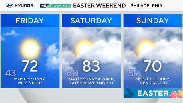
Friday will be mostly sunny with warm temperatures featuring light breezes. Temperatures will peak in the low-70s.
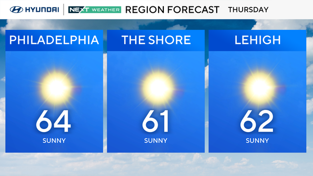
Thursday morning in the Philadelphia region will start a bit on the cold side with widespread temperatures in the 30s, but warmer weather is on the way.
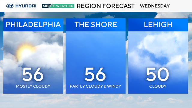
On Wednesday, it will be a bit calmer in the Philadelphia region but it will still be on the breezy side with wind gusts up to 30 mph.
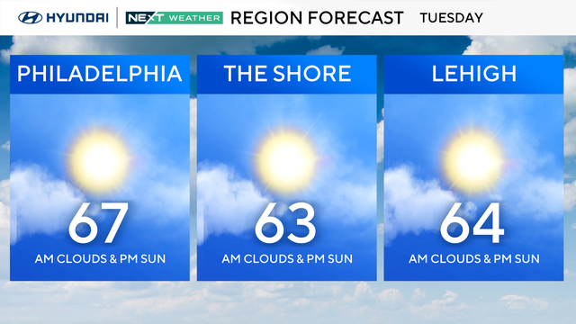
Gusty winds up to 35-40 mph will be the story Tuesday in the Philadelphia area after overnight showers.
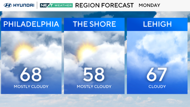
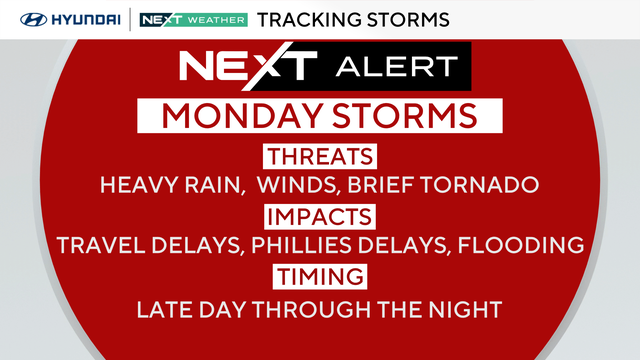
Temps will warm up Monday, and thunderstorms are possible at night in the Philadelphia area.
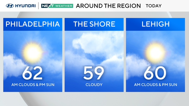
After a rainy and chilly Saturday, we'll finally start to warm up on Sunday, with some sunshine returning for the end of your weekend.
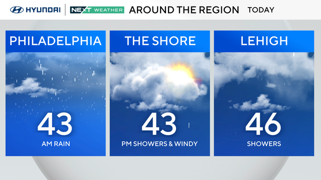
We're seeing scattered rain and snow showers across the Philadelphia region before a clearer, warmer Sunday.
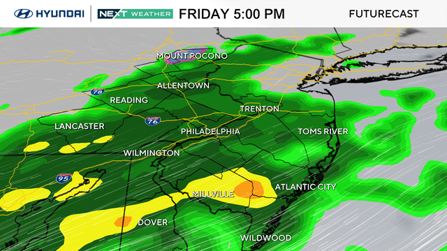
Rain will intensify Friday night in the Philadelphia region and there could even be snow outside the city for Saturday.
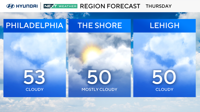
On Thursday, skies will be cloudy in the Philadelphia region with a chance of isolated showers.
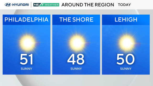
After the coldest morning since early March with temperatures that dropped below freezing, highs will slowly climb to near 50 Wednesday afternoon.
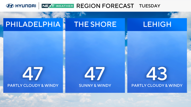
Temperatures will top out in the mid-40s on Tuesday in the Philadelphia region, while the normal is in the low 60s.
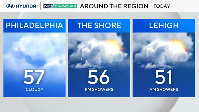
Fog will linger throughout the day Sunday, with scattered showers expected in Philadelphia throughout the morning. Tomorrow, heavier rain is likely during the AM commute.
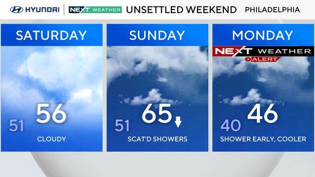
Expect a damp weekend with passing spotty showers before heavier rain Sunday night into Monday for your morning commute.

After the Friday morning storms in Philadelphia, conditions dry out a bit ahead of yet another weather maker for the weekend.
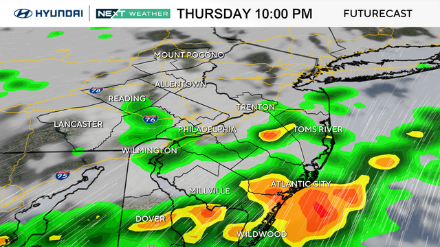
A NEXT Weather Alert will be in effect for the Philadelphia region for a chance of a few severe storms on Thursday night.
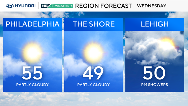
Wednesday starts chilly, but by the afternoon the Philadelphia region will be back into the mid-50s.
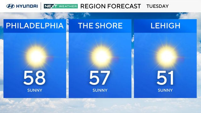
After Monday's storms, Tuesday is a mostly sunny day in the Philadelphia region.
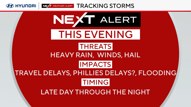
The rain held off for the Phillies' home opener, but potentially severe weather is set to move into the Philadelphia region on Monday night.
Overnight, we'll see mixed skies, light winds and patchy fog. So be careful if you're out late or very early in the morning on Sunday.
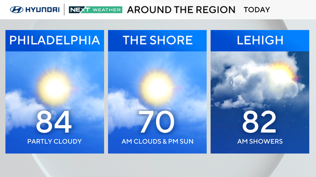
This weekend will feel almost like early summer with highs making a run into the 80s on Saturday.
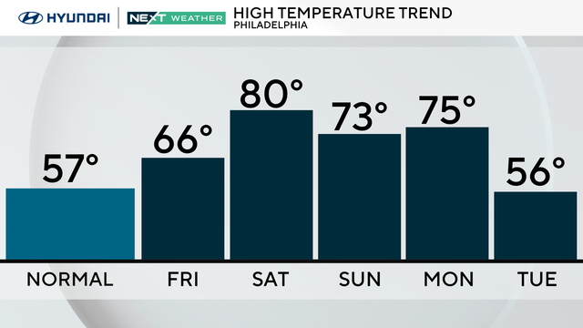
The weekend will feel almost like early summer in Philadelphia with warmer temps and a chance for rain.
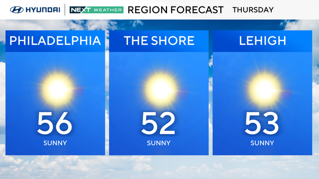
Thursday will start quite chilly in the Philadelphia region, but temps will jump back to seasonably mild in the mid-50s later in the day.
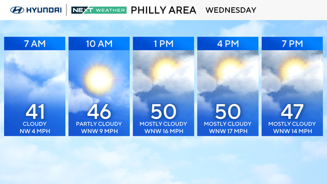
Wednesday will turn breezy and cooler with some clouds bubbling up in the afternoon.