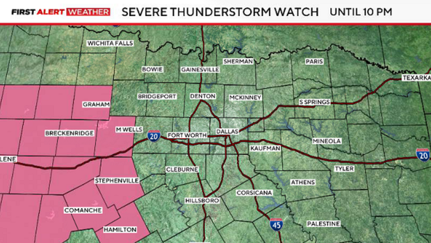
Severe thunderstorm watch trimmed back to western counties until 10 p.m.

Severe thunderstorm watch trimmed back to western counties until 10 p.m.
The 4th of July was a warm one, marking the hottest day of the year so far for North Texas, with a high of 99°.
That heat sticks around today, with forecast highs in the upper 90s to near triple-digits and, of course, feeling slightly hotter when you factor in the humidity.
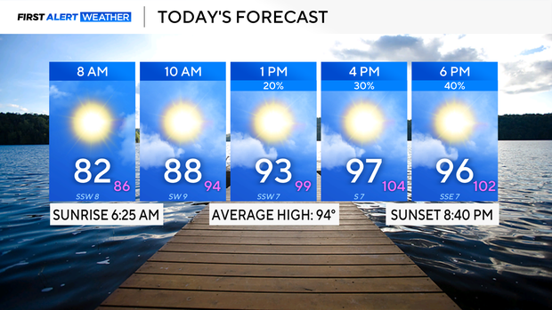
Fortunately, the humidity won't be really oppressive, just a bit sticky as you step out.
As daytime heating builds during the afternoon and evening, we will start to watch scattered showers build, moving from north to south.
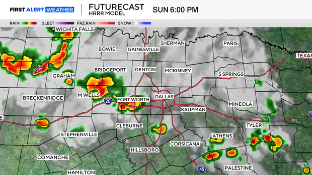
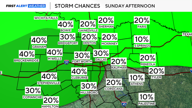
Better storm chances look to form first in the northwestern portions of North Texas, with better coverage north of I-20, and west of I-35.
It's far from a washout, and not a day where everyone will see storms.
But if you do have outdoor plans, please keep an eye on the radar, and if you see storms headed your way, make sure you are off the water and seeking shelter.
Storms that set up will have threats for lightning, and also strong gusty winds.
We'll hang onto a very isolated shower chance tomorrow, to kick off the new workweek, with the best chance south of I-20.
Otherwise, expect a hot and sticky week, with temperatures running slightly above average.