Temperatures spike into upper 90s in DFW as Tropical Storm Arthur forms in Gulf
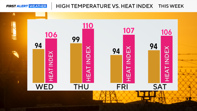
Looking ahead to Thursday, a First Alert Weather Day is in place due to extreme heat, with a heat advisory in effect at noon.
Watch CBS News
Looking ahead to Thursday, a First Alert Weather Day is in place due to extreme heat, with a heat advisory in effect at noon.
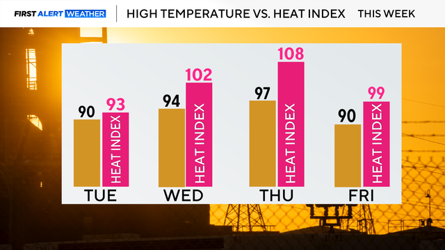
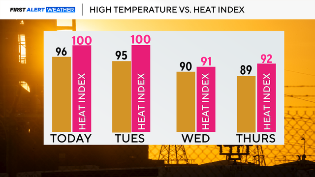
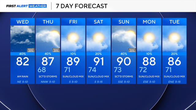
By Wednesday, feels-like temperatures reach the lower 100s and then on Thursday it may feel as hot as 108.

Areas along and south of I-20 will see rain in the late morning and afternoon due to a stalled front and a disturbance
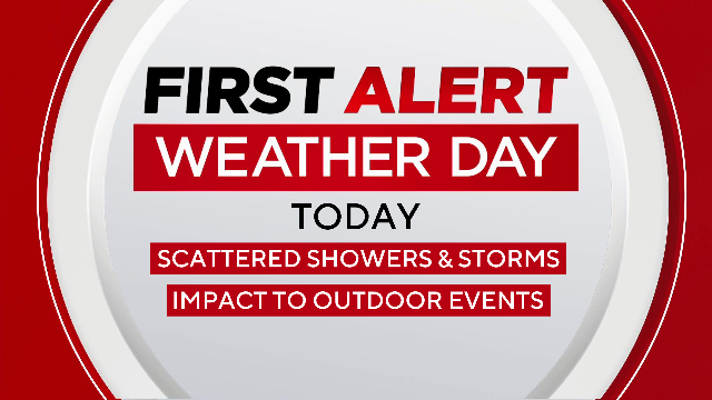
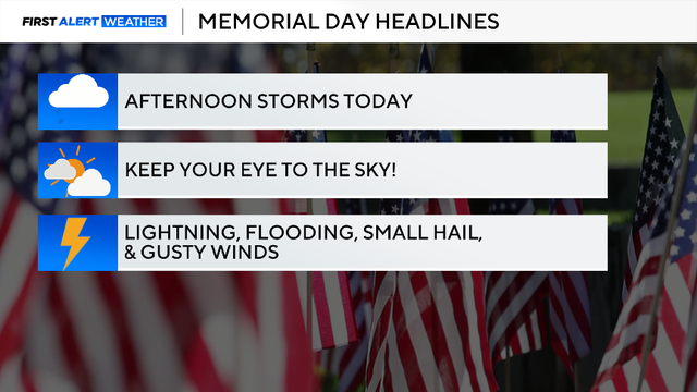
More scattered storms are anticipated across the Metroplex in the late morning and afternoon.

A First Alert Weather Day is in effect Sunday as storms and heavy rain threaten outdoor plans, including World Cup events across North Texas.

Sunday is a First Alert Weather Day due to the chance of severe weather.

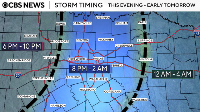
Most locations remain dry through midnight, but showers and thunderstorms are expected to develop near the Red River late tonight into the pre-dawn hours Friday.
The First Alert Weather Team is monitoring a potential First Alert Weather Day on Thursday, with an expected heat index of around 105 degrees.
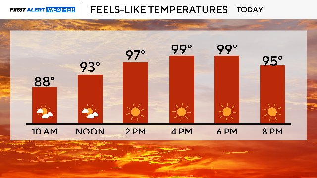
Drink plenty of water and take frequent breaks in the A/C.

Grounds are already saturated, leading to flooding in low-lying areas across parts of North Texas.
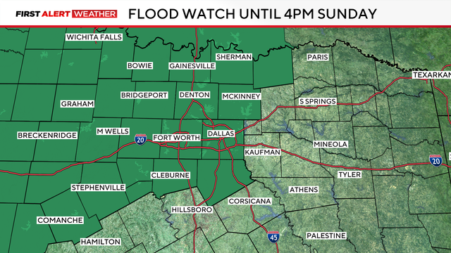
A Flood Watch is in effect until 4 p.m. on Sunday.
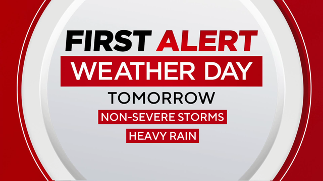
Scattered showers and thunderstorms are expected Friday, with periods of heavy rain on the way for Saturday and into Sunday morning.

Temperatures will be right around where they should be for this time of year – in the mid to upper 80s, feeling more like 90° once you factor in the humidity.

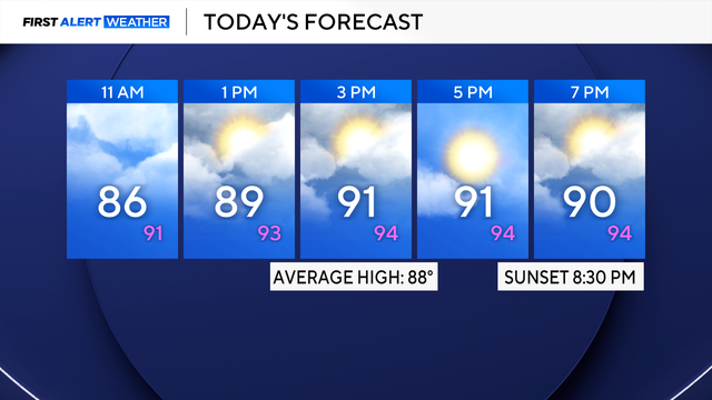
Expect a mix of clouds and sunshine, with highs around 90° and feels-like temperatures closer to the mid-90s.
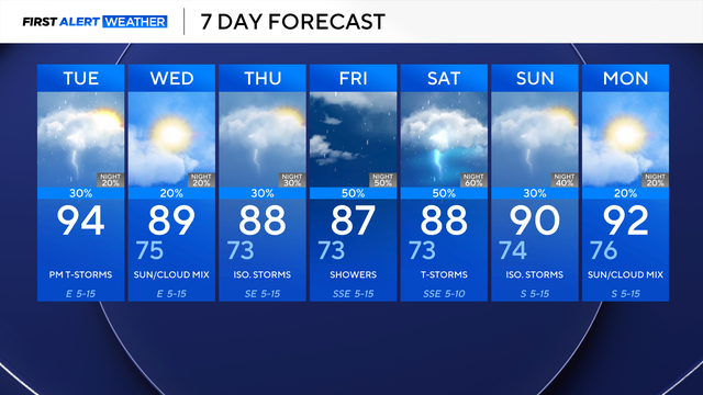
By Tuesday afternoon, a backdoor cold front (a cold front that moves in from the northeast) arrives, increasing our chances of isolated thunderstorms.
Some showers and thunderstorms will impact the afternoon commute on Tuesday. The best opportunity for widespread rain and thunderstorms currently looks to be Friday into Saturday.
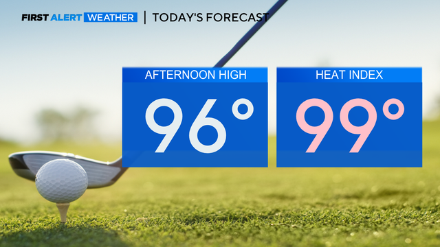
For those attending the Charles Schwab Challenge, be sure to wear sunscreen and drink plenty of water.
Don't rule out a pop-up shower for some western counties on Saturday.
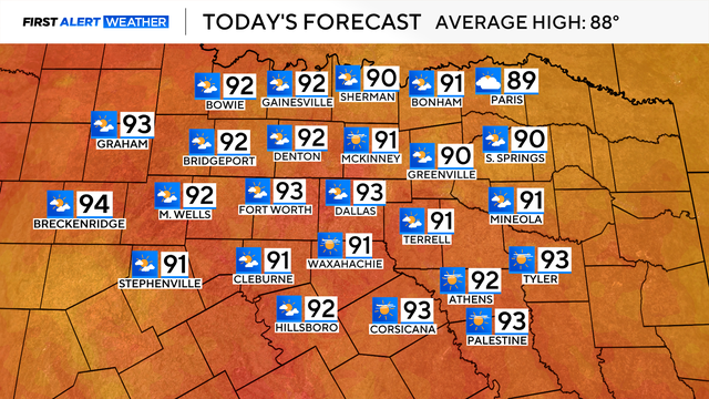
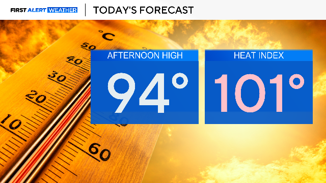
Friday will be the first of five days in the 90s. Feels-like temperatures in the Dallas-Fort Worth Metroplex will be 94° on Friday afternoon.
There's a threat of isolated thunderstorms, especially east of I-35 throughout the afternoon.
There were plenty of flooding issues across Tarrant County Monday, and DFW is under a level 2/4 risk for flooding again Tuesday into early Wednesday morning.
Temperatures will reach into the mid-80s in the late afternoon and cool into the 70s after sunset.

Expect mostly sunny skies and mild winds.

Be mindful of an early afternoon system for Saturday that could disrupt plans.
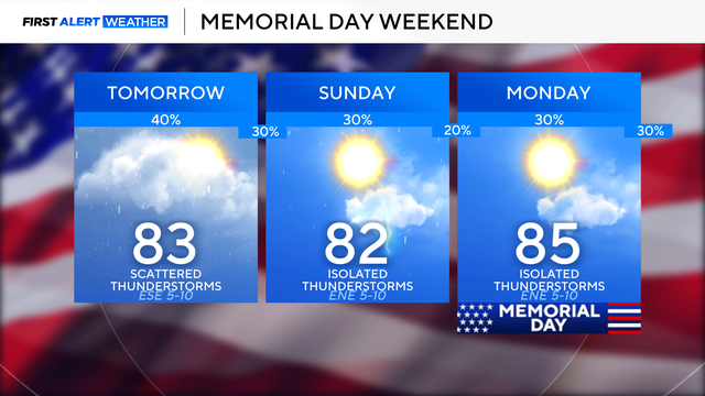
Temperatures will be warmer in the mid-80s by Friday afternoon. Most will stay dry, with a 20% chance of an isolated shower or thunderstorm.