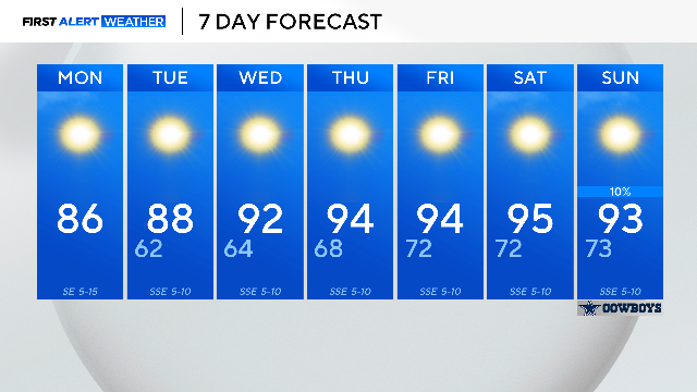
Mild, clear week ahead in North Texas
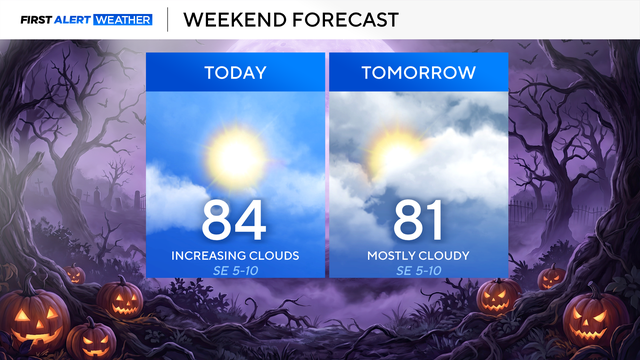
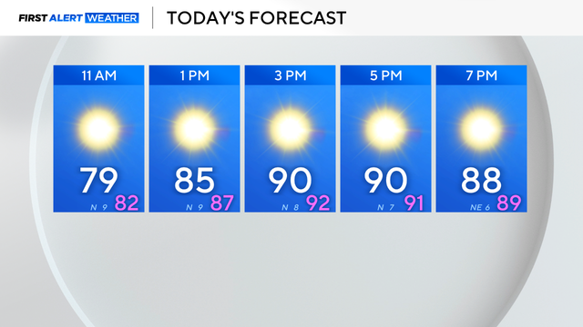
Mostly sunny skies, winds from the southeast around 5 to 10 mph and highs in the mid-80s are in the forecast today.
Watch CBS News
Mostly sunny skies, winds from the southeast around 5 to 10 mph and highs in the mid-80s are in the forecast today.
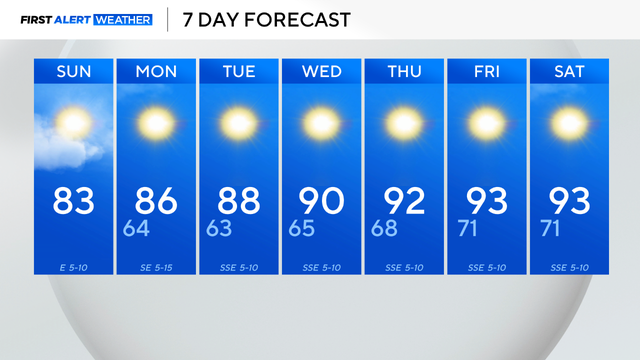
Take advantage of the mild weather and enjoy a long walk on the trail.
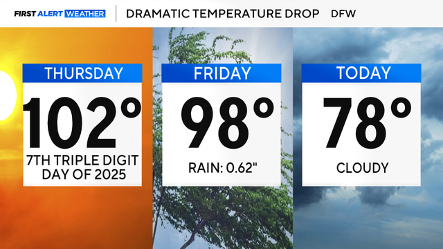
The cold front also brought a needed cooldown. It felt like fall Saturday morning; lows were in the lower to mid-60s.

Scattered storms moved through along a cold front. Cooler, drier air is expected to settle in for the weekend.

If DFW hits 100 degrees, it will only be the 7th time that has happened in 2025. The average is 20 times per year.
Thursday will be even hotter with highs in the upper 90s and sunny skies.

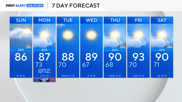
Wednesday morning will be beautiful with lows in the 60s and a light breeze from the northwest.

Scattered showers will continue through the first half of Labor Day with drier conditions by the afternoon.
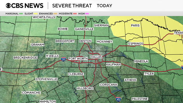
Storms were expected but not forecasted to move as slowly as they have been, which is leading to flooding.
Afternoon highs will climb into the upper 90s with "feels-like" temperatures up to 104 degrees.

Wednesday morning started off with temperatures around 70 degrees and comfortable humidity.

There will be a large spread in temperatures from north to south, with DFW looking to top out in the upper 80s.
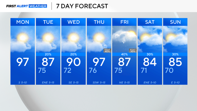
After a brief cooldown on Tuesday, temperatures will steadily rise back to the upper 90s.
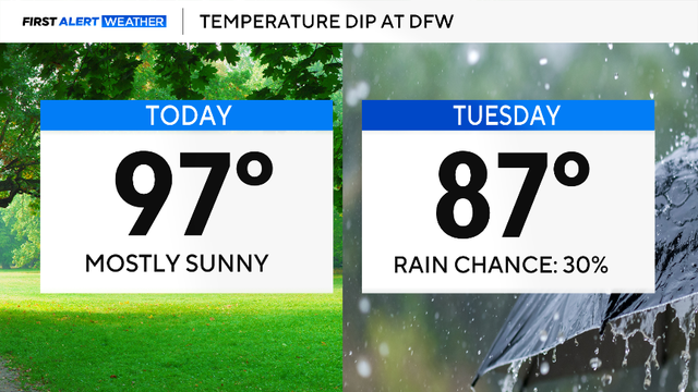
The cooler air is forecasted to settle in across North Texas on Tuesday, and highs are only expected to reach 87 degrees!
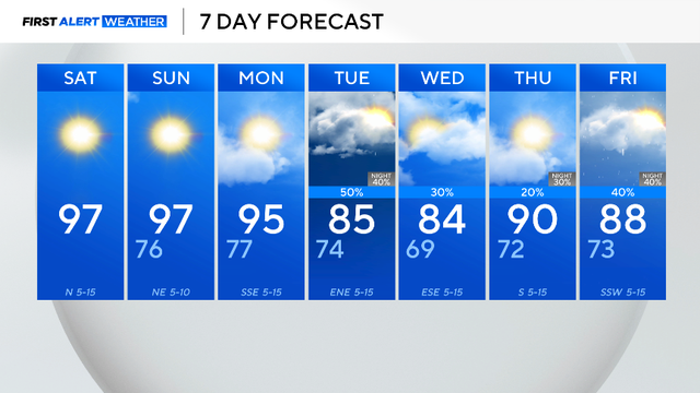
An Air Quality Alert is in place this weekend for the Dallas-Fort Worth Metroplex and surrounding counties.

The cold front will bring rain and a drop in temperatures next week.
Temperatures will warm into the mid-90s Thursday afternoon, but high humidity will push feels-like temperatures to near 100.
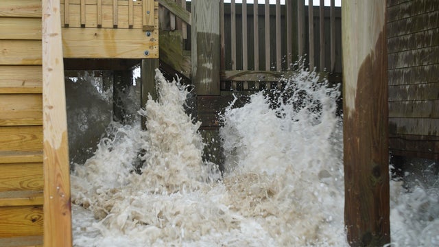
Hurricane Erin battered North Carolina's Outer Banks with strong winds and waves that flooded part of the main highway and surged under beachfront homes before slowly moving away.

After the rain moves out, mosh of the region will be under a heat advisory until 7 p.m.
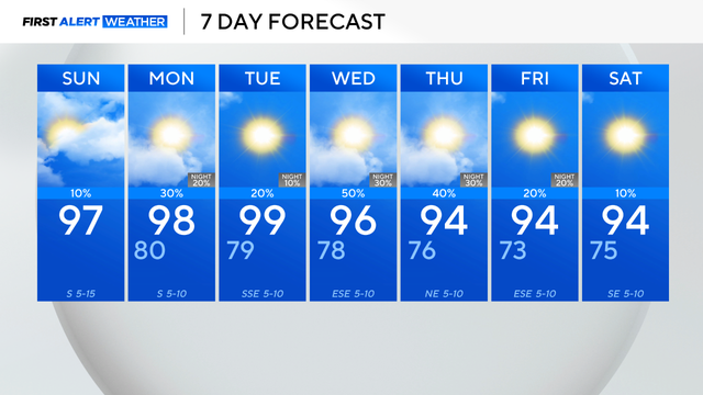
An active forecast is expected this next week with daily storm opportunities.

Hurricane Erin underwent rapid intensification to become a Category 5 storm in just hours. It has since weakened to a Category 4 status.
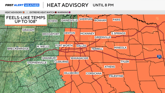
It's important to take precautions over the next several days.
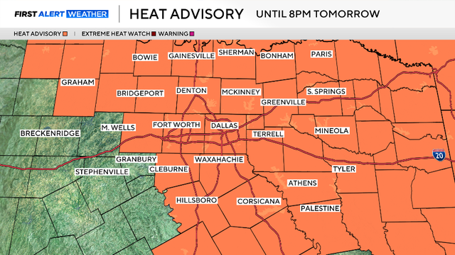
A heat advisory is in effect until 8 p.m. Saturday due to the heat index bringing "feels-like" temperatures up to 108 degrees.
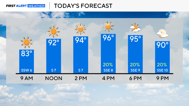
Plan for a hot and muggy day with a mix of sun and clouds.

Four people have died in heavy rain and flooding that hit near Chattanooga in Tennessee, officials said.