Storm chances linger as North Texans return to school
Storm chances bring mild temperatures with it.
Watch CBS News
Storm chances bring mild temperatures with it.
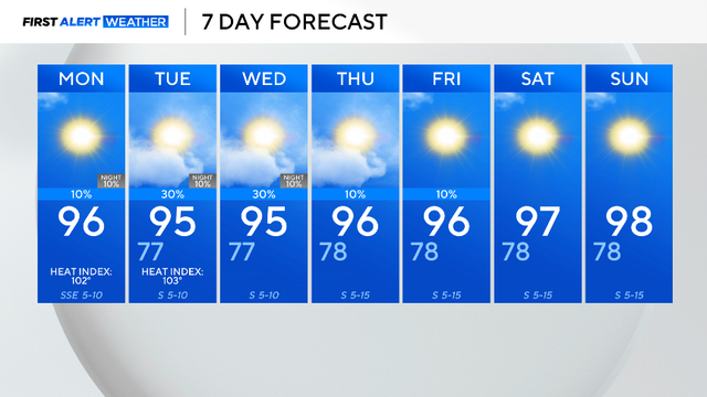
So far, 28% of this summer has been cooler than normal and this trend is likely to continue through the week.
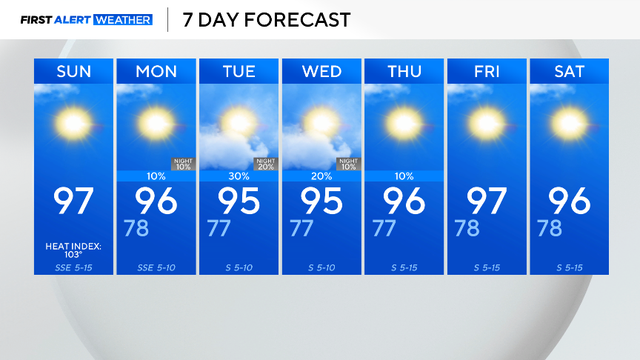
Mostly sunny skies are expected with a chance of isolated storms for the eastern counties on Sunday.
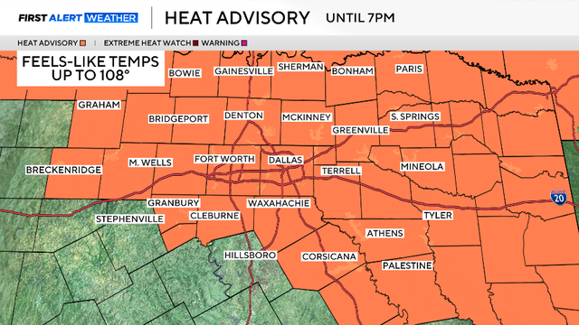
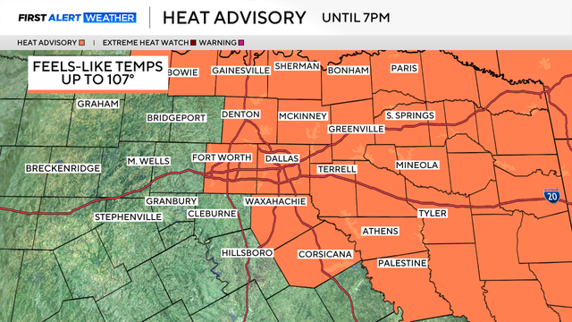
A Heat Advisory is in effect for most of North Texas Saturday, Aug. 9, until about 7 p.m.

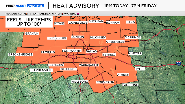
The heat advisory continues through 7 p.m. Saturday for "feels-like" temperatures reaching up to 109 degrees and it may be extended into Saturday.
Temperatures continue to slowly creep closer to 100 degrees in North Texas each afternoon.

A typical summer day is ahead in North Texas with sunny skies and hot temperatures.

Tuesday begins a warming trend with highs in the mid-90s, which are still below average for this time of year.

It was a noisy Monday morning across North Texas as a complex of storms raced south through the area.
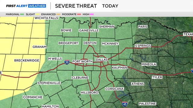
The Storm Prediction Center has just issued a marginal risk, level 1 out of 5, for the threat of isolated severe thunderstorms.
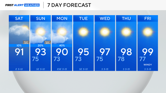
Saturday at DFW, the forecast high is 91 degrees with a chance of an isolated storm.
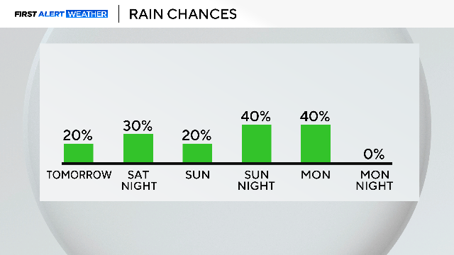
Multiple rounds of storms are expected over the weekend, with temperatures staying below normal for early August.
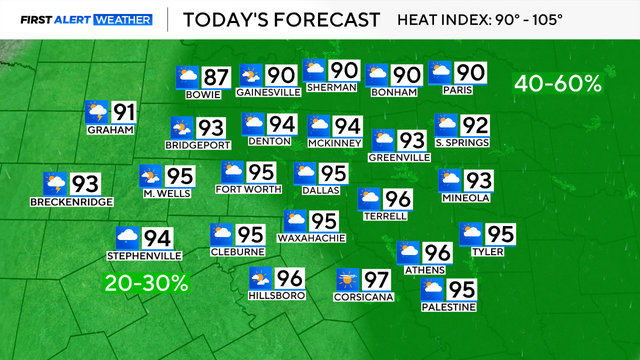
High temperatures will likely reach the mid-90s across North Texas on Friday.
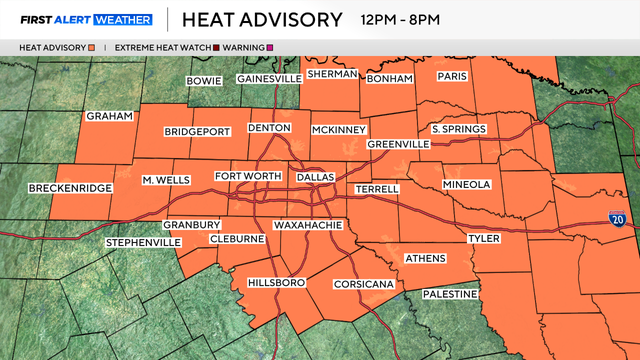
Thursday is another scorcher with highs around 102-103 degrees.
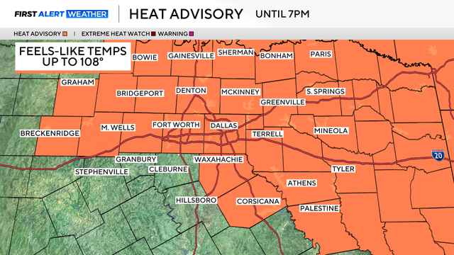
DFW officially hit 100 degrees for the first time in 2025 yesterday and more triple-digit temperatures are on the way Wednesday.
Another hot and sunny day is ahead with highs near 100 degrees in Dallas-Fort Worth this afternoon.
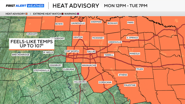
A heat advisory will go into effect starting at 12 p.m. Monday and will continue through 7 p.m. Tuesday.

Expect partly cloudy skies with the high temperature reaching the mid-90s and winds from the south gusting up to 20 mph.

The heat, combined with the high moisture content, is causing the heat index values to reach up to 107 degrees on Saturday afternoon.
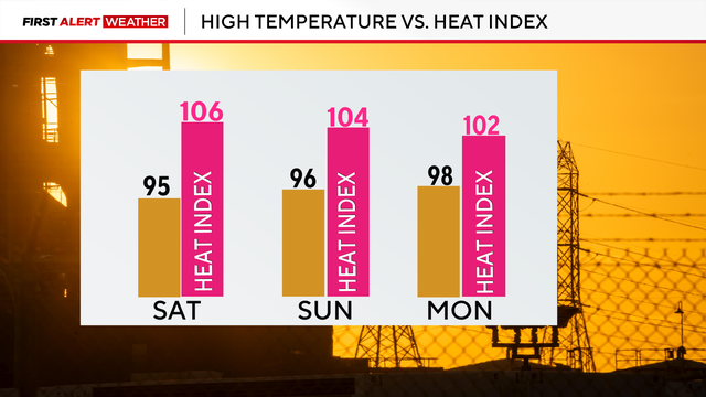
Friday marked our hottest day of the year so far, with a high temperature of 99° at DFW Airport. Parts of North Texas reached triple-digit temperatures, though, including Fort Worth.
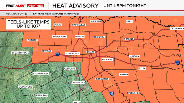
The heat advisory issued by the National Weather Service is in effect until 9 p.m. for most of North Texas.
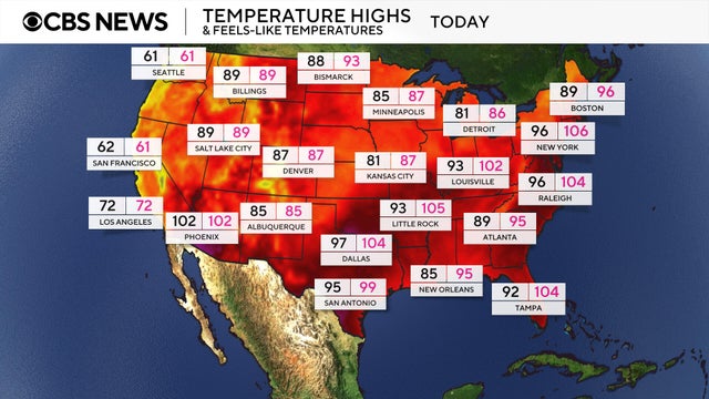
More than 100 million Americans are under heat alerts as the extreme temperatures that have smothered the Midwest this week arrive on the East Coast.

Temperatures on Thursday could stay in the upper 90s but the heat index will bring "feels-like" temperatures to 105 degrees.
The hottest day of the summer so far is showing up to North Texas on Wednesday.

The first heatwave of the season is in full force across North Texas as triple-digit highs finally arrive this summer.