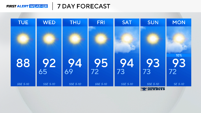
Unseasonably warm temperatures stick around North Texas this week
Though most of the area will remain dry, there is a slight chance of an isolated shower for areas to the east.
Watch CBS News
Though most of the area will remain dry, there is a slight chance of an isolated shower for areas to the east.

This month has started dry and will likely continue to stay dry through mid-October.
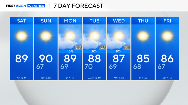
The hot and dry streak continues this weekend.

An air quality alert is also in place for Friday, meaning it will be unhealthy outside for sensitive groups.
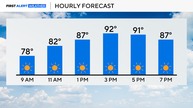
The stretch of sunny days with above-average temperatures continues in North Texas.
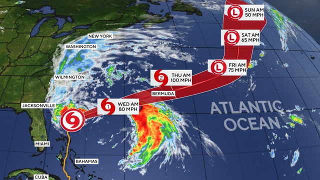
Imelda, the ninth named storm of the 2025 Atlantic hurricane season, has weakened to a post-tropical storm after lashing Bermuda with wind and rain.
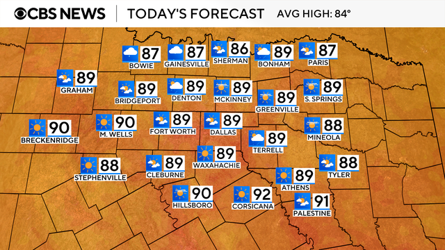
It is a hot end to the month of September. Most days have been above average temperature-wise and that trend is looking to continue starting in October.

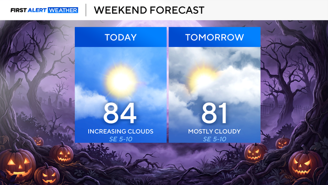
The high for Dallas-Fort Worth is expected to top out around 87 degrees and cloud cover will be increasing with dry conditions expected.

If you plan to tailgate for the Dallas Cowboys game Sunday, expect mostly sunny skies and temperatures in the mid-80s.
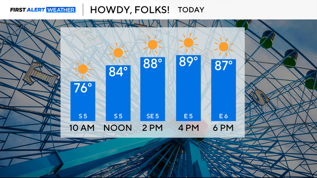
The average high temperature for DFW this time of the year is around 85 degrees; however, over the next week, temperatures will stay above average.
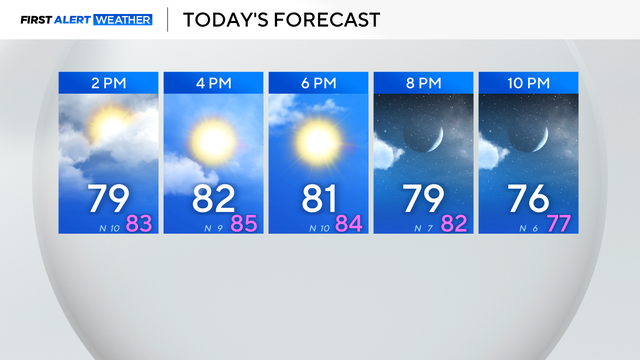
Clouds are clearing, and temperatures settle back close to normal through the end of the week.
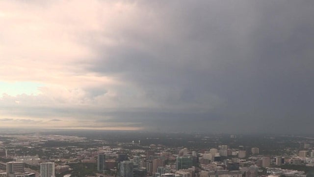
Monday started off stormy in North Texas, specifically in Denton and Collin counties.
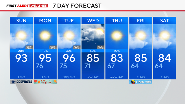
Summer is ending hot with highs in the 90s Sunday afternoon, but storms are possible for parts of North Texas.

Saturday will be another hot, above-average day across North Texas.

A complex of showers and storms will move in from Oklahoma Friday and may bring some rain to the parts of North Texas.
The First Alert weather team is tracking a cold front currently in the Texas and Oklahoma panhandles.
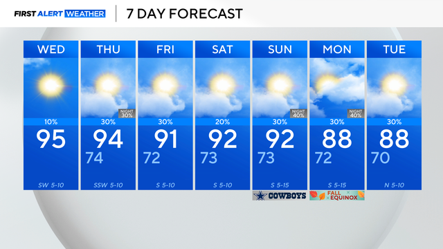
Once again, there's an Air Quality Alert in place for the Dallas-Fort Worth Metroplex and surrounding counties.
As we get through the end of the week, expect spotty shower chances that are fairly short-lived.
Rain chances Thursday are greatest along the Red River and diminish farther to the south.
Sunday will be much like Saturday, with temperatures a few degrees above average and mostly sunny skies.

Anyone planning on attending weekend festivities should be prepared to dress for the heat.
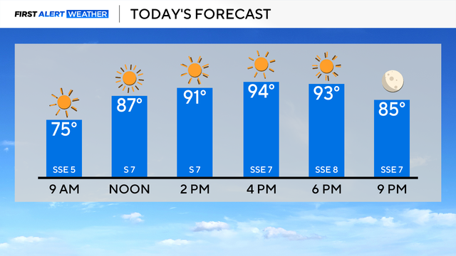
Thursday in North Texas started off with sunny skies and temperatures warming into the 70s.
Wednesday will be nice and a little warmer than on Tuesday.
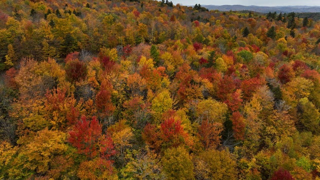
Maps show the best weeks in 2025 for leaf peeping across the U.S., with peak colors arriving as early as late September in some states.
Tuesday morning was another crisp and cool one with the low temperatures dipping to 63 degrees.