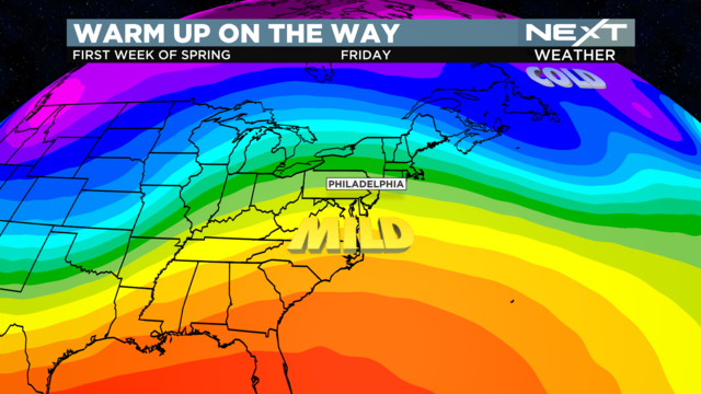
NEXT Weather: Springing into the week ahead
Spring officially begins Monday at 5:24 p.m., with warmer temperatures right on cue.
Watch CBS News
Spring officially begins Monday at 5:24 p.m., with warmer temperatures right on cue.
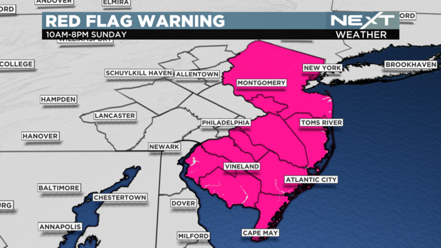
Weather conditions have created a fire danger for all of New Jersey Sunday from 10 a.m. to 8 p.m.
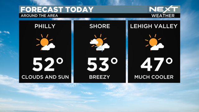
Summer is fewer than 100 days away!
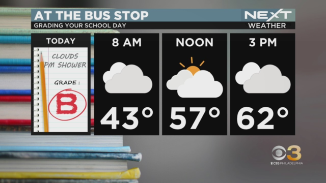
Expect a mild day with a chance of light showers.
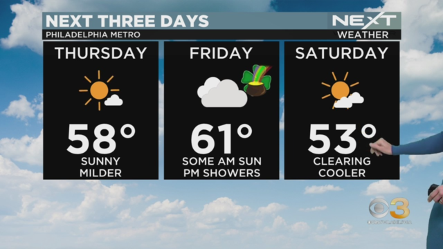
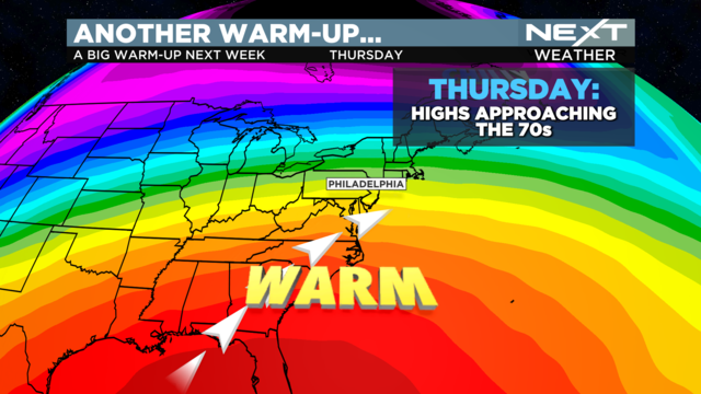
After biting wind chills earlier this week, we're in for a great, warmer day Thursday with possible highs nearing 60.
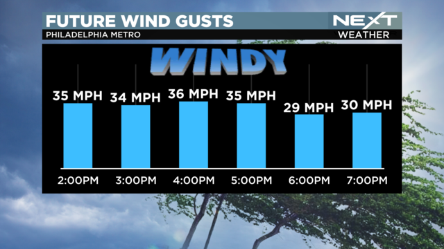
Wednesday will be another windy day, though slightly more bearable.
We may get some wraparound snow showers as a nor'easter storm moves out.
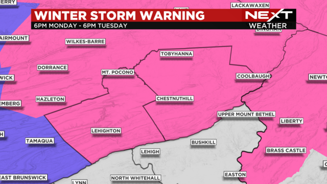
A Winter Storm Warning in effect will last through Tuesday evening for Carbon and Monroe Counties.
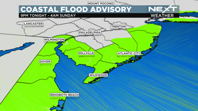
Another near-miss snowstorm moved across the region Friday into Saturday.
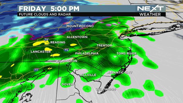
A NEXT Weather Alert has been issued for Friday afternoon through Saturday morning.
Parts of the Delaware Valley could wake up to 2 to 4 inches of slushy wet snow.
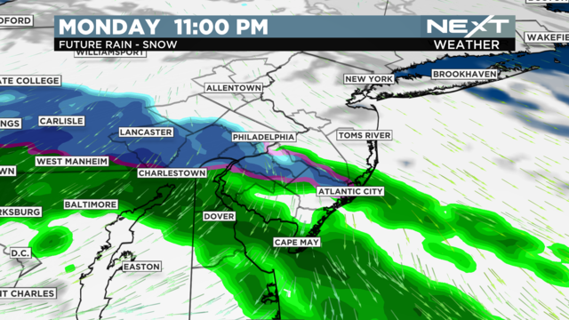
CBS Philadelphia's NEXT Weather team is also tracking a large storm for Friday night into Saturday.
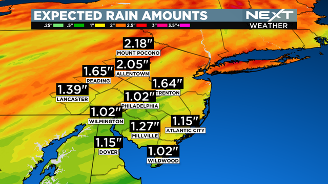
Precipitation from a strong storm system will be light through the afternoon, but evening heavy rain will develop in the evening.
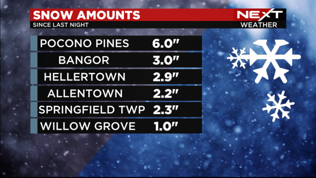
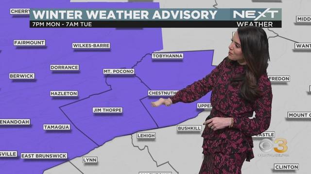
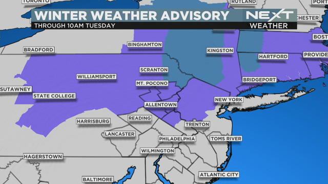
A Winter Weather Advisory remains in effect through Tuesday morning for much of the Lehigh Valley and northern New Jersey.
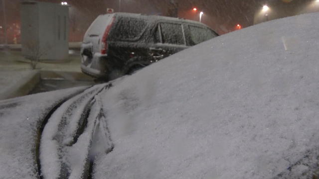
On Monday night - Mother Nature made sure to remind many that despite a mostly mild start to 2023 - winter is still very much here.
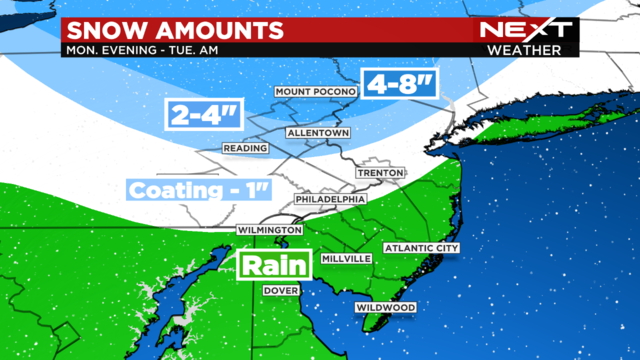
After a quiet start to the new work week, get ready for a messy evening commute as a storm system works its way into the area.
CBS Philadelphia's weather team has issued a NEXT Weather Alert Day for Monday.
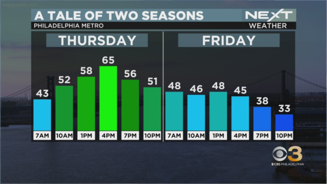
Warm air from the south is coming up north Thursday. But then a cool down will happen soon after.
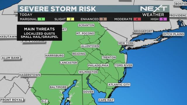
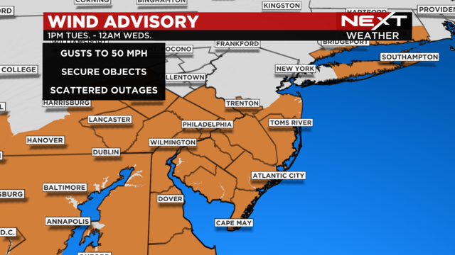
The biggest threat with the storms is wind gusts of up to 50 mph and possibly hail and graupel.
It's a shorter work week for many, with Presidents Day kicking off Monday — but there's no shortage of interesting weather for the Delaware Valley.
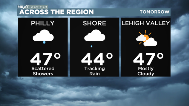
Sneak peek into next week: Dry, sunny and much milder through Wednesday, with highs approaching the 60s.
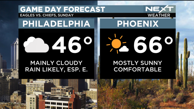
Another week, another shot at near-record high temperatures. This week has already brought about big changes, with increasing temperatures and a shot at highs near or at 60 degrees
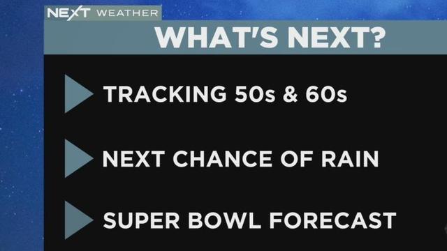
Tuesday evening will be the next chance of rain for the Philadelphia region, but it won't stick around for long. And we're in luck, a warmup is on it's way.
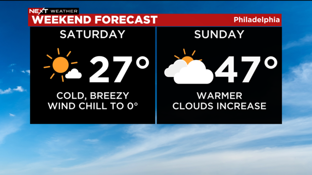
Don't forget your jacket! It's going to be a cold weekend before warmer air is on its way.
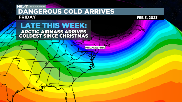
The NEXT Weather team is tracking an alert day for Saturday due to dangerous cold.