NEXT Weather Alert Day for strong to severe storms
PHILADELPHIA (CBS) -- Saturday is a NEXT Weather Alert Day for strong to severe storms that could arrive in the early evening hours and potentially bring damaging winds and downpours.
Parts of our region are under a slight risk for severe weather, or 2 on a 5-point scale.
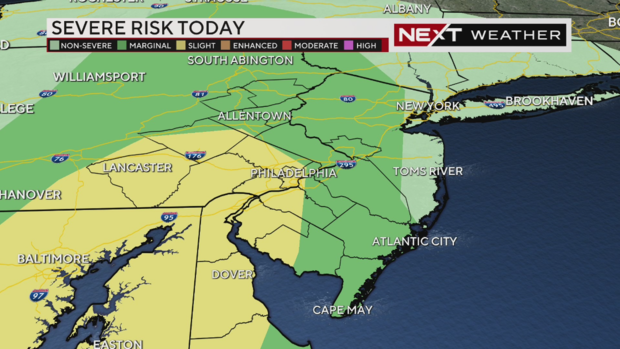
The counties facing the higher risk of severe weather include Philadelphia, Berks, Chester, Delaware, Montgomery and Lancaster counties in Pennsylvania.
In Delaware, all of New Castle and Kent counties are included in the higher-risk area.
In New Jersey, most of Salem County is under this slight risk, along with parts of Cumberland, Gloucester counties and a small portion of Camden County.
The rest of our region is under a "marginal" risk, or 1 on a 5-point scale. Everyone should be on guard, but the risk increases the farther south you go.
Stay with our NEXT Weather team throughout Saturday and we will keep you updated as weather develops.
NEXT Weather Alert Day: Parts of South Jersey saw rain, wind, and hail
Parts of south jersey saw some of the worst weather. Some places had rain, wind, and hail.
This no doubt reminded people of the seven tornadoes that touched down in New Jersey three Saturday's ago, luckily we didn't see any of that.
Severe thunderstorm watch until 9 p.m.
Severe thunderstorm watch issued for Pa., N.J. counties
A severe thunderstorm watch is now in effect in Pennsylvania and New Jersey.
The weather alert covers the following counties in Pennsylvania:
- Berks
- Bucks
- Chester
- Delaware
- Lancaster
- Lehigh
- Montgomery
- Northampton
- Philadelphia
The following counties in our region in New Jersey are under the alert:
- Gloucester
- Camden
- Salem
- Cumberland
- Burlington
- Mercer
Severe thunderstorm watch issued in Delaware
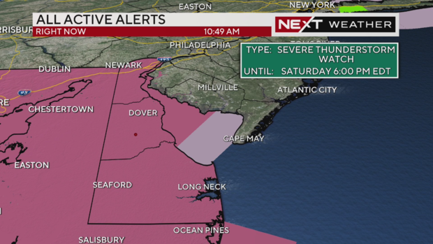
The entire state of Delaware is under a severe thunderstorm watch Saturday.
The alert includes New Castle County, Kent County and Sussex County.
This severe weather alert is set to expire at 6 p.m.
Timing of severe threat
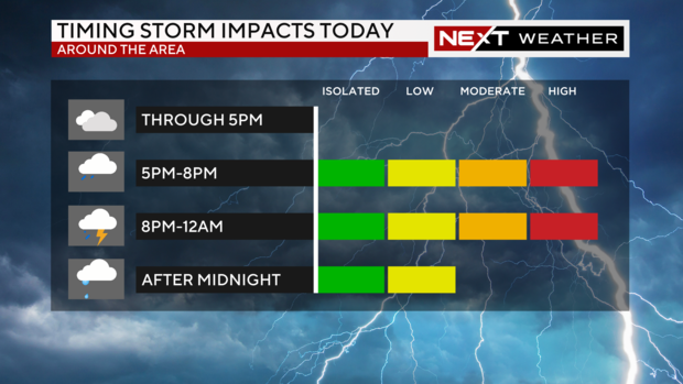
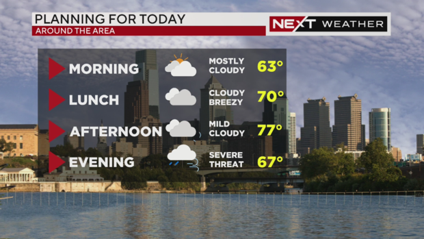
Through 5 p.m., you're fine to make plans, it'll be warm, breezy and cloudy out there. Then after 5 or 6 p.m., rain will start to pick up.
Between 5 p.m. and 9 p.m., we will see the worst of the storms' impacts.
Moderate impacts are possible through midnight.
Impacts of Saturday evening storms
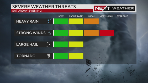
Clouds will thicken as the day goes on, and winds will pick up out of the south.
We're facing a high threat of heavy rain and potential localized flooding.
Strong winds are the biggest threat we're facing.
There is a moderate chance of hail up to an inch in size.
And there is a possibility of isolated, brief spin-ups that could spawn tornadoes.
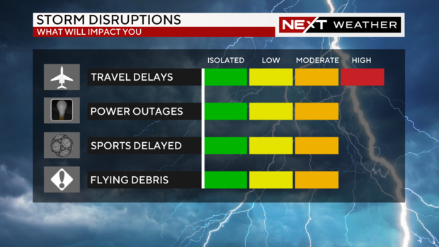
There are chances of downed tree branches or power lines, scattered power outages, delays at Philadelphia International Airport and other airports, ponding on roads, and flying debris.


