Seasonable temperatures return to Philadelphia region this week, storms possible
The Philadelphia region is back to a typical summer pattern today with sunshine, highs near 90 and increasing humidity.
Watch CBS News
The Philadelphia region is back to a typical summer pattern today with sunshine, highs near 90 and increasing humidity.
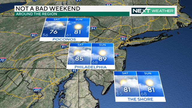
Saturday will feature cloudy skies with peaks of sunshine and the chance for isolated showers.
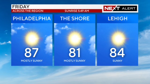
Friday is shaping up to be a magnificent July day in the Philadelphia region with comfortable temperatures and lower humidity.
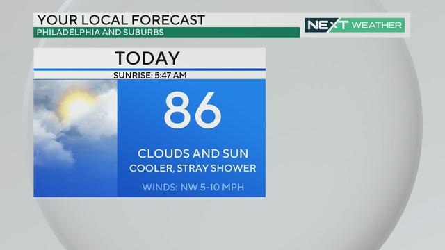
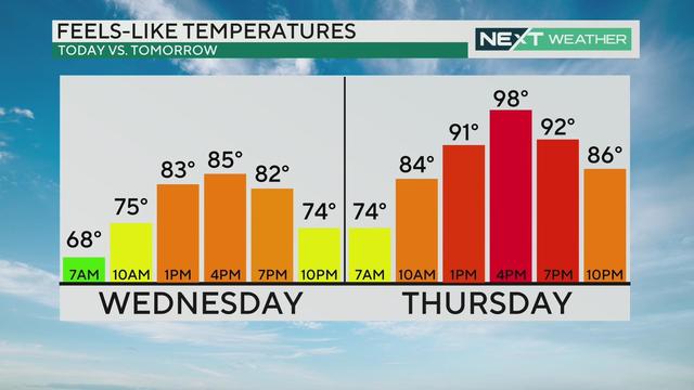
Thursday afternoon will see partly cloudy and sunny skies with highs near 86 degrees in Philadelphia, much more seasonable for this time of the year.
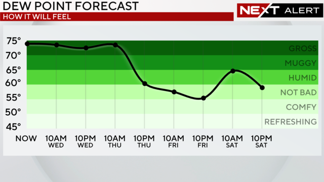
Severe weather is moving into the Philadelphia region Wednesday evening.
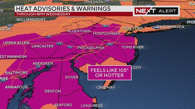
Tuesday will likely be the hottest day so far this year, and the air temperature itself may get to 100 degrees. There's also a chance for severe storms.
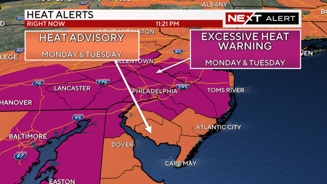
The searing heat is back again, with highs on Monday in the mid and upper 90s.
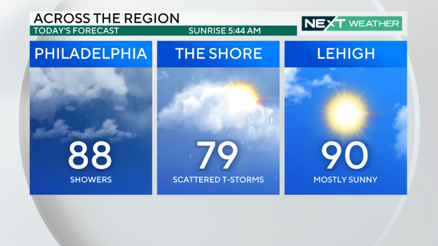
Saturday is off to a wet start with a flood watch in effect into the afternoon. But the Philadelphia area won't be totally washed out.
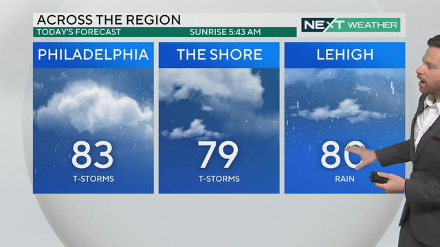
Friday will bring below-normal temperatures and a chance for rain to the Philadelphia region.
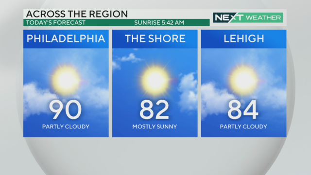
The heat wave will continue in the Philadelphia region on Thursday with another 90-plus day in the city.
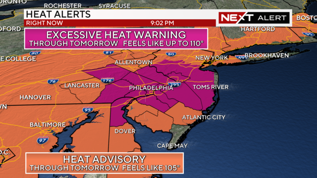
Tuesday will be the sixth day of the ongoing heat wave in the Delaware Valley. Highs will reach the mid-90s but the heat index will get up to 105 degrees.
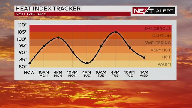
A heat advisory is in effect through Tuesday, meaning the heat and humidity will combine to make it feel between 100 and 102 degrees across the Delaware Valley.
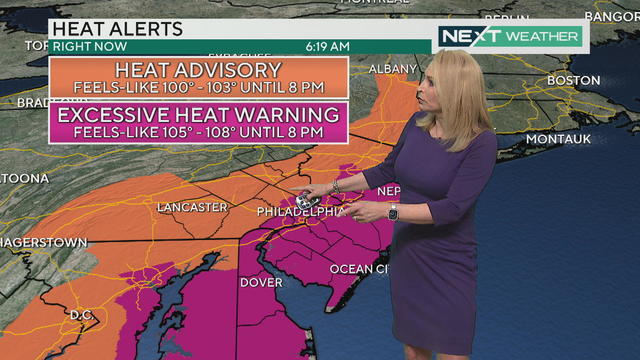
Today's dangerous hot weather around the Philadelphia region has triggered an Excessive Heat Warning, which is the highest level of heat alert
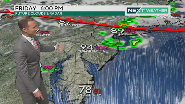
Much of the Philadelphia region is under a heat advisory Friday, with hot and humid conditions expected.
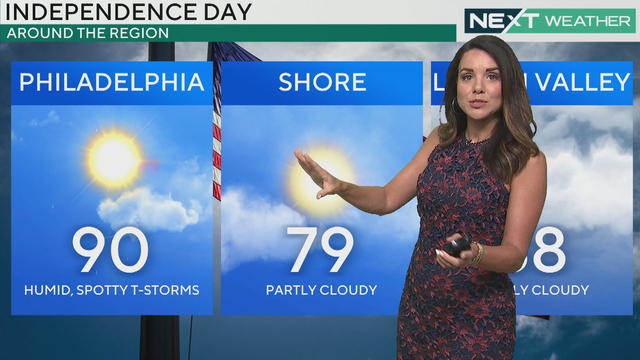
After a few gorgeous days, things change on the Fourth of July in the Philadelphia region as showers and storms will develop, mainly during the afternoon and evening.
Expect another gorgeous day on Wednesday with seasonably mild temps, plenty of sun mixed with a few clouds and very low humidity.
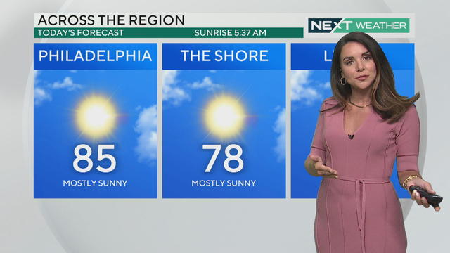
Low humidity, sunny skies and seasonably mild temperatures are once again in the weather forecast on Tuesday in the Philadelphia area.
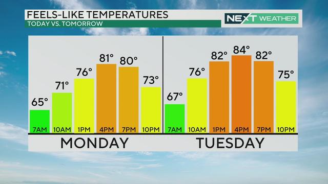
After severe weather Sunday, the Philadelphia region is starting July off today with sunny skies from start to finish.
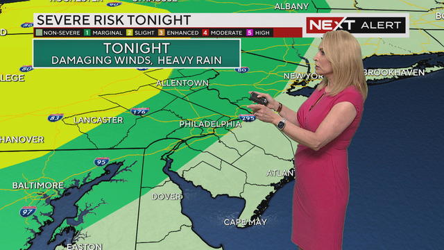
Potential severe storms could roll through late Saturday night and again Sunday afternoon into the evening.
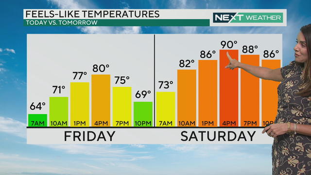
Be sure to spend a ton of time outside today as the dew point is low and the temperature is just right for early summer.
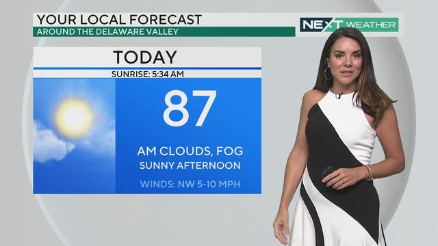
Get ready for a brighter, calmer end to the weather week in the Philadelphia region, with humidity dropping to pleasant levels.
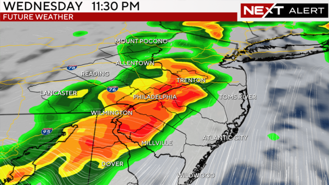
After two days of comparatively cooler conditions, heat and humidity will return to the Philadelphia area Wednesday, along with the chance for strong to severe weather.
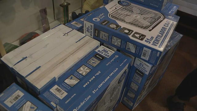
Delaware County is stepping up its efforts to keep seniors safe as the region deals with intense heat and feels-like temperatures around 100.
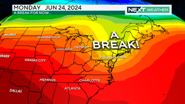
The severe thunderstorm watch ended in the Philadelphia region on Sunday night after it was in effect for several hours.
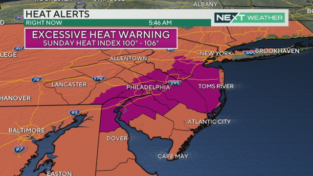
The feels-like temperature in Philadelphia and other cities including Reading, Trenton and Vineland could reach triple digits on Saturday.