Freezing temps continue in Philly Monday, more chances for snow this week
The Philadelphia area officially broke its stretch of subfreezing temperatures Monday, but gusty winds are keeping conditions dangerously cold.
Watch CBS News
The Philadelphia area officially broke its stretch of subfreezing temperatures Monday, but gusty winds are keeping conditions dangerously cold.
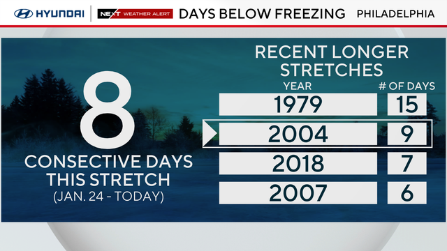
Sunday marks nine consecutive days with a high temperature below freezing, the longest subfreezing stretch since 2004.
A "bomb cyclone" looks to avoid our area in terms of significant snow, but could bring coastal wind and flooding impacts.
A coastal storm may brush by the Jersey Shore on Sunday and drop some snow, or potentially miss the Philly area entirely.
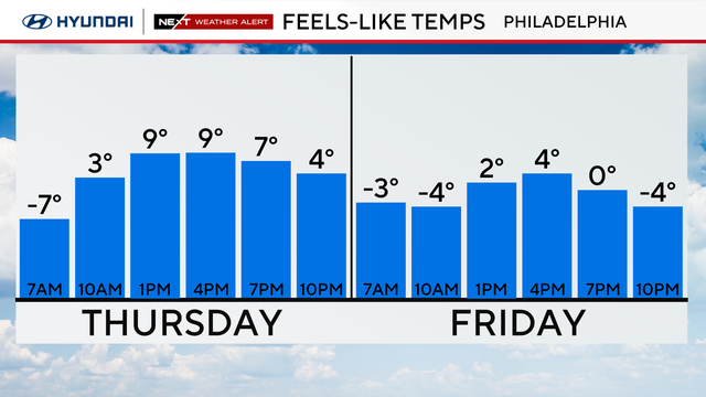
Thursday in the Philadelphia region will be another frigid day with a high of 20 degrees and feels-like temperatures of 9 degrees.
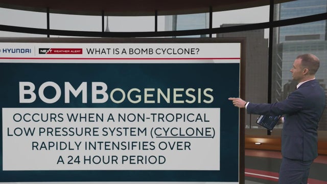
Bomb cyclones are possible year-round, but they are most common along the eastern seaboard of the United States during winter and early spring.
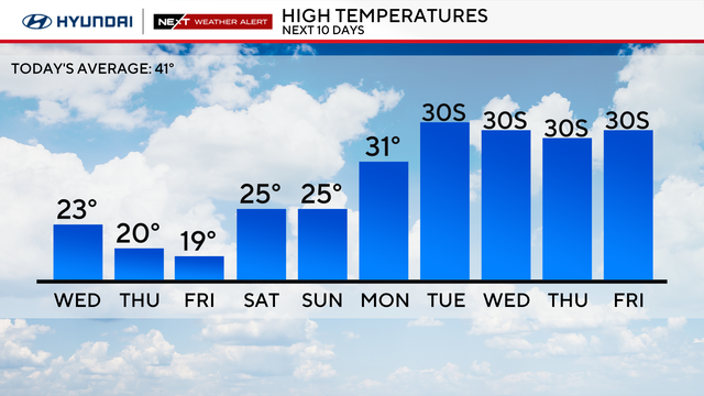
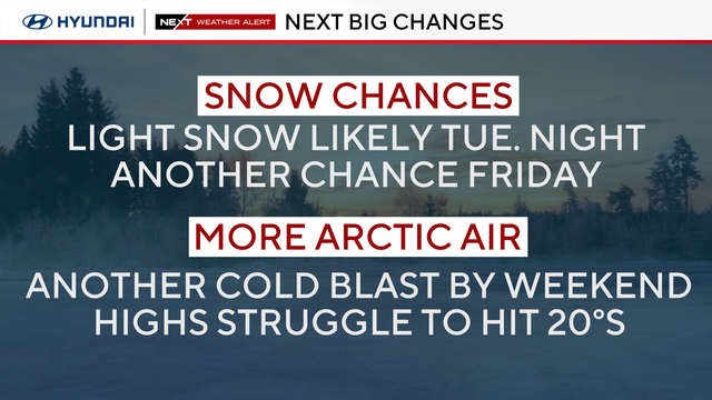
Temperatures will likely not get back above freezing until Tuesday of next week, marking 10 days of subfreezing temps.
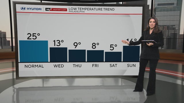
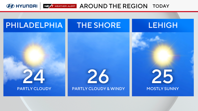
Tuesday in the Philadelphia region will be very cold again, with highs in the low 20s and feels-like temperatures at 10 degrees.
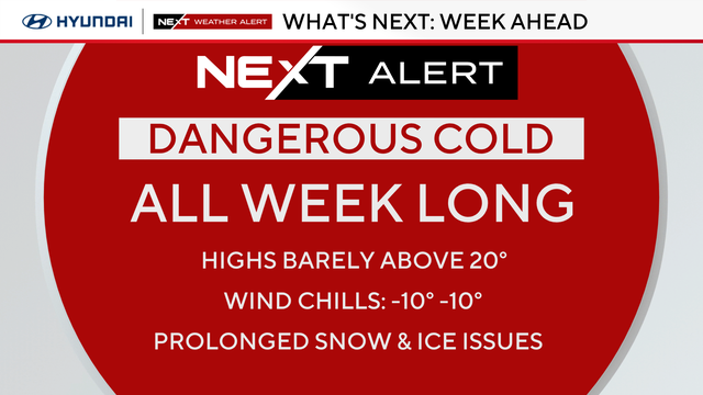
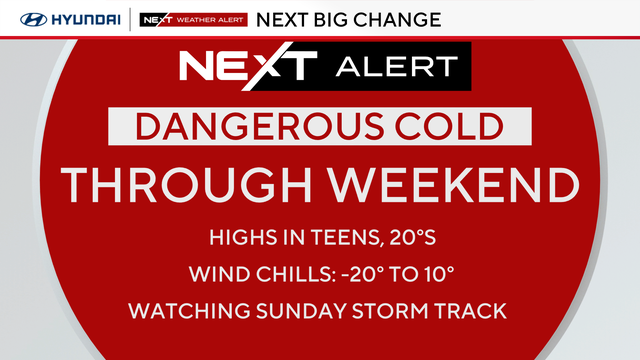
Dangerous cold grips the Philadelphia region all week, meaning the snow that fell on Sunday isn't going anywhere.
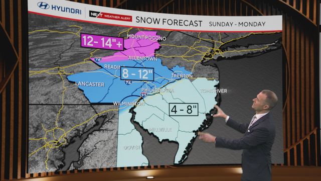
The entire Philadelphia area is under a winter storm warning for heavy snow and sleet through 1 p.m. Monday afternoon.
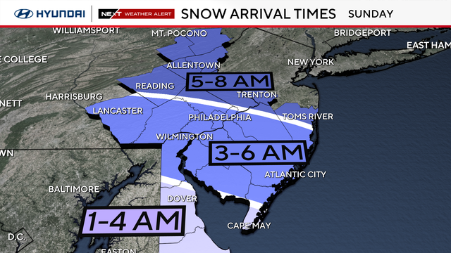
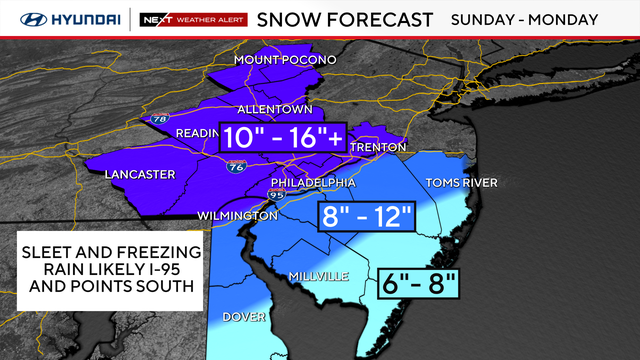
A major winter storm is headed to the Philadelphia region, forecast to bring at least 6 inches to the area. Here's what to know.
Friday in the Philadelphia region will be another milder day with some sun before a snowstorm arrives this weekend.
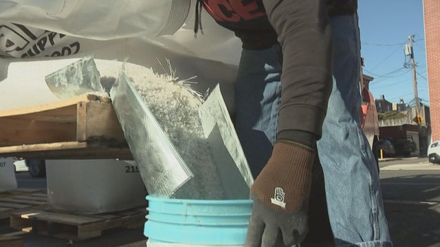
With the Philadelphia region expecting a major snowstorm this weekend, here's the best choice of ice melt to keep you safe.

The NEXT Weather team breaks down four types of precipitation and what conditions create each one.
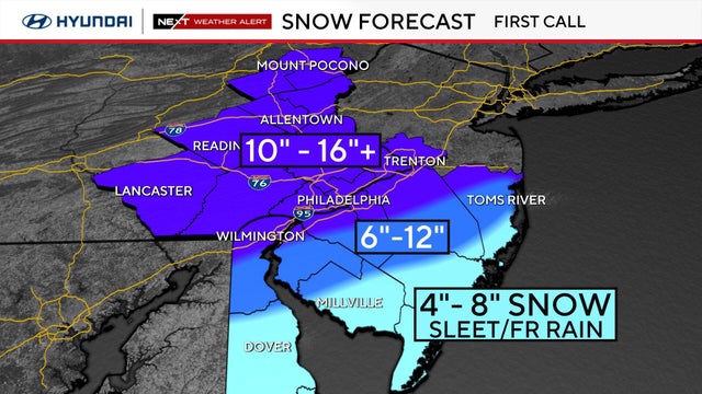
It'll be quiet and mild around Philadelphia for the next two days before a major winter storm could potentially drop a foot of snow around the region this weekend.
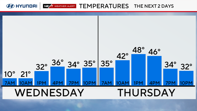
It'll still feel brutally cold in Philadelphia Wednesday, though temps climb slightly back above freezing. Looking to the weekend, the region could see its biggest snowstorm in a decade.
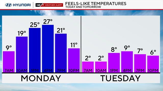
Arctic cold combined with breezy winds will create dangerously cold wind chills Tuesday morning across the entire Philadelphia region.

Snow fell across the Philadelphia region over the weekend as multiple winter storms hit the Delaware Valley.
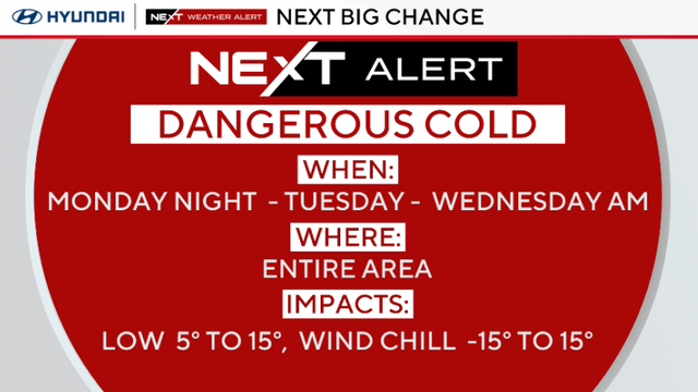
With temperatures dropping overnight across the Philadelphia region, any wet areas will freeze and become slick.

Leave a little extra drive time Sunday as more snow is on the way for the Delaware Valley.
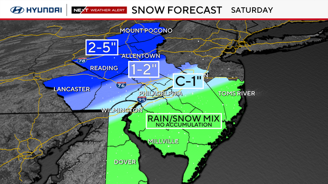
Have your winter gear ready and try to lay down some salt to help melt any of the slushy snow.
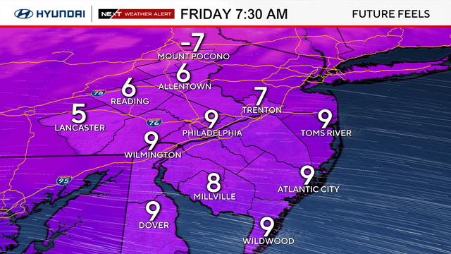
Arctic air is bringing bitter cold to the Philadelphia area Friday, before snow showers Saturday morning.
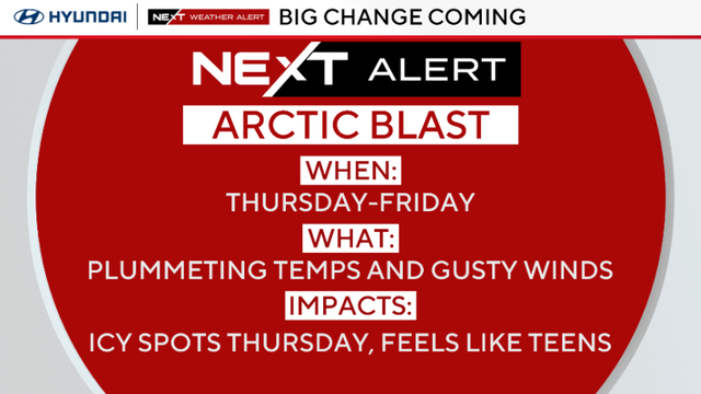
Temperatures will plummet Thursday in the Philadelphia region with winds gusting as high as 30 mph from the northwest.
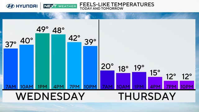
Highs will hit the 50s Wednesday in the Philadelphia region, but we'll have a chance of snow and rain at night.
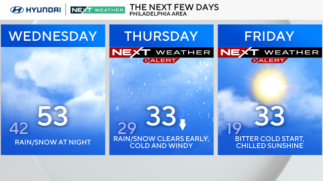
Tuesday in the Philadelphia region will be mild, but we're tracking storms this week that will bring rain and possibly snow.