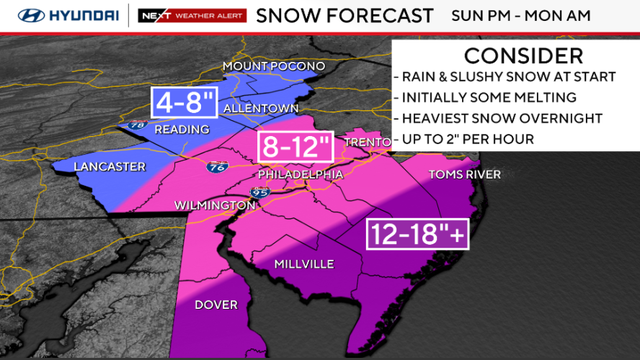
Blizzard warning issued as Sunday-Monday snow storm takes shape
Saturday is dry and mild but Sunday's snow will likely really pick up during the afternoon and evening.
Watch CBS News
Saturday is dry and mild but Sunday's snow will likely really pick up during the afternoon and evening.
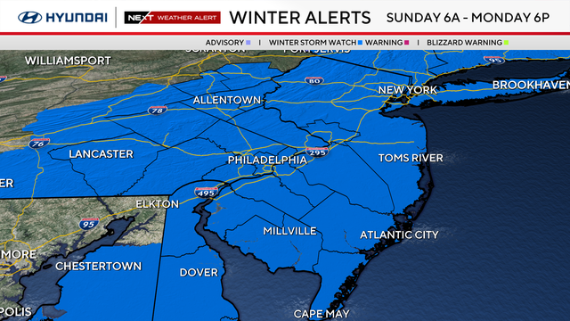
We've issued a NEXT Weather Alert for Sunday into Monday as we track the possibility of a wintry mix and snow.
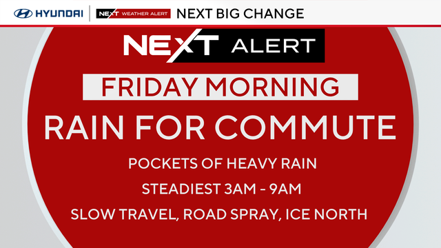
Thursday will be cloudy and cool thanks to a breeze from the east. Looking to the weekend, the NEXT Weather team is tracking the chance for more snow Sunday night.
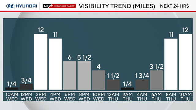
After a morning with fog, low clouds and light rain, visibility is beginning to improve in the Philadelphia region.
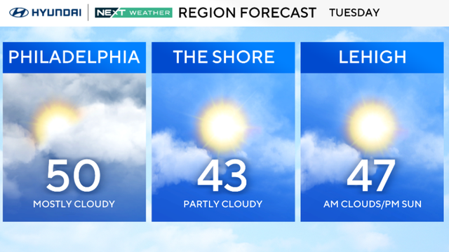
Expect temperatures to stay around 45 degrees this week in the Philadelphia region, which will significantly help melt the remaining snowpack.
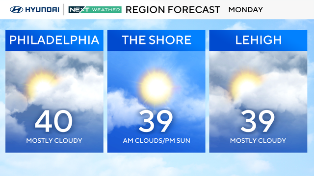
Temperatures in the Philadelphia area will stay above freezing for much of the week.
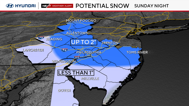
A NEXT Weather Alert is in effect as light rain and slushy snow move into the Delaware Valley Sunday afternoon into early Monday morning.
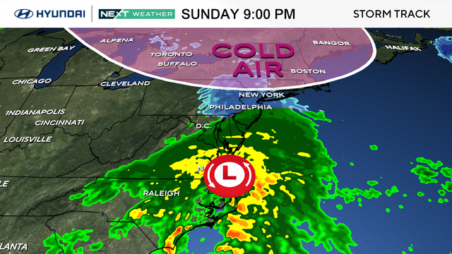
After a wonderful Valentine's Day, we could see rain changing to snow, or a wintry mix, in parts of the Philly area Sunday night.
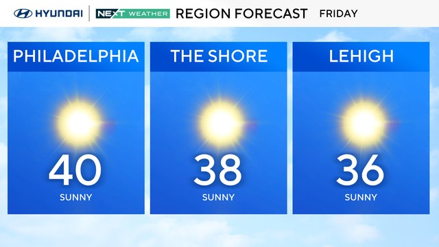
Mild Friday ahead of a mostly sunny Valentine weekend with a slight chance of snow on Sunday.
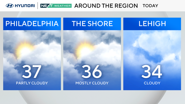
After a taste of more seasonable conditions yesterday with highs in the middle 40s, cooler air sneaks back into the Philadelphia region Thursday.
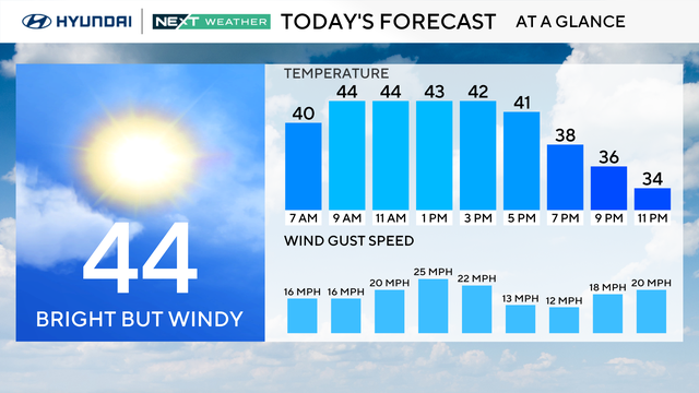
Seasonable temperatures continue Wednesday and Thursday in the Philadelphia area.
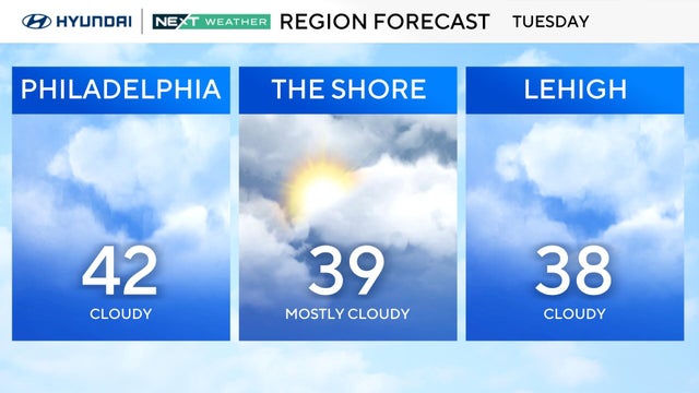
Starting Tuesday, the Delaware Valley will warm above freezing each day to the mid and upper 30s, with low the 40s possible for some.
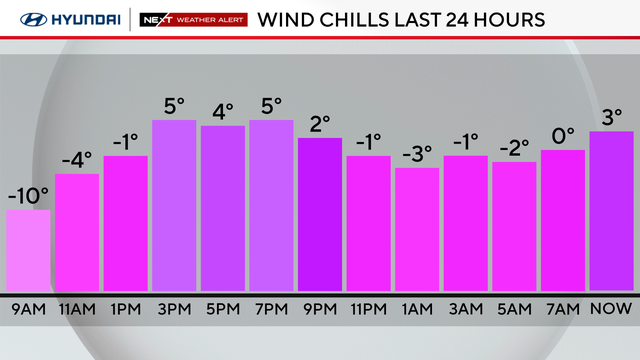
Monday in the Philadelphia region will be mostly sunny, but it will remain dangerously cold with lows in the single digits.
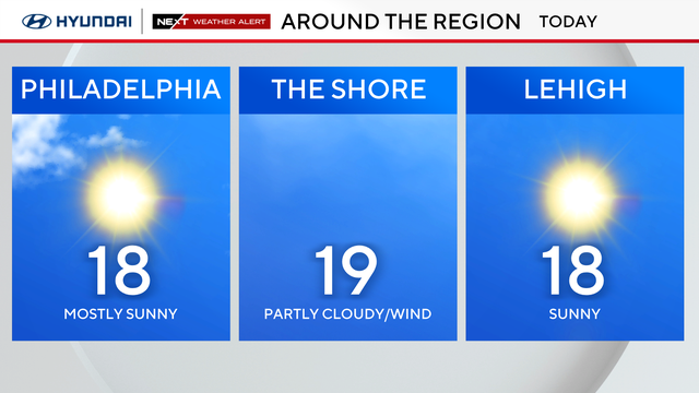
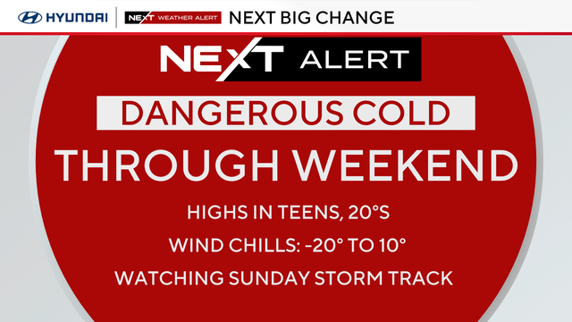
Arctic air remains Sunday as highs only climb into the upper teens. Philadelphia woke up to temps around 5 degrees, the first single-digit low for the city since 2022.
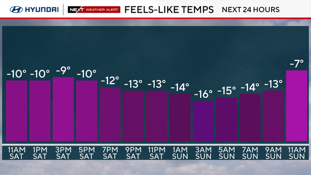
Old man winter is not done with us yet. A dangerously cold night is on tap as subfreezing temperatures return to the Delaware Valley.
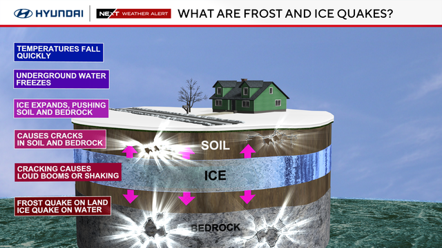
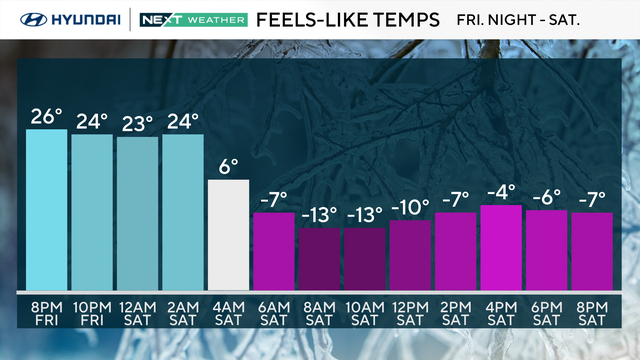
The coldest air of the season is set to slide over the Philadelphia area this weekend, which could lead to frost quakes, ice quakes and lake quakes.
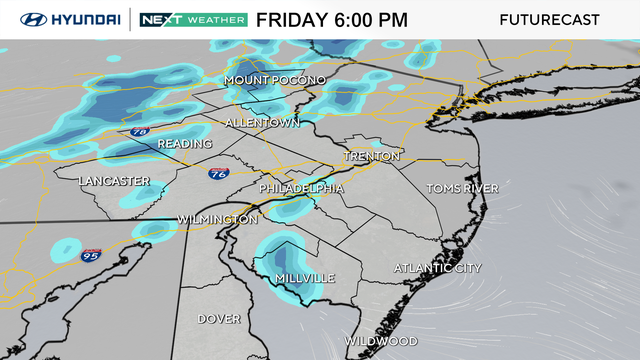
An Arctic cold front will blast through the Philadelphia region overnight Friday into Saturday.
Temperatures will get above freezing for a short period Thursday afternoon before another Arctic blast moves into the Delaware Valley this weekend.
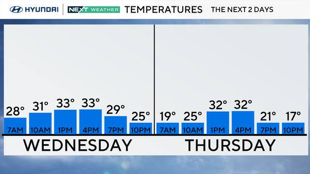
The temperatures Wednesday afternoon in the Philadelphia region will help some of the widespread snow melt.
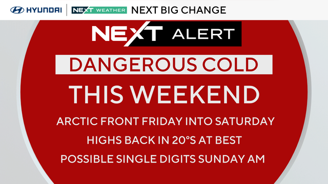
Tuesday is even milder than Monday, with highs in the upper 30s in Philadelphia before a return to the 20s over the weekend.
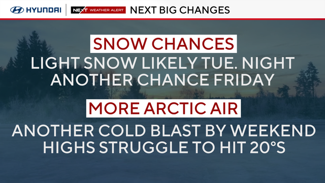
The Philadelphia area officially broke its stretch of subfreezing temperatures Monday, but gusty winds are keeping conditions dangerously cold.
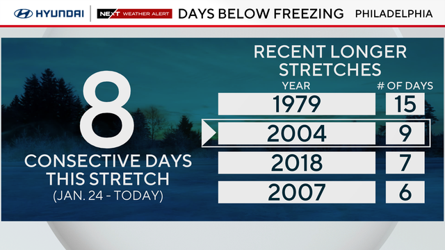
Sunday marks nine consecutive days with a high temperature below freezing, the longest subfreezing stretch since 2004.
A "bomb cyclone" looks to avoid our area in terms of significant snow, but could bring coastal wind and flooding impacts.
A coastal storm may brush by the Jersey Shore on Sunday and drop some snow, or potentially miss the Philly area entirely.
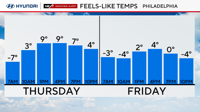
Thursday in the Philadelphia region will be another frigid day with a high of 20 degrees and feels-like temperatures of 9 degrees.