
Storm damage limits some areas of Kensington, Stony Creek Metroparks
Some parts of two Huron-Clinton Metroparks in Metro Detroit remain off-limits to the public due to storm damage.
Watch CBS News
Some parts of two Huron-Clinton Metroparks in Metro Detroit remain off-limits to the public due to storm damage.
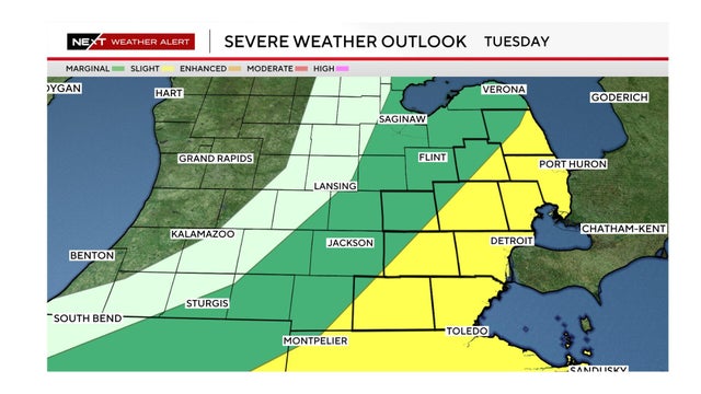
The National Weather Service has issued a slight risk forecast for severe weather on Tuesday in an area that includes Metro Detroit.

Monday's severe weather caused damage across Metro Detroit, and resulted in some school closings for Tuesday in Macomb County.
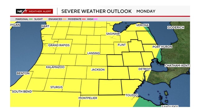
Wind gusts up to 60 mph, large hail, heavy rainfall and an isolated tornado are possible Monday in Southeast Michigan.
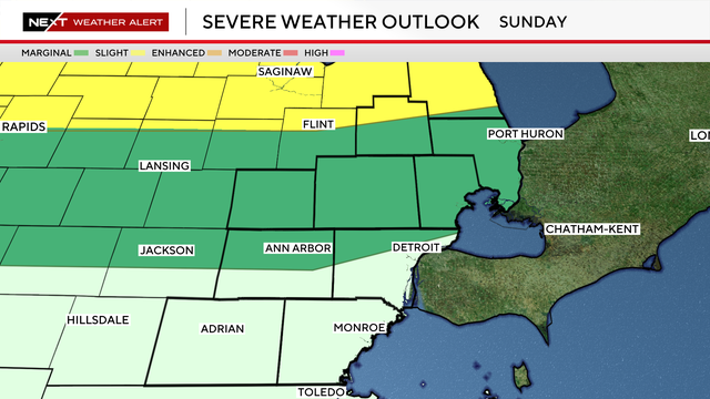
Severe storms are moving through the northern portion of Southeast Michigan on Sunday evening.
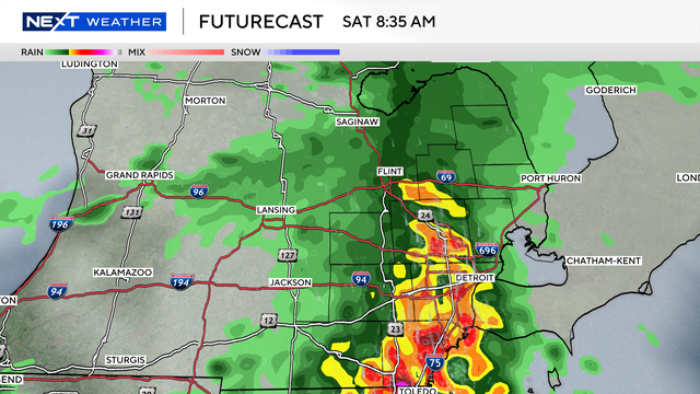
A significant weather shift is heading to Southeast Michigan over the next few days.
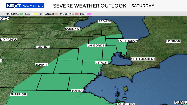
The main window for weather activity looks to open during the mid-to-late afternoon and persist through the evening hours.
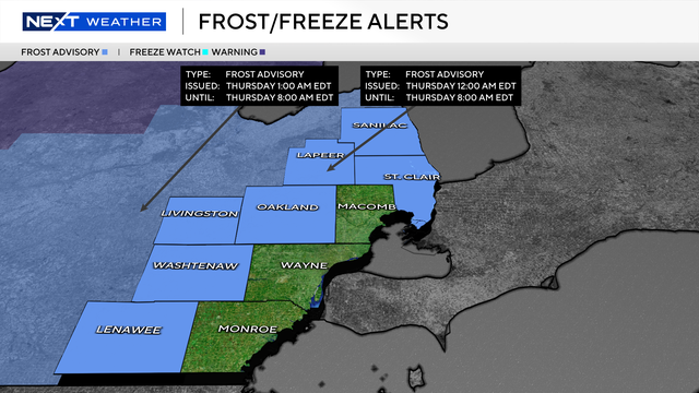
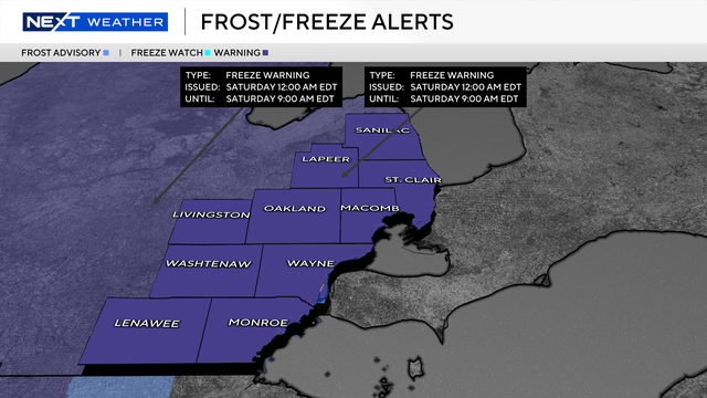
While the most recent cold front is moving out, it is leaving behind a chill that could be dangerous for sensitive vegetation.
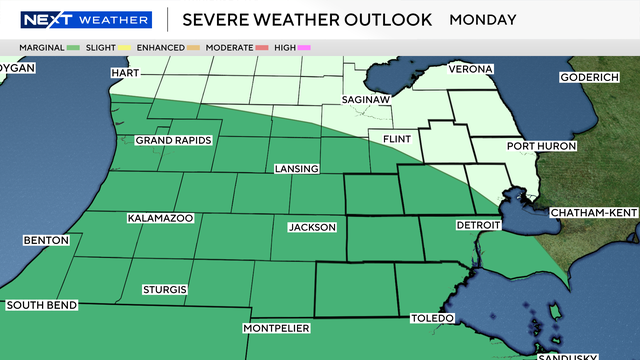
The primary weather threats for Monday evening are brief damaging wind gusts, small hail and heavy downpours.
The 8-14 day temperature outlooks show Southeast Michigan has a fair chance of below-average temperatures as we enter May.

A popular water gun game among high schoolers resulted in charges for three teens in Dearborn, including careless driving and breach of peace.

The most chill is expected to arrive in two waves later this week and into the early weekend.
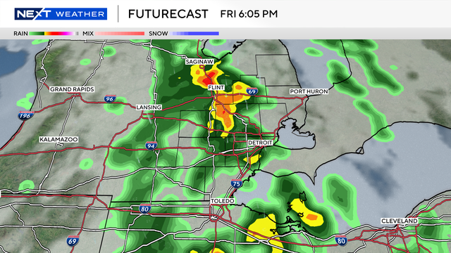
Any storms that do develop could bring brief heavy rain and gusty winds, though the overall severe threat appears limited at this time.
Police departments across Southeast Michigan are alerting residents that high school students are playing water wars again as the school year ends, and some water guns look realistic from a distance.
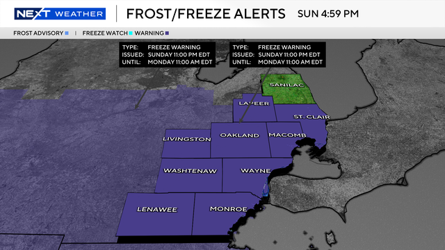
A freeze warning is in effect from 11 p.m. Sunday through 11 a.m. Monday for all of Southeast Michigan.
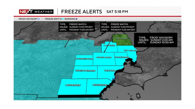
The National Weather Service issued a frost advisory for Sunday morning, and a freeze watch for Sunday night, in Southeast Michigan.
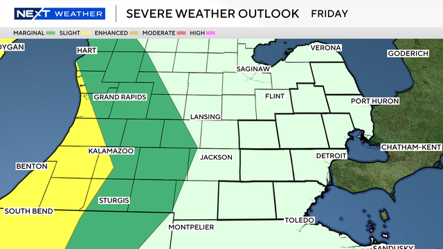
Behind this system, a noticeable cooldown will settle in across Michigan through the weekend, with temperatures dropping well below recent highs.

This past week has been a wild one in the weather department.

Nine tornadoes have been confirmed so far from the Tuesday night / early Wednesday severe weather outbreak in Michigan.
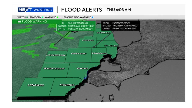
Following a tumultuous week of heavy rain and overnight severe weather, a flood watch remains in effect for all of Metro Detroit through late Thursday.
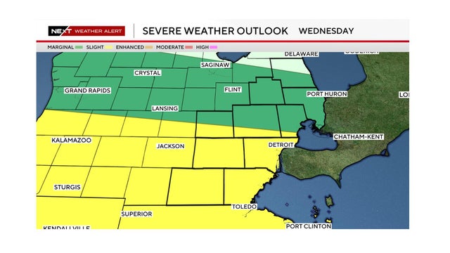
Metro Detroit's forecast includes damaging wind gusts, heavy rain and a chance of a tornado on Wednesday.
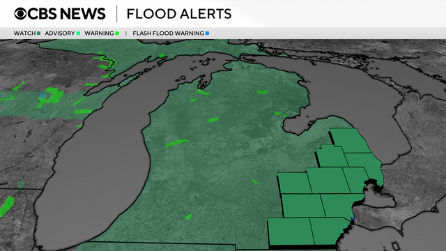
A flood watch has been issued for all of Southeast Michigan, to be in effect from 8 p.m. Tuesday through late Thursday night.
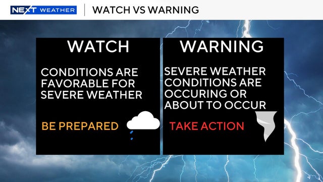
The National Weather Service Storm Prediction Center placed all of Southeast Michigan into the "enhanced risk" (level 3/5) for severe weather on Tuesday.
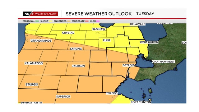
A severe weather threat with high winds, hail and the possibility of tornadoes exists for Tuesday in Southeast Michigan.
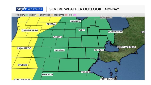
The weather conditions on Monday for Southeast Michigan could include damaging wind gusts and hail. The severe weather risk is higher on Tuesday.