Heat, humidity and storm chances in store for Southeast Michigan

The NEXT Weather Team is tracking Florida-like humidity and some storm chances for Southeast Michigan this week.
Monday will be the most comfortable day of the week, with dew points in the mid-50s to low 60s and high temperatures in the low to mid-80s under partly cloudy skies. Expect dry conditions and light winds as high pressure holds over the region.
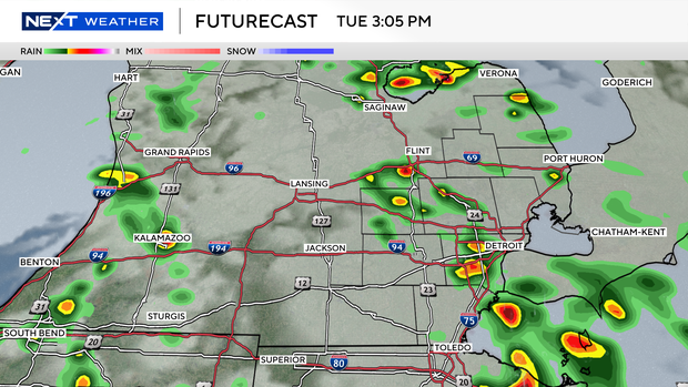
A low pressure system from the High Plains will start moving in late Monday, bringing lots of moisture. Dew points are projected to rise sharply into the mid-60s to low 70s by Tuesday evening.
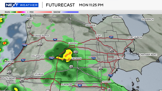
Showers and storms may start moving into Southeast Michigan overnight Monday and most of the Lower Peninsula is at moderate risk for excessive rainfall on Tuesday.
An extended stretch of heat and humidity is expected Wednesday through Friday with high temperatures between the upper 80s and low 90s and peak heat index values solidly in the upper 90s, with a chance of those values reaching 100.
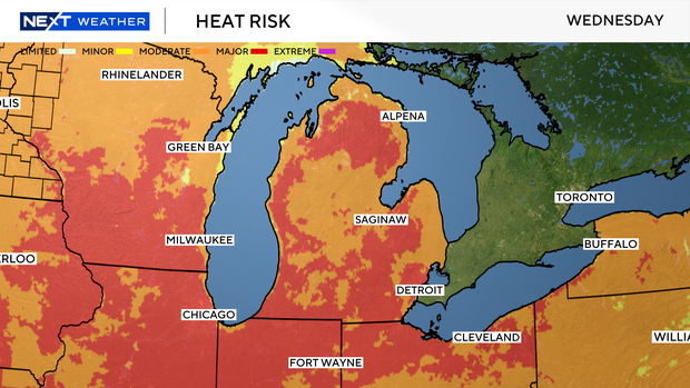
Thursday is a NEXT Weather Alert Day as there could be either the highest and most dangerous heat index numbers or strong to severe storms. If storm chances increase, widespread heat impacts would be lessened. However, moderate to major heat impacts are possible, so be prepared by having a location for adequate cooling, limiting time outdoors and staying hydrated.
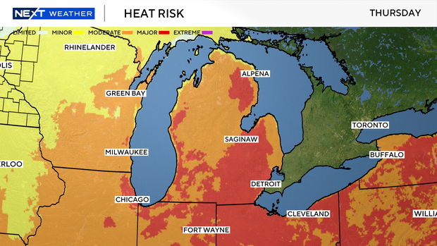
Pets should not be left outside for extended periods of time and may require extra water.
A cold front is expected to move through the state late Friday, bringing the heat and humidity down to more comfortable levels for the weekend.


