Severe thunderstorm watch issued for all of Southeast Michigan through Monday evening


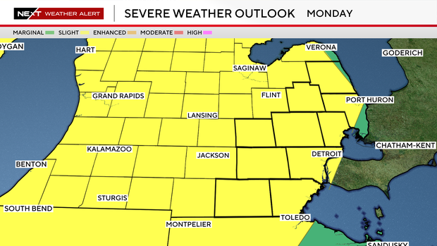
Southeast Michigan faces a heightened risk of severe weather on Monday, May 18, with the National Weather Service Storm Prediction Center placing the area in a slight risk (2 of 5).
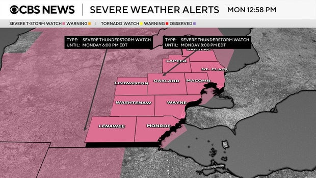
A severe thunderstorm watch is in effect for Lapeer, Lenawee, Livingston, Macomb, Monroe, Oakland, Sanilac, St. Clair, Washtenaw and Wayne counties until 8 p.m. Monday.
The reason is that warm, humid air will combine with an approaching storm system to fuel strong thunderstorms across the region.
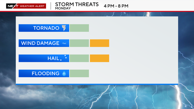
The main weather threats include damaging wind gusts up to 60 mph, large hail, heavy rainfall, and the possibility of an isolated tornado, especially during the late afternoon and evening hours. Storms are expected to become more widespread as a cold front moves into the Great Lakes, creating unstable atmospheric conditions across Metro Detroit, Ann Arbor, Flint, and surrounding communities.
Please monitor forecasts closely, have multiple ways to receive weather warnings, and be prepared for rapidly changing conditions later today. The CBS News Detroit weather team has declared Monday to be a NEXT Weather Alert Day, stepping up forecasts and announcements as needed.
There were tornado warnings in mid-Michigan on Sunday.
This has been a busy severe weather season in Michigan, with 15 tornadoes confirmed already. Michigan saw one of its most-active tornado seasons on record during 2025, with 33 tornadoes confirmed in the state that year.
Watch vs warning
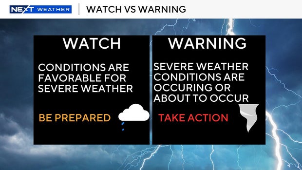
The National Weather Service says a severe weather watch means "be prepared." It is possible that weather will reach severe levels during the time frame specified.
A severe weather warning means "take action," that severe weather conditions have been reported by spotters or can be detected on radar. People are asked to take shelter indoors, away from windows.
Cancellations and closings
The City of Monroe has rescheduled the Monroe High School choirs' Concert in the Park slated for Monday night at St. Mary's Park to May 27. This is the first outdoor concert in downtown Monroe of the 2026 season.


