Very windy Saturday ahead with storms returning
WEATHER ALERTS issued for Saturday afternoon through Sunday afternoon.
Watch CBS News
WEATHER ALERTS issued for Saturday afternoon through Sunday afternoon.

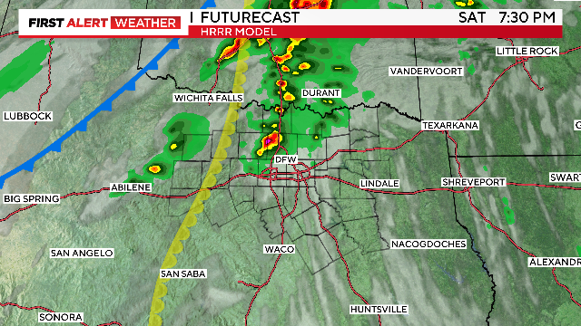
On Saturday, a few isolated showers and storms are possible by afternoon. However, the greatest threat for strong storms will arrive late Saturday night into Sunday morning.
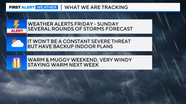
The First Alert Weather Team issued Weather Alerts for Friday, Saturday, and Sunday.
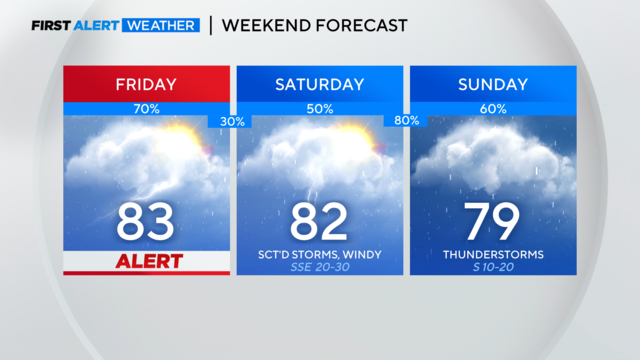
A Weather Alert is issued for Friday. There may also be a need for an alert on Saturday and Sunday.

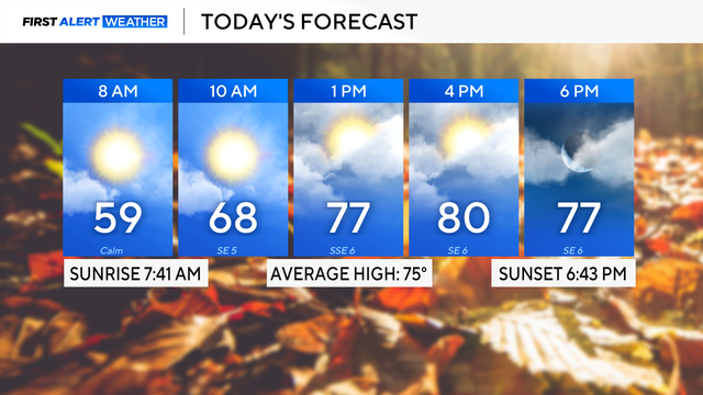
It's a milder start to the day with temperatures in the upper 50s.
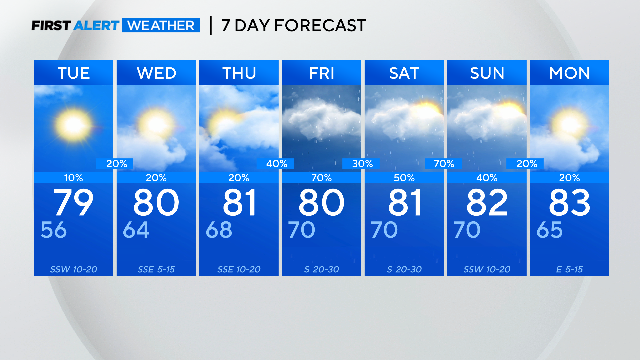
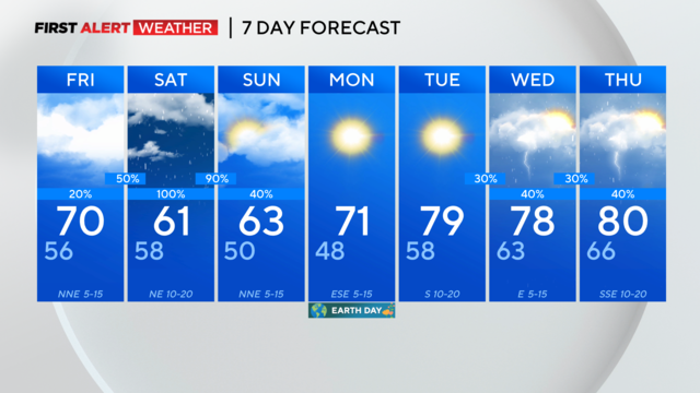
More heavy spring rain is in the forecast and is expected to arrive between Friday and Saturday.
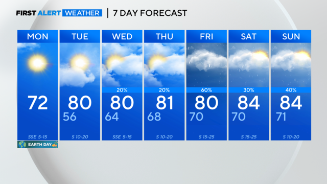
A gorgeous North Texas Earth Day! Warming temperatures and late-week rain chances.
The National Weather Service has issued a Severe Thunderstorm Watch for parts of North Texas through 11 p.m. which includes Dallas and Collin counties.

There is a near-perfect afternoon in store for NorthTexas on Monday.
Severe storms head for parts of North Texas Thursday before a big cool down this weekend.
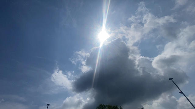
We'll see another round of potentially strong thunderstorms in parts of North Texas Thursday.

We're not expecting a washout but an isolated strong storm is possible with gusty winds and lightning. Otherwise, expect a mix of clouds and sunshine.
Storms are developing out west.
CBS News Texas meteorologists have a weather alert posted for tonight into early Tuesday. Storms will likely impact our area from about 7 p.m. to 2 a.m.

A Weather Alert is out for Monday evening and overnight.
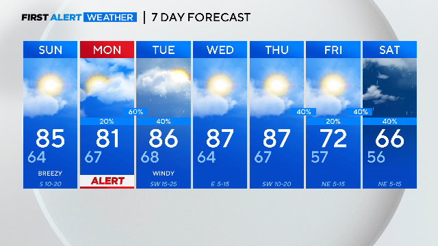
WEATHER ALERT issued for Monday night into the overnight hours.
We are starting off your Saturday with some cloud cover but the clouds will continue to break up, giving way to mostly sunny skies.
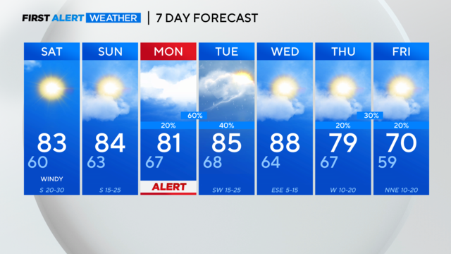
Strong storms are possible late Monday evening and into the overnight hours. Warmer temps return to North Texas for the rest of the week.

As we move through this Friday, after a cool start, our high temperatures will climb to near 80 degrees this afternoon.

The next round of strong storms is expected late Monday.
Tonight, we'll see mostly clear skies with low temperatures in the low 50s.

A cold front sweeps across North Texas Saturday night. Looking ahead to just after the eclipse, we're looking at the possibility of two rounds of severe weather on Monday.

We're tracking another round of rain and strong storms in North Texas.
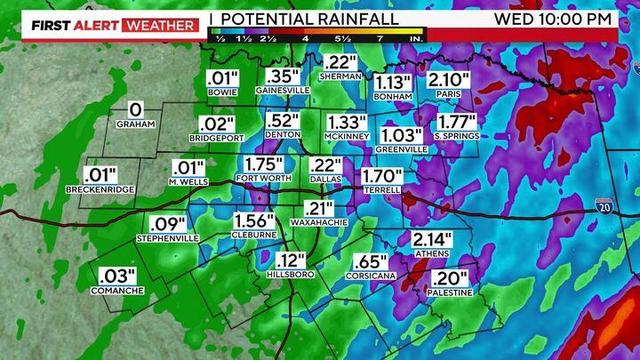
The alert continues Tuesday night for the potential of some isolated strong to severe storms.

As we continue moving through the morning drive, we'll see a good deal of the rain and storms tapering off before another round moves in late morning into the afternoon and evening.