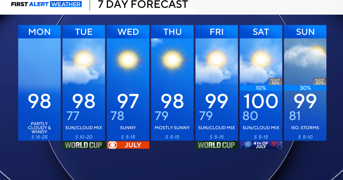
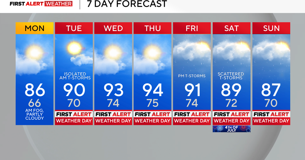
Cloudy skies with highs in the 80s before storms return
NORTH TEXAS — After a cloudy (and rainy, for some) start, we warmed into the upper 80s!

It will stay warm and muggy Wednesday, and then we get to Thursday. We've issued a Weather Alert for afternoon/evening storms for parts of North Texas.

There will be a cap in place for the morning, but as a dryline approaches from the west in the afternoon, we're expecting the cap to eventually erode away. With how warm and humid it will be, instability will be high. Large hail and damaging winds will be the main threats.

The SPC has a level 1 "marginal" risk for most of the area, with a level 2 "slight" risk to the northeast.

If the cap erodes away, and with the dryline moving in from the west, I've highlighted the area we think could see some stronger storms starting Thursday afternoon and continuing into the evening.

Once we get past our Weather Alert Thursday, we'll look to the soggy and cool weekend forecast. 1-2" of rain could fall for parts of North Texas Saturday into early Sunday, with some isolated amount closer to three inches of rain.