
Beautiful start to the week; more unsettled weather for North Texas begins mid-week
The first round of possible strong storms hits our western counties along a dryline Tuesday night.
Watch CBS News
The first round of possible strong storms hits our western counties along a dryline Tuesday night.

A First Alert Weather Day has been issued for Sunday.

North Texas started off on the cooler side Wednesday morning, with a few spots dipping down into the mid-40s.

The First Alert Weather Team is monitoring the potential of First Alert Weather days for Saturday and Sunday.

Storm chances start late Friday and run into Sunday.

A dry front cools temperatures on Tuesday and chances for thunderstorms return Friday into this next weekend.

Some of our western spots will near the triple digits Sunday afternoon.

The work week is closing out with beautiful spring weather across North Texas.

High pressure remains in charge across North Texas and that means more sunny skies are ahead.

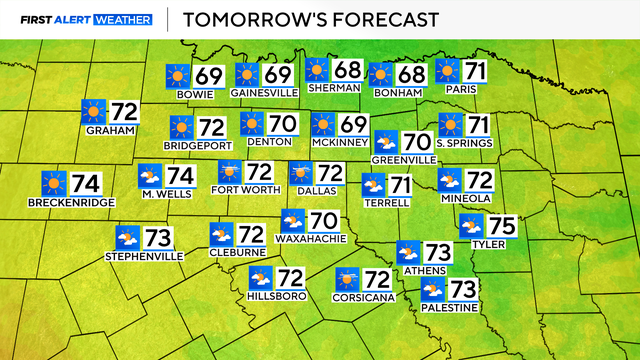
Despite the cold start, bountiful sunshine is in the forecast and the high temperature will reach the mid-70s.

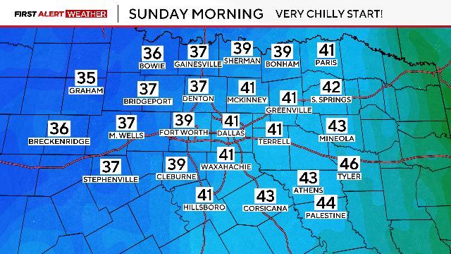
It might be spring but Monday is starting off cold with sub-freezing temperatures across North Texas

Sunday will be cold and cloudy before temperatures drop to near-freezing Sunday night.
A few stronger storms will be possible for Eastern Texas Saturday afternoon, but for most of the region, the threat will diminish.
A severe thunderstorm watch is in effect through 8 a.m., including much of North Texas.
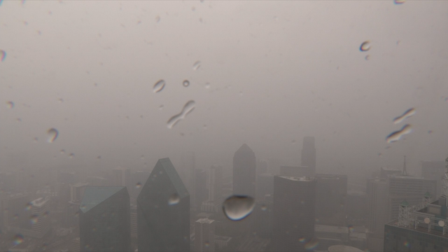
Several First Alert Weather Days are in place for multiple rounds of rain and storms in the forecast.
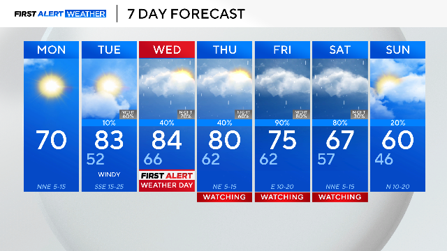
Monday in North Texas will be pleasant and beautiful but strong storms are ahead the rest of the week.
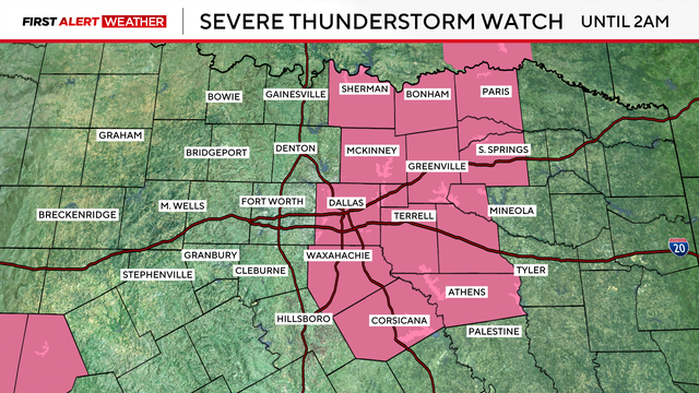
A severe thunderstorm watch remains in effect for Delta, Ellis, Hopkins, Hunt, Johnson, Kaufman, Navarro, Rains, Rockwall and Van Zandt counties until 2 a.m.
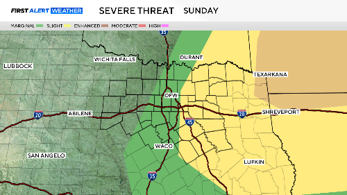
On Sunday, a dryline and cold front will bring another chance of strong to severe storms.
There is also a risk of severe weather late Saturday night as a dryline stalls over the Metroplex.

A First Alert Weather Day is in place for Friday due to more widespread rain in the forecast, along with some embedded thunderstorms.

Friday is a First Alert Weather Day due to the treat of severe weather on the southeast side of North Texas.

We go from isolated storms to scattered in nature for our northeastern North Texas areas Tuesday night and into Wednesday morning.

Tuesday looks to be the hottest day of the week.

As for Sunday, temperatures will climb in the 80s and gusty winds up to 25 mph will be possible ahead of an advancing front.

An abundance of sunshine combined with a southerly wind will allow highs to climb into the 80s.