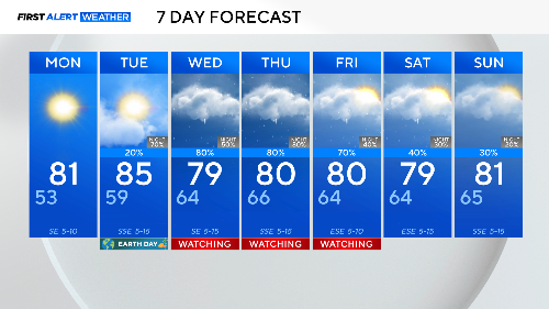
Beautiful start to the week, but more unsettled weather for North Texas begins mid-week

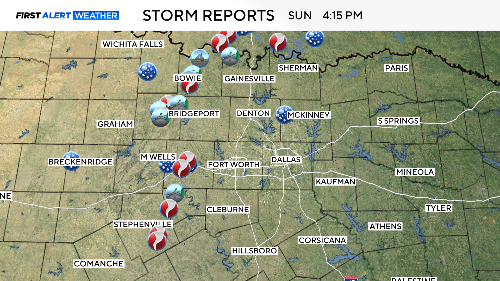
It was a night of powerful spring storms on Saturday. The National Weather Service will do its storm surveys on Monday, but multiple reports of tornadoes, large hail and wind damage are coming in Sunday afternoon.
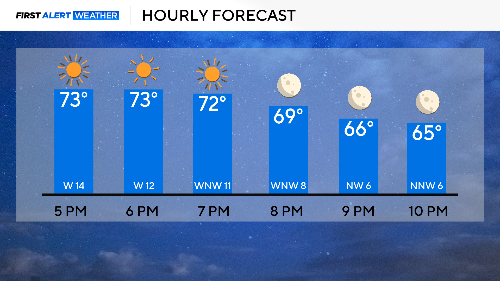
Morning rain cleared out nicely here on Easter, and a beautiful evening follows a wonderful afternoon.
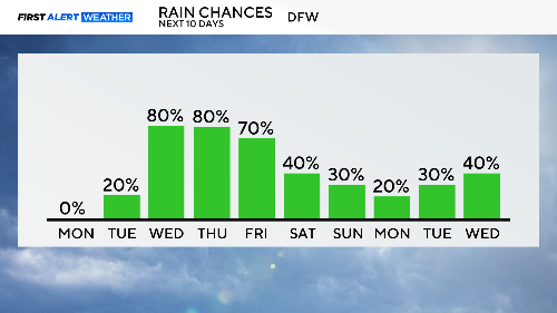
Great weather starts the work week. Monday and Earth Day will be mostly dry. We might see some thunderstorm activity by Tuesday afternoon, with a much better chance later that night and overnight.
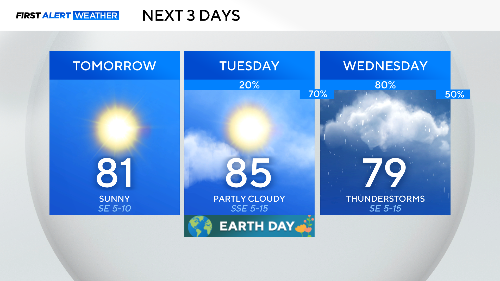
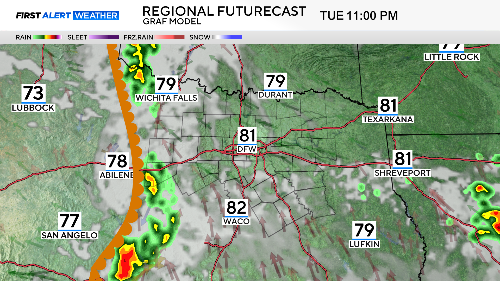
The first round of possible strong storms hits our western counties along a dryline Tuesday night. They'll weaken by the time they reach the metroplex in the overnight hours.
For the rest of the week and weekend, we'll see daily and nightly rain chances. It is still unclear if and when severe weather would be possible.
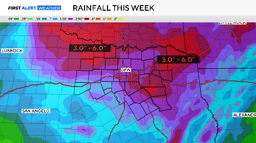
We are expecting the flooding threat to increase as we get deeper into the week ahead. Some significant rainfall amounts in our area are possible.
For now, the First Alert Weather Team will watch the stretch of weather from Wednesday to Friday for either a severe threat or prolonged rain of inconvenience. Please let us keep you updated on the weather ahead this week, we are in the midst of our peak severe season, April and May. Temperatures will hover in the same range for the whole period.