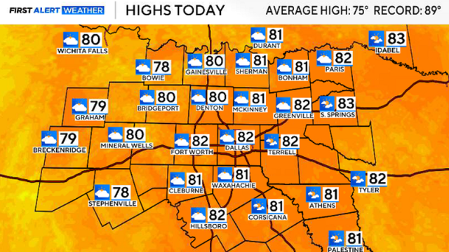
Temps in the 80s, small chance of rain for DFW this weekend
An abundance of sunshine combined with a southerly wind will allow highs to climb into the 80s.
Watch CBS News
An abundance of sunshine combined with a southerly wind will allow highs to climb into the 80s.
North Texas is heading into the weekend with warmer temperatures and small rain chances.

"People that are really allergic need to stay indoors more than outdoors," said Dr. Alfred Johnson.
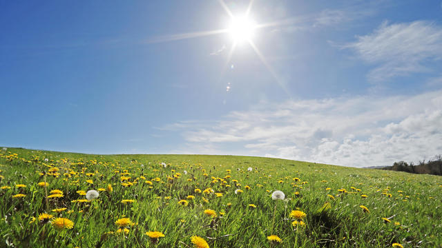
On this spring morning, temperatures are colder than Wednesday morning by as much as 25-30 degrees.
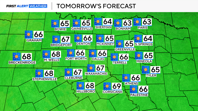
Cooler, closer to seasonable temperatures move in for the Spring Equinox Thursday.
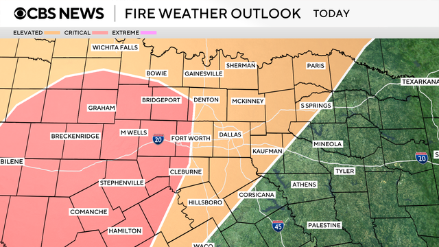
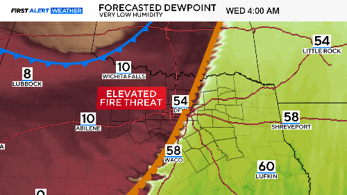
The elevated fire danger continues through the end of the week into the weekend.
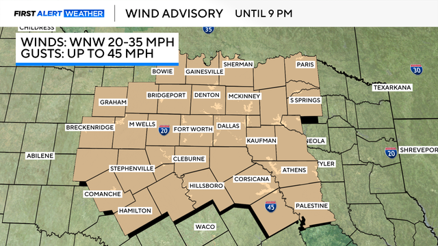
A wind advisory covers all of North Texas. It continues through 9 p.m. Wednesday.
Outdoor burning is strongly discouraged, along with any activities that could generate a spark.
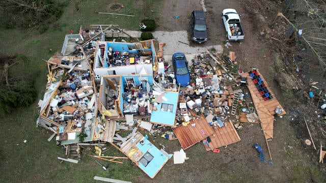
Violent tornadoes ripped through parts of the U.S., wiping out schools and toppling semitractor-trailers in several states.
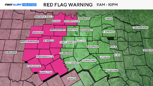
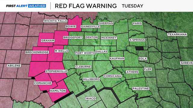
A red flag warning is in effect for counties to the west of Dallas-Fort Worth.

Though Sunday started off cool, the afternoon highs will top out seasonably in the upper 60s and lower 70s.
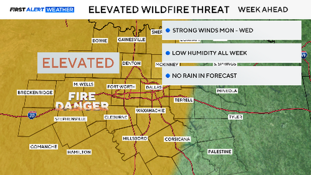
Red flag warnings were just south of us on Saturday. We could easily see these warnings return by Tuesday or Wednesday.

The Kansas Highway Patrol reported Saturday that eight people died in an interstate pile-up after a dust storm caused a 55-car pile-up.

St. Patrick's Day on Monday will be golden with plenty of sunshine, mild winds and warm temperatures.

About 47 million people faced an enhanced to moderate severe storm threat from Madison, Wisconsin, to Birmingham, Alabama.
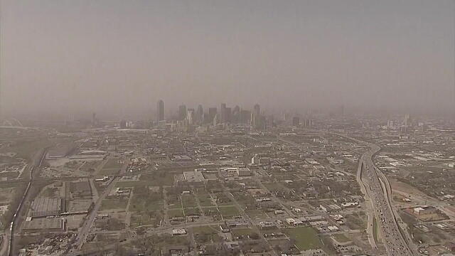
Wind gusts topped 80 mph for parts of West Texas.
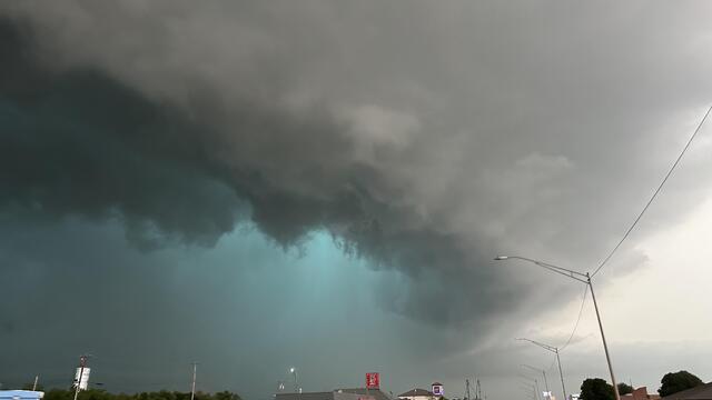
When it comes to severe weather events like tornadoes and flash floods, what's the difference between a watch and warning, and which is worse?
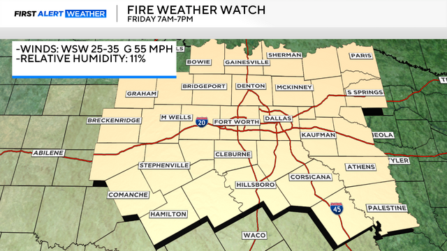
Thursday is the day to make sure any outdoor items are secure before a high wind watch and fire weather watch go into effect.
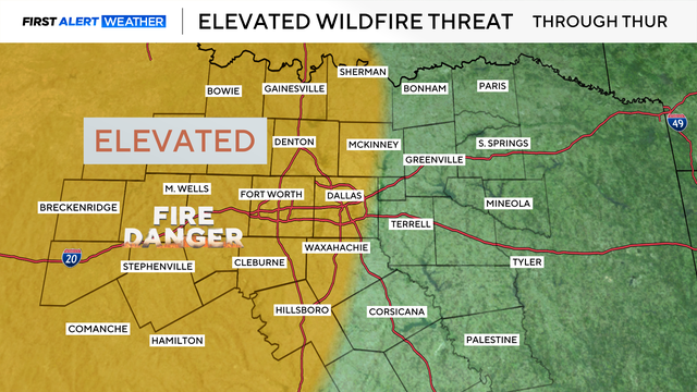
As we head into Thursday, it will be a dry day for the area, with highs in the middle 80s and breezy conditions.

A cap is a weather term used when atmospheric conditions keep severe storms from forming.

The elevated fire threat turns critical Friday.
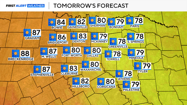
On Tuesday, highs are forecasted to reach the lower 80s, driven by a strong southerly wind.

Monday started off cold across North Texas, with temperatures in the 30s to 40s to start the work week.
There is heightened fire danger to the west and a chance of storms on Wednesday and Friday to the east.

Several weather warnings were in place early Saturday morning.