Skies clearing Easter Sunday after round of severe storms, several possible tornadoes


Happy Easter, North Texans!
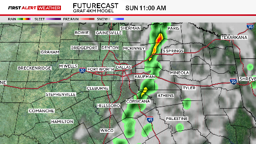
The First Alert Weather Team is still tracking scattered showers and a few non-severe thunderstorms Sunday morning, but the precipitation is coming to an end.
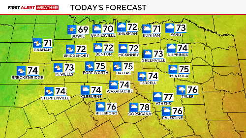
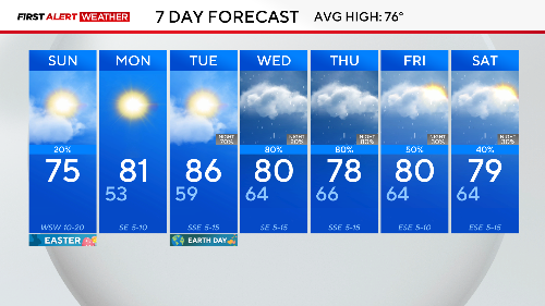
The trend will be for clouds to clear from west to east as temperatures climb into the mid-70s.

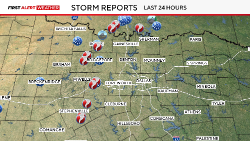
Saturday evening was very active with numerous severe thunderstorms and multiple possible tornadoes.
Flash flooding occurred in our northwest areas around Jack and Montague counties, where there were water rescues and reports of water going into homes.
The NWS will compile the damage reports on Sunday and survey the damage Monday.
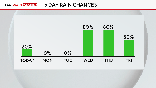
An isolated shower or storm is possible early Sunday afternoon in the eastern counties, before dry air settles in.
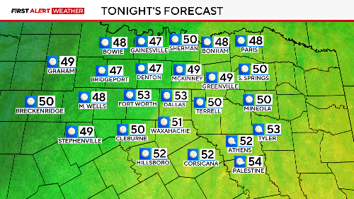
The kids will likely want a light jacket Monday morning, with temperatures in the upper 40s to lower 50s across the area.
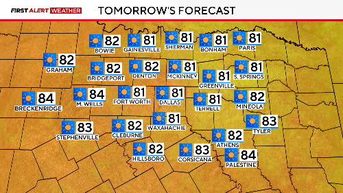
Monday is looking gorgeous with sunny skies, low humidity, and afternoon temperatures near 80.
DFW's break from the storms is short-lived as multiple rounds of showers and storms return starting Tuesday evening into next week.
The First Alert Weather Team will continue to monitor the need for First Alert Weather Days, either due to severe storm potential or disruptive storms.
CBS News Texas will be tracking the storms all weekend long. Download the CBS News app and search for the "Texas" section.


