Highs near 80 on Friday in North Texas before heavy rain arrives
A First Alert Weather day is in effect for Saturday, for disruptive rain and the chance of some isolated severe storms.
Watch CBS News
A First Alert Weather day is in effect for Saturday, for disruptive rain and the chance of some isolated severe storms.

Temperatures will warm into the mid-70s in the afternoon with a mix of sun and clouds.
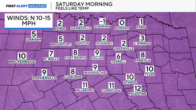
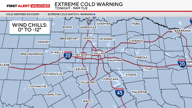
Feels-like temperatures on Saturday morning will be as cold as 0.
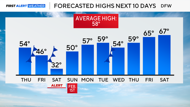
A First Alert Weather Day is in effect for Saturday due to extreme cold, with wind chills ranging from -5 to 15.

A First Alert Weather Day is in effect for Wednesday morning due to the chance for freezing fog.
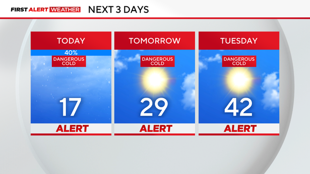
Weather Alerts are in place through Tuesday due to dangerously cold temperatures and icy roads at times.
Saturday began with rain, sleet and snow in parts of North Texas, with temperatures falling into the low 30s by 3 a.m.
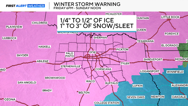
The National Weather Service has issued a winter storm warning for the entire region.
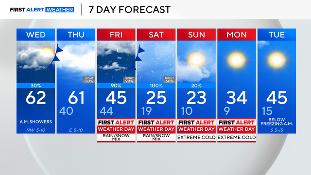
After Wednesday, all eyes are on our winter system.
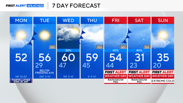
An arctic air mass is set to bring dangerously cold air and wintry precipitation to North Texas this weekend. We have issued First Alert Weather Days for Friday through Sunday for all of this.
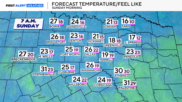
Sunday's morning low will be in the 20s and feels-like temperatures in the teens.

Low temperatures fall into the upper 30s on Saturday morning.

Temperatures on Friday will be 10 degrees cooler than Thursday, and drop even more by Saturday.

Through the day, expect partly cloudy skies with temperatures rising into the mid-70s.

Friday in North Texas is warmer than earlier this week, but a cold front is on the way and will drop temperatures over the weekend.
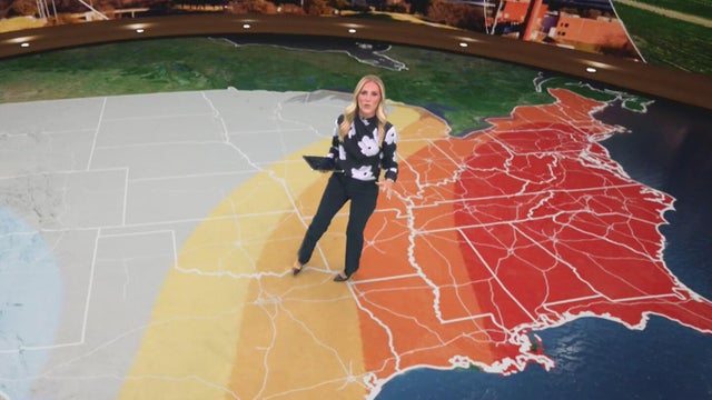
Dallas-Fort Worth saw highs in the low 70s on New Year's Day, about 15 degrees above normal, with warm, dry conditions expected to continue into next week.
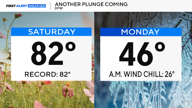
North Texas reached a record high of 86 degrees the day after Christmas.

A ridge of high pressure is dominating in the upper levels of the atmosphere, resulting in above-average highs.
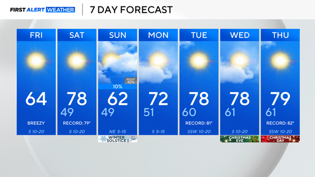
Jackets will be needed to start the day but by this afternoon, it will warm into the mid-60s with breezy winds.
Thursday morning in North Texas is mild and humid ahead of a cold front that will move through, increasing winds.
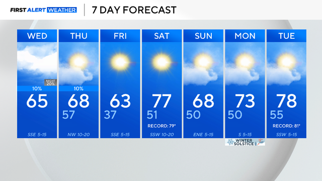
Expect plenty of clouds throughout the day today with highs rising up into the mid-60s.
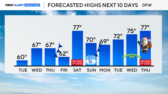
North Texas temperatures Tuesday morning are above freezing with the help of cloud cover and southerly winds.

Temperatures stay cool and below average into Monday afternoon with highs in the lower 50s.
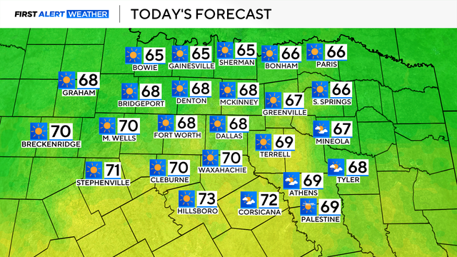
Highs Saturday will be in the mid-60s, but drop to the mid-40s on Sunday.
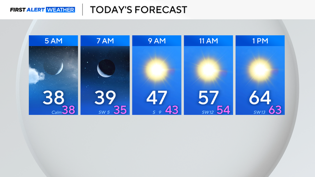
Winter weather in North Texas stays on the warmer side for a few more days until a strong cold front brings a winter punch on Sunday.