North Texas warms above freezing Tuesday afternoon before freezing fog arrives Wednesday morning


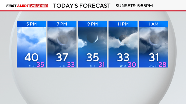
Temperatures are now above freezing, and the ice is starting to melt. The lack of cloud cover on Tuesday kept temperatures in the low 40s in the afternoon. However, once the sun sets at 5:55 p.m., temperatures will eventually dip into the 30s and drop below freezing by midnight.
Overnight, refreezing will take place and black ice will form on the roads.
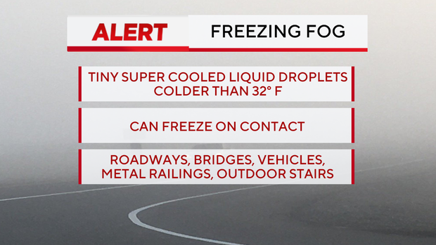
The southerly wind is pumping more moisture into North Texas on Tuesday, which is increasing the dew point temperature. Overnight, light winds combined with the moisture, as well as temperatures dipping into the 20s, will lead to the formation of freezing fog.
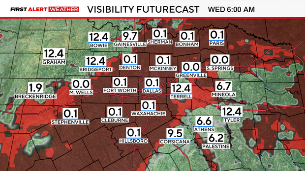
Freezing fog is more dangerous than fog. Not only will visibility be reduced, but a thin layer of ice will also develop on surfaces due to the supercooled water droplets in the air clinging to any surface that is at or below 32 degrees.
The added thin glaze of ice on roads, car windshields, and bridges will lead to more travel concerns—especially with the melting slush on the roads turning into black ice in the morning.
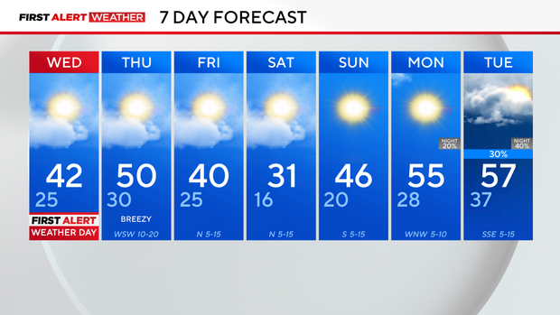
Temperatures will increase in the afternoon back into the 40s, which will also help with the melting process. The next few afternoons will be above freezing, but the mornings will be below freezing. This will create some black ice in the mornings, so drive with caution.
The next cold front is expected to move through on Friday, which will cool temperatures off once again. Thankfully, no precipitation is expected. The next shot of rain will be midweek, next week.