Pittsburgh Weather: Scattered showers, storms remain through holiday weekend
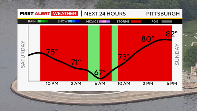
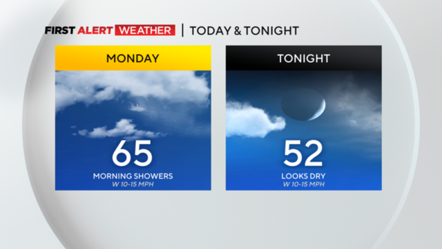
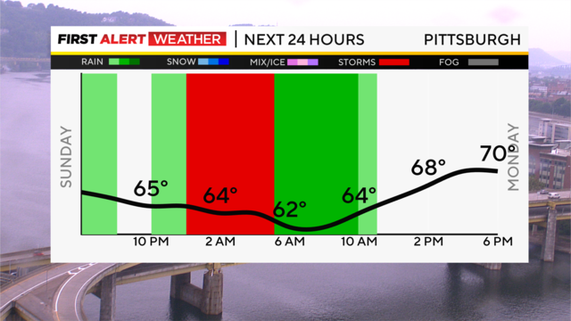
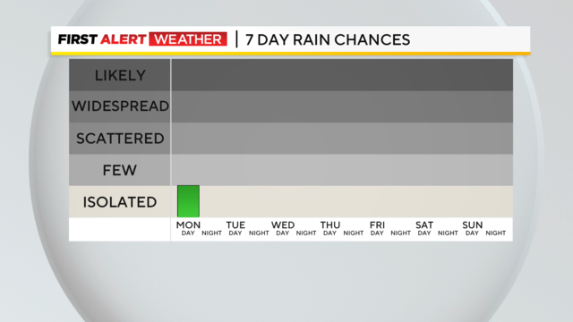
Scattered showers and thunderstorm chances stick around the rest of tonight, tomorrow, and Monday.
Watch CBS News
Scattered showers and thunderstorm chances stick around the rest of tonight, tomorrow, and Monday.
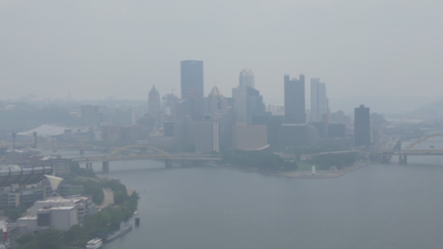
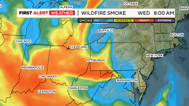
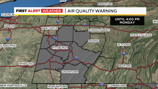
A Code Red Air Quality Action Day has been issued by the Department of Environmental Protection for the second straight day.
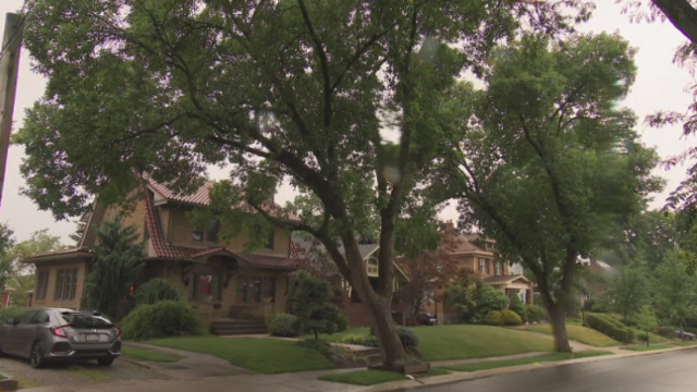
KDKA's John Shumway went looking into the potential tree trouble.
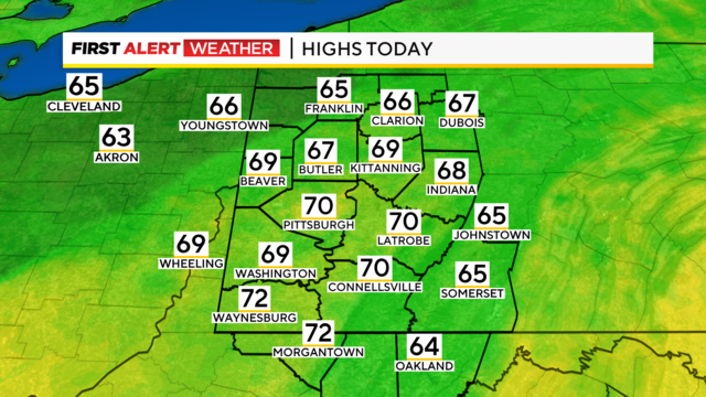
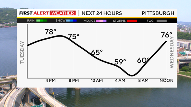
Temperatures will be cooler Tuesday, with highs near 70 and morning lows in the low 60s.
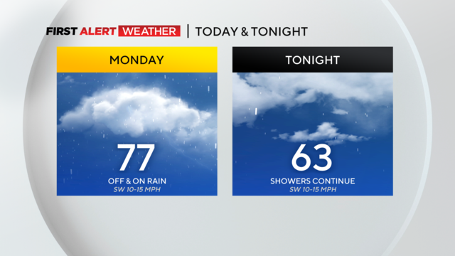
While rain totals today won't be very big, every little bit helps when it comes to alleviating drought conditions.
The KDKA-TV First Alert Weather Team is issuing a First Alert Weather Day for Sunday night for the possibility that severe storms could hold together across our area.
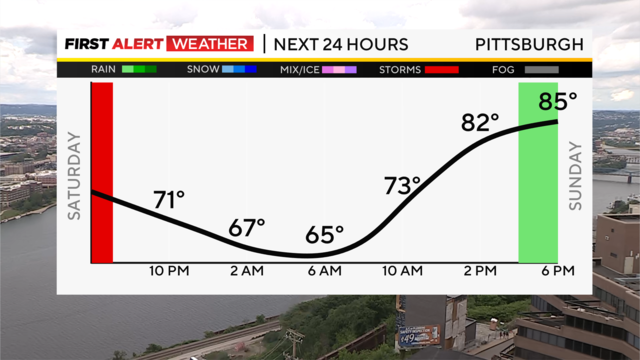
Sunday will start mainly dry until the mid-to-late afternoon when a chance of scattered showers returns.
Our First Alert Meteorologists are here to keep you safe.
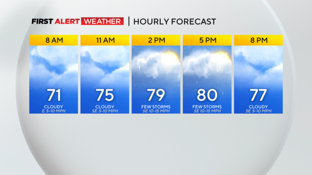
. Most of the activity will be south of the city, but some showers could creep northward.
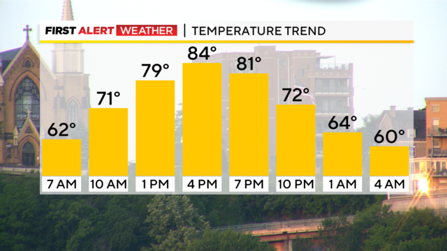
It was a gorgeous day with highs in the upper 70s and some in the low 80s.
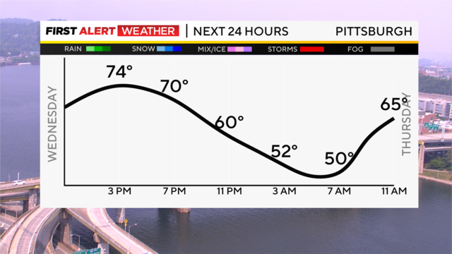
Even though summer does not officially start until 10:58 a.m. on Wednesday, it will feel like summer, starting on Father's Day.
The rain will be nice and much-needed.
While the rain by itself probably won't constitute a 'drought buster', conditions will help to make this rain a 'soaking' shower with little in the way lost due to downpours or evaporation.
After 21 days of no measurable rain at the airport, we have recorded 0.02 inches of rain, with more showers and even a few storms on the way later tonight.
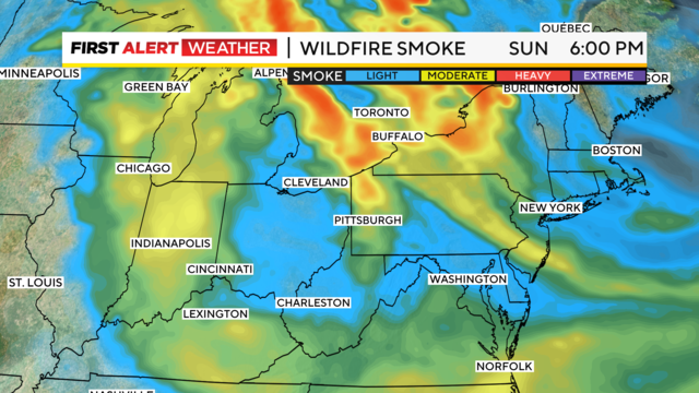
We will still have a Code Yellow air quality status for Sunday for some of the haze and smoke in the upper levels of the atmosphere.
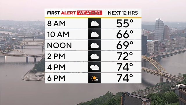
The interesting week continues, with several unusual things all coming together, giving us mets plenty of things to discuss.
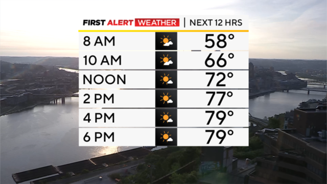
This is such an interesting week.
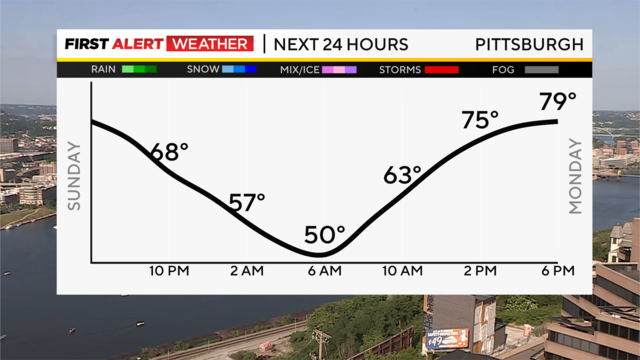
Relief from the heat finally arrived with the cold front Saturday, and the high Sunday was 10 degrees cooler than Saturday in Pittsburgh.
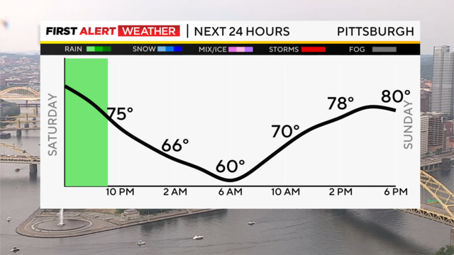
After the driest May in Pittsburgh since 1986 and 12 days with no rain, we finally saw a few raindrops today and a few strong storms across the region.
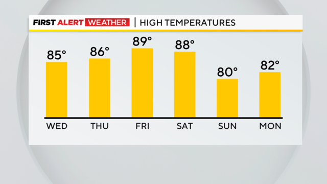
The hottest temperatures of the year are expected to arrive tomorrow afternoon.
We could be looking at one of the hottest stretches of weather on record for the period starting yesterday and going through June 7.
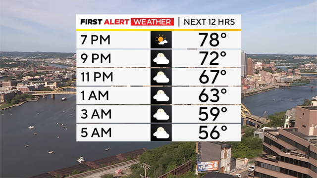
Overnight into Memorial Day, showers will linger south, and clouds clear through the day, leaving us with a dry, sunny, and hot day with highs in the low 80s.
Saturday has been gorgeous, with highs in the mid-70s with plenty of sunshine. Clouds will increase by the evening.
Smoke from the Western Canada wildfires is leading to high particulate levels in the upper atmosphere and haze across our region.
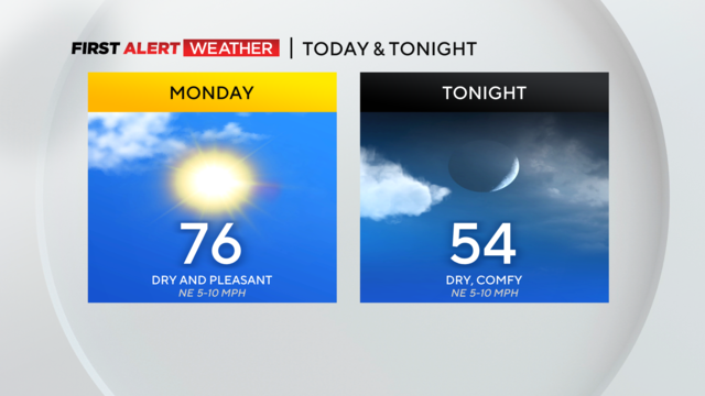
It's going to be a sunny day with blue skies across Western Pennsylvania.