Pittsburgh Weather: Rain moves out as dry spell begins
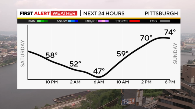
Clouds will gradually break overnight, giving us a pleasant evening and eventually partly cloudy skies by morning.
Watch CBS News
Clouds will gradually break overnight, giving us a pleasant evening and eventually partly cloudy skies by morning.
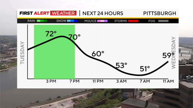
The best chance for rain occurs from noon to around 6 p.m.
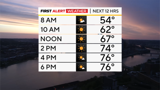
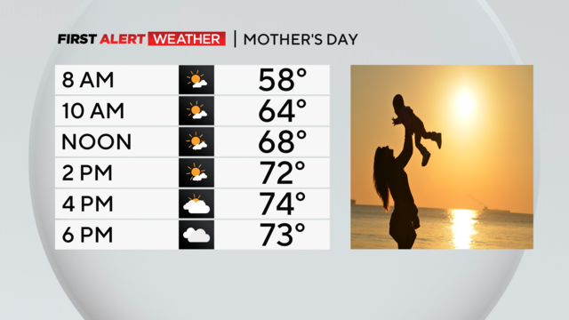
Highs today should remain in the mid-70s, but if anything today will actually be more pleasant than yesterday
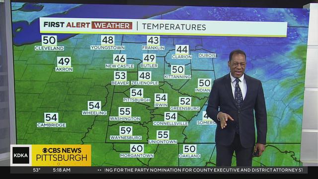
Get the latest weather updates from First Alert Meteorologist Ron Smiley!
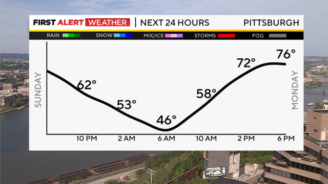
After a sunny Sunday, we'll watch a few clouds roll in overnight, but temperatures will be cooler, with lower humidity levels.
After a damp and dreary Saturday, we'll see showers ending north to south this evening and dry conditions overnight.
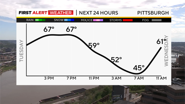
We are just a little over a week into May, and it's already been a heck of a month.
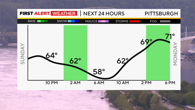
A few isolated showers are moving out to our east this evening, and we'll be in for a mild, quiet Sunday night.
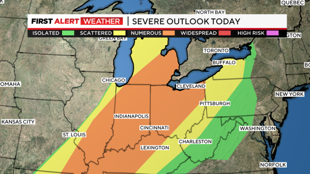
Storm chances will peak tonight around 8 p.m.
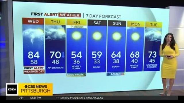
Get the latest on the weather with Mary Ours' full forecast!
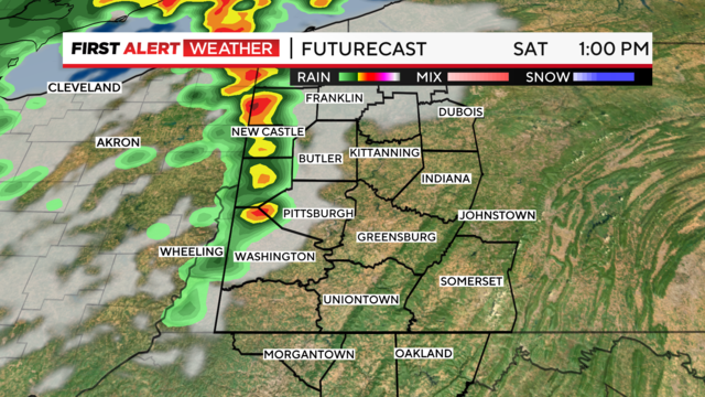
Saturday afternoon brings heavy winds and possible severe storms.
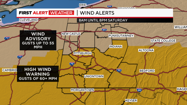
Wind gusts will be around 50-60 miles per hour and could be stronger in some spots.

The storms on Saturday afternoon and evening brought down trees, and power lines, and left many without power.
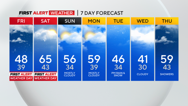
Showers and storms will continue on-and-off throughout today, but they will pick up in intensity Thursday night into Friday morning.
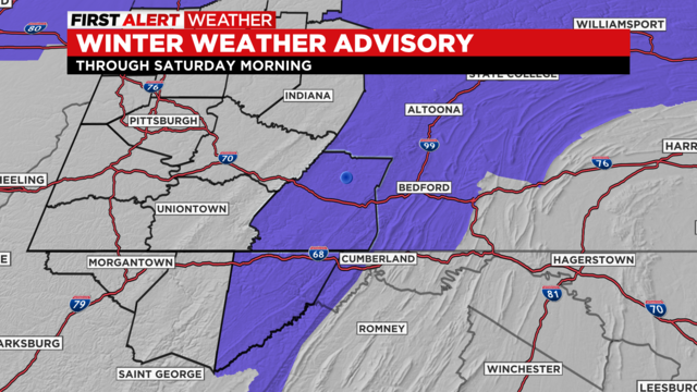
The Laurel Highlands are under a winter weather advisory with several inches of snow in the forecast.
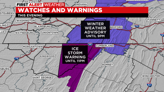
We are still operating under First Alert, as the ice storm warning continues in Garett County, Maryland, and the high wind warnings remain in place.

The snow we see will be a wet snow with temperatures hovering around the freezing mark.
A mix of snow showers and rain could lead to a messy morning commute.
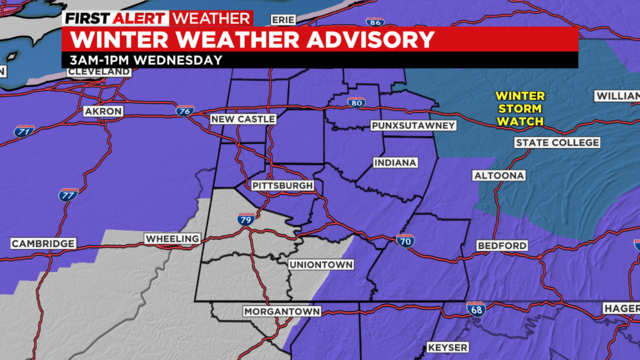
It's going to be a sleep-in-and-you'll-miss-it event with three-to-five inches of snow in some parts of our area.
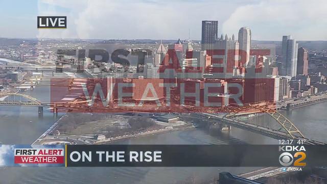
KDKA meteorologist Falicia Woody has all the details for your afternoon forecast!
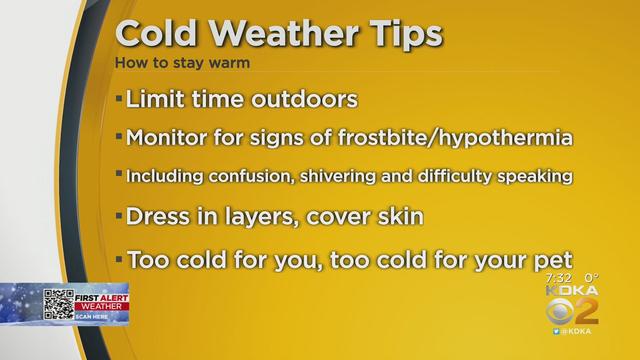
KDKA's Chris DeRose is giving you, the viewer, tips on how to stay warm on yet another freezing day.

Christmas Eve will be another freezing cold day with temperatures again in the single digits.

Temperatures started in the 40s and are rapidly dropping throughout the day.

It's the first official day of winter and it will be the last nice day before the storm moves in.
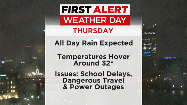
Travelers should be on alert for dangerous travel conditions and power outages.