Partly cloudy, cooler than average Labor Day in Philadelphia region
The great weather will continue through the middle of the week with low temperatures near 60 degrees and highs near 80 degrees.
Watch CBS News
The great weather will continue through the middle of the week with low temperatures near 60 degrees and highs near 80 degrees.

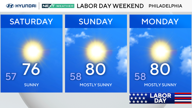
Sunday will be mostly sunny and cooler than average for this time of year, with highs in the mid-to-upper 70s.
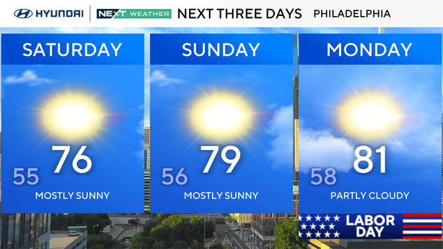
The coolest day this holiday weekend will be Saturday, with highs in the 60s in the Poconos and mid-70s in Philly and along the shore.
The weekend is nearly upon us, and Mother Nature plans on delivering award-winning conditions for the final weekend of August in the Philadelphia region.
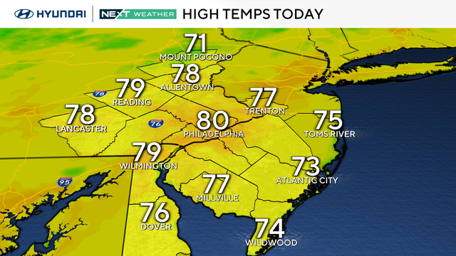
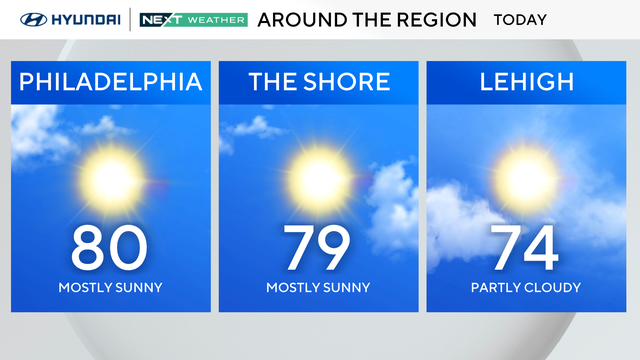
Thursday will be partly sunny across the Philadelphia area as temperatures reach the upper 70s to 80 degrees.
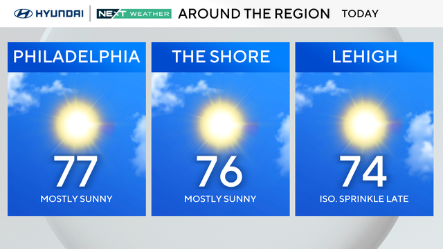
An early taste of fall will remain in the air as temperatures on Wednesday morning in the Philadelphia region start in the low 50s to near 60 degrees.
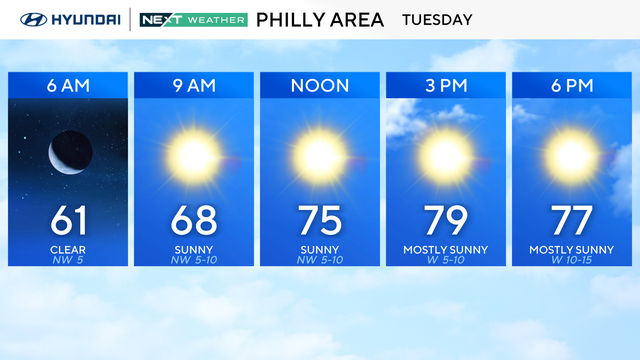
Temperatures will be below normal in the Philadelphia area for the next few days.
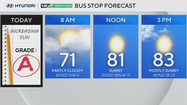
Skies will turn mostly sunny on Monday and highs will be in the low to mid-80s.
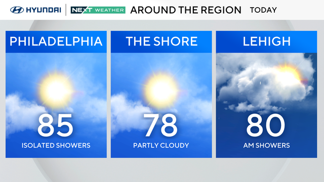
Sunday will be partly sunny and seasonable with isolated showers possible, mainly north and west of the city.
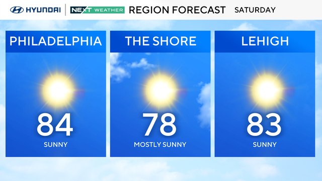
The weekend will feature more of the same with sunshine both days, Saturday and Sunday, cool mornings and warm afternoons.
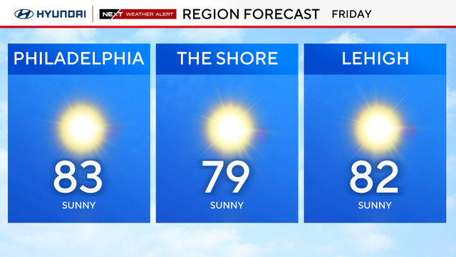
Hurricane Erin continues its track away from the United States, and the weather conditions in the Philadelphia region improve considerably Friday, making way for a beautiful weather weekend.
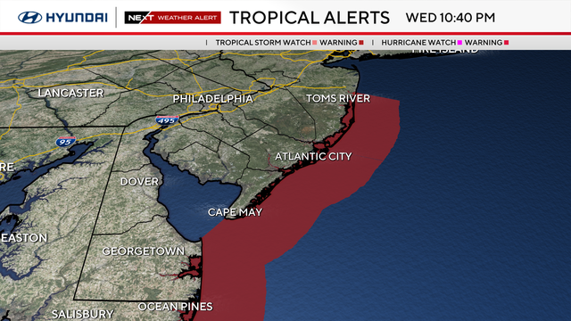
Hurricane Erin continues its northerly track and is set to deliver impacts to the beaches in New Jersey and Delaware.
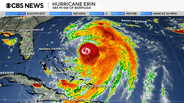
Hurricane Erin won't make landfall, but Jersey Shore and Delaware beaches will be affected by its presence offshore.
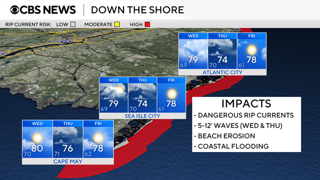
Hurricane Erin won't make landfall, but Jersey Shore and Delaware beaches will be affected by its presence offshore.
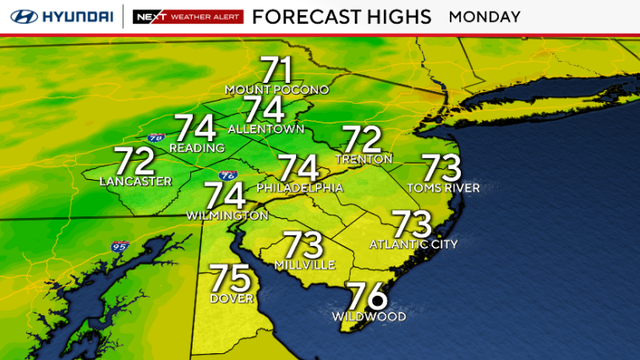
Much cooler air is arriving in the Philadelphia area, bringing temperatures in the 70s for Monday.
A NEXT Weather Alert is in effect on Sunday night as multiple counties in the Philadelphia region are under a flash flood warning due to heavy rain.
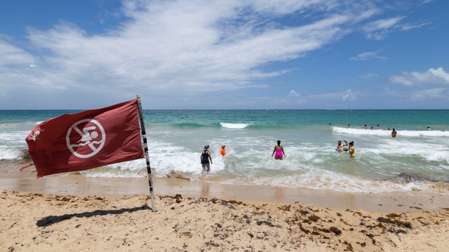
Hurricane Erin underwent rapid intensification to become a Category 5 storm in just hours. It has since weakened to a Category 4 status.
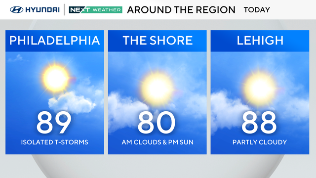
Labor Day weekend is only 2 weeks away, meaning weekends like the one upcoming will be few and far between from here on out.
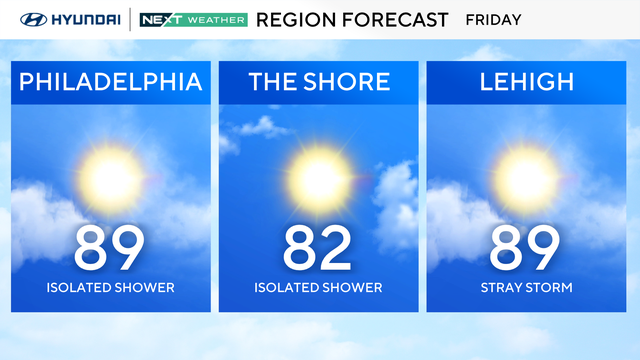
The Philadelphia area can expect a hot weekend without rain.
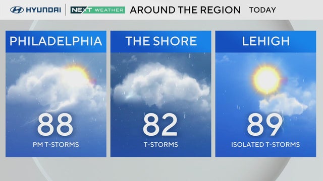
Thursday has potential for afternoon or evening storms and a low-end flooding risk around the Philadelphia region.
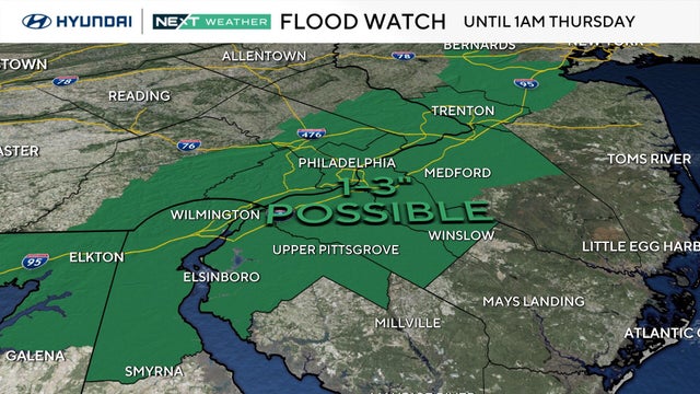
A flood watch is in effect for most of the Philadelphia region through early Thursday morning as heat, humidity and storms make a comeback.
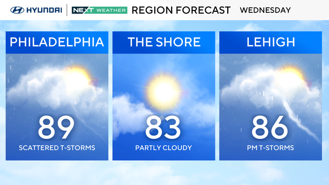
The Philadelphia region will have the potential for pop-up storms on Wednesday and Thursday as the temperatures heat up.
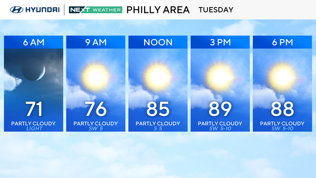
After a relatively cool start to August, summer air is returning to the Philadelphia area.
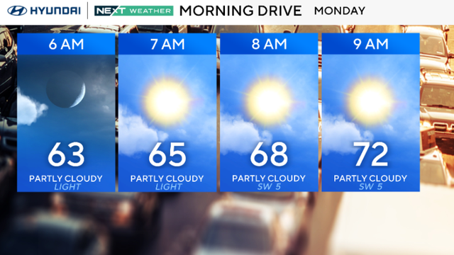
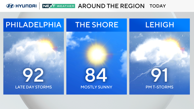
We may make a run for 90 this afternoon, but most spots should top out in the upper 80s.
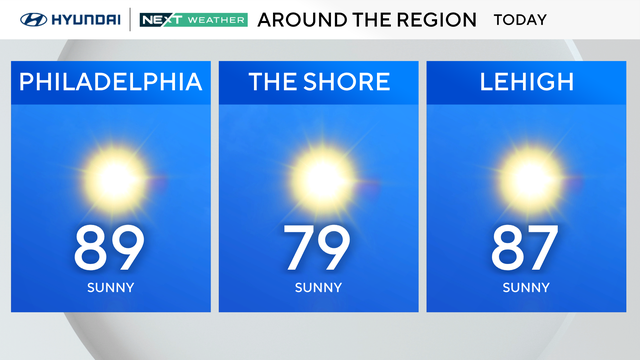
Sunday will have plenty of sunshine and light southerly breezes. However, several Pennsylvania counties will be under an air quality alert.