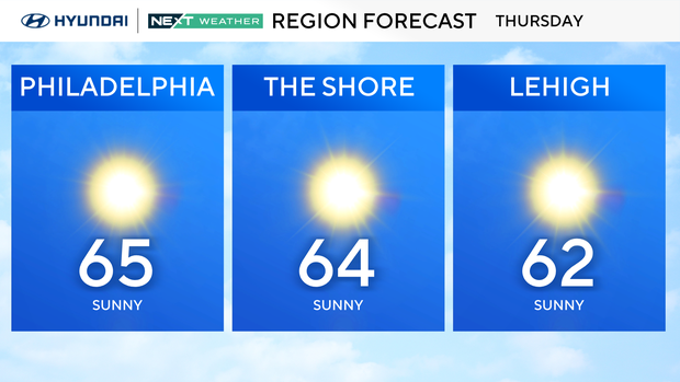
Sunny and cool Thursday in Philadelphia region, tracking more rain this weekend. Here's the weather forecast.
After a wet morning Wednesday in the Philadelphia region, the rest of the week looks dry and cool, thanks to high pressure building back in.
High temperatures Thursday afternoon will be in the low-middle 60s, and the night will likely be the chilliest so far this season. We have frost and freeze advisories and warnings for all areas northwest of Philadelphia and parts of New Jersey, including Atlantic, Burlington, Camden, Cumberland and Gloucester counties, and into Friday morning, with lows in the 30s in most spots.
Friday is a gorgeous fall day with sunshine and highs in the upper 60s. The normal high for this time of year is 70 degrees.
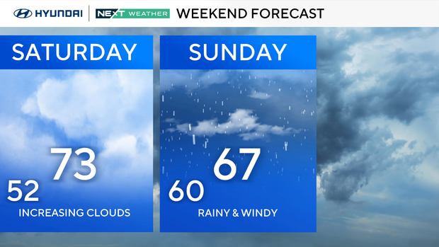
Looking ahead, there's a growing potential for a coastal low to develop to our south and bring some very unsettled weather by Sunday that could last into Monday.
The weather includes heavy rain and wind. Currently, the models have total rainfall for Sunday to Monday in the 1-4 inches range, with the highest totals east and south of Philadelphia.
Your NEXT Weather team has issued a NEXT Weather Alert for Sunday and Monday and will continue to monitor the situation.
There are already coastal flood alerts issued for Sunday and Monday due to this coastal low.
Here's your 7-day forecast:
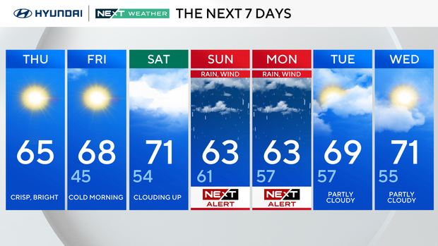
Thursday: Much cooler. High 65, Low 50.
Friday: Bright and cool. High 68, Low 43.
Saturday: Mostly sunny. High 73, Low 51.
Sunday: NEXT Weather Alert for rain and wind. High 67, Low 60.
Monday: NEXT Weather Alert for rain and wind. High 64, Low 56.
Tuesday: Partly cloudy. High 70, Low 55.
Wednesday: Mixed skies. High 73, Low of 56.


