Muggy and mostly cloudy with chance storms in Philadelphia Sunday
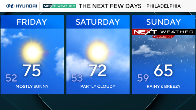
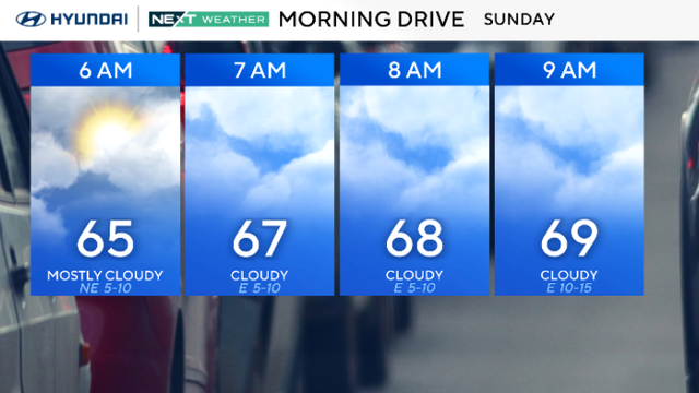
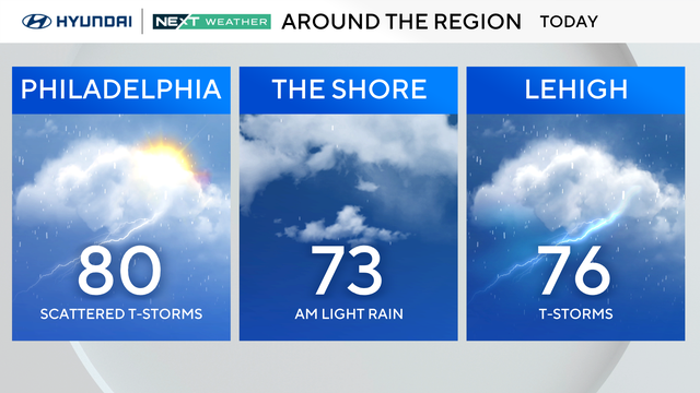
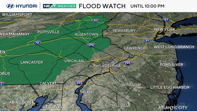
A light, isolated shower is possible Sunday morning, but the bigger chance for heavy rain and scattered thunderstorms is this afternoon around 3-4 p.m.
Watch CBS News
A light, isolated shower is possible Sunday morning, but the bigger chance for heavy rain and scattered thunderstorms is this afternoon around 3-4 p.m.
Temperatures will hover near normal on Saturday with highs near 80, before a cold front crosses the region Saturday night.
The Philadelphia area ends the week with increasing clouds as a storm system approaches.
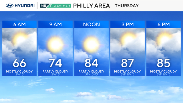
Thursday in the Philadelphia region will be very warm and humid, with highs in the upper 80s and low 90s.
Both Wednesday and Thursday in the Philadelphia region will be very warm and humid, with highs in the upper 80s and low 90s.
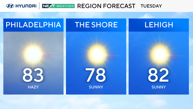
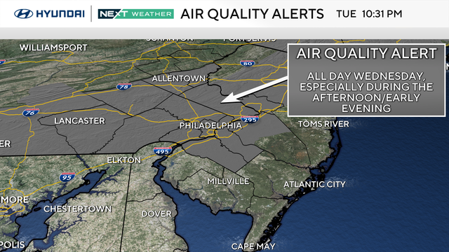
Smoke from Canadian wildfires will give the sky a milky filter Tuesday as temperatures climb into the mid-80s around the Delaware Valley.
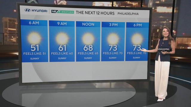
Highs temps will be around 75 with lots of sunshine across the Delaware Valley Monday. Looking ahead, the region could see its first 90 degree day of the season this week.
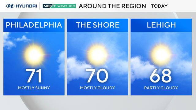
Sunday marks the start of meteorological summer, though it'll feel more like spring. Expect plenty of morning sun followed by afternoon fair weather clouds.
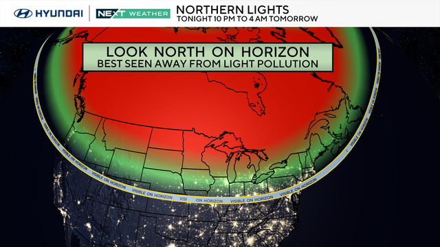
On Sunday and Monday, a widespread display of the northern lights will dance across parts of the U.S., including Philadelphia.
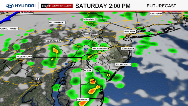
Some parts of the Philadelphia region saw instability showers that had the potential to turn severe Saturday afternoon.
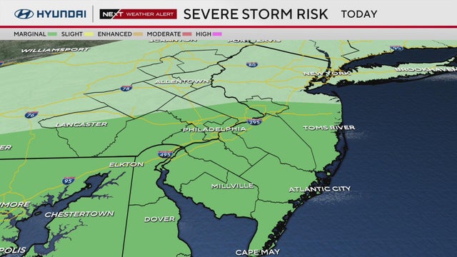
After tornado alerts and heavy rain Friday into Saturday, we will see more scattered storms Saturday afternoon.
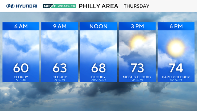
After a cold, dreary Wednesday, Thursday in the Philadelphia region will be warmer. Here's the forecast.
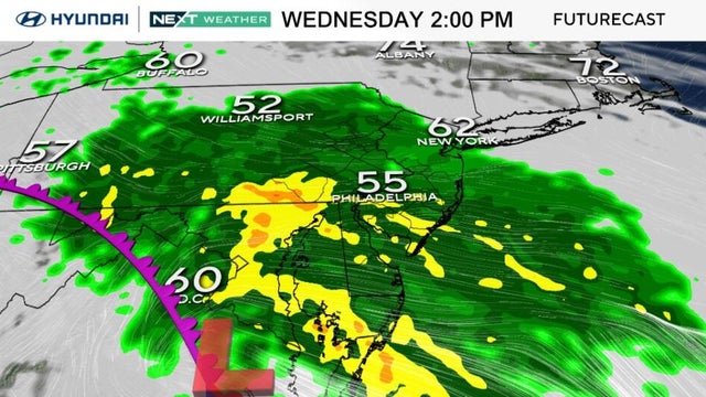
After a beautiful Memorial Day and a mostly dry start to the week, rain is returning to Philadelphia. Here's what to expect.
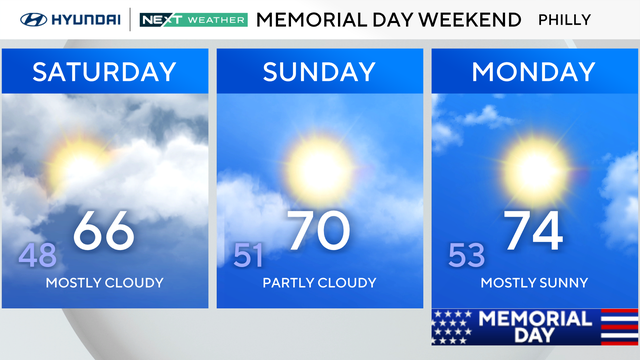
This MDW we're feeling cool air and a breeze with a mix of sun and clouds, plus an occasional brief shower.
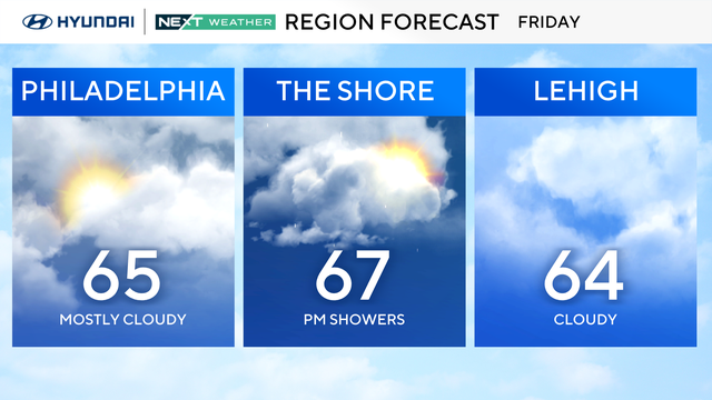
Once again, you will need the umbrella and coat with you on Friday in the Philadelphia region.
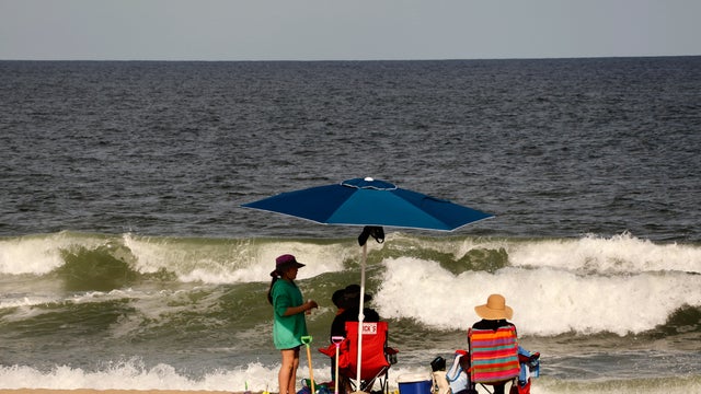
Don't expect summer-like weather for Memorial Day Weekend, but the weekend isn't a total loss in Philadelphia and New Jersey.
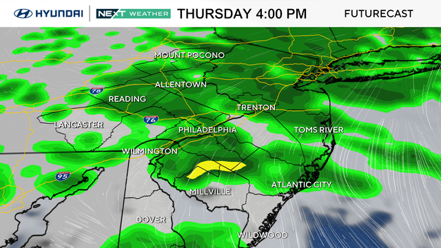
Clouds and rain continue Thursday in the Philadelphia region, but things clear up a bit for Memorial Day weekend.
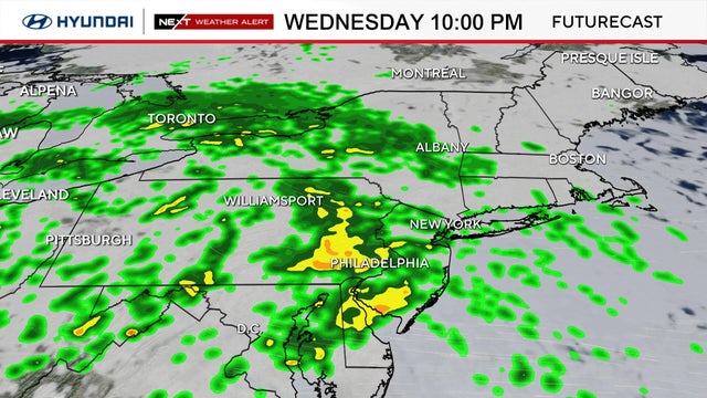
Temperatures both Wednesday and Thursday will likely struggle to climb out of the 50s, with overnight lows remaining around 50 degrees.
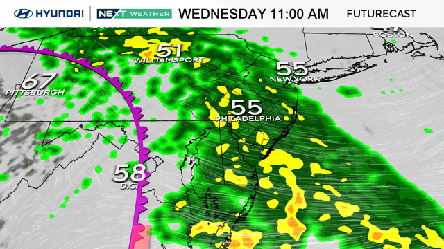
A pair of systems will bring soaking rain, gusty winds and unseasonably cool temperatures to the Philadelphia area Wednesday.
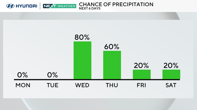
Monday will be mostly sunny with high temperatures in the mid-70s. A cooldown and your next chance for rain will move into the Philadelphia area later this week.
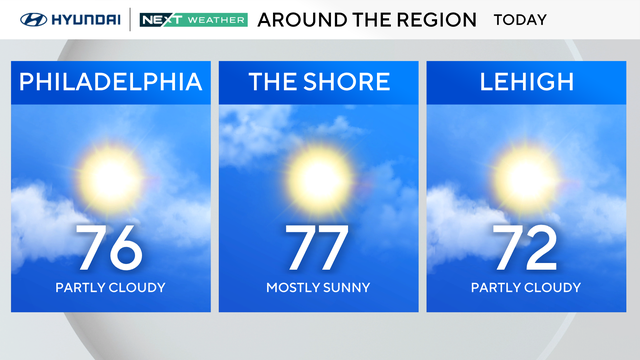
Sunday will be mostly sunny and breezy with temperatures in the 70s in the Philadelphia area.
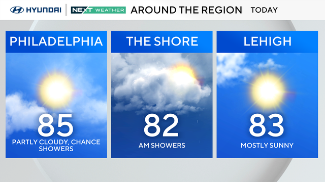
Morning storms are clearing out Saturday and we'll see some sun and clouds through Tuesday before rain returns.
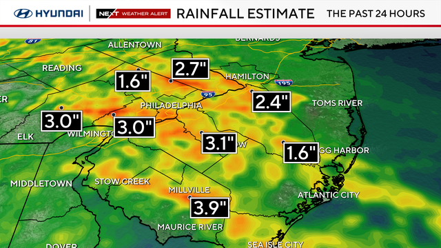
Storms packing high winds and heavy rain rolled through the Philadelphia area, impacting Pennsylvania, New Jersey and Delaware.
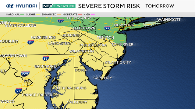
After a foggy morning, rain will exit the Philadelphia region on Thursday afternoon, but strong storms could move through on Friday.
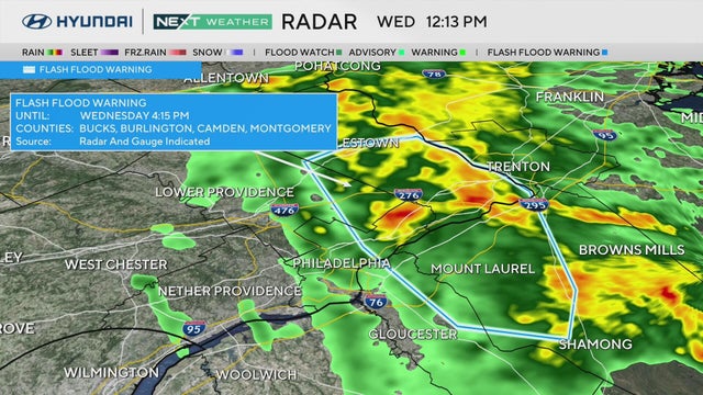
Heavy rain moved out Wednesday morning in the Philadelphia area and several streams and creeks are dealing with more water than normal.