Summer warmth, sunshine to greet southeast Michigan for the weekend
Seasonably summer temperatures are set to make a strong stance in Southeast Michigan.
Watch CBS News
Seasonably summer temperatures are set to make a strong stance in Southeast Michigan.

The Detroit Grand Prix is back, and the weather is expected to be ideal for the three-day event.

Southeast Michigan will see ideal conditions for outdoor activities and the Detroit Grand Prix during the coming weekend.
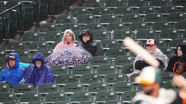
The Detroit Tigers and Baltimore Orioles will play a split doubleheader on Sunday after their game on Saturday was postponed due to inclement weather.
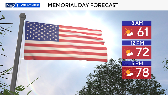
The Memorial Day forecast currently looks favorable, with partly sunny skies and afternoon temperatures in the low to mid-70s.
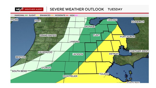
The National Weather Service has issued a slight risk forecast for severe weather on Tuesday in an area that includes Metro Detroit.
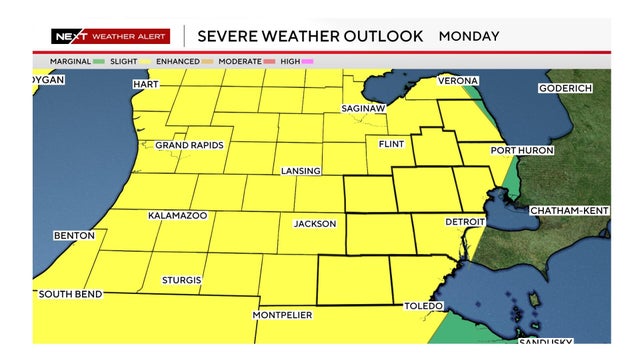
Wind gusts up to 60 mph, large hail, heavy rainfall and an isolated tornado are possible Monday in Southeast Michigan.
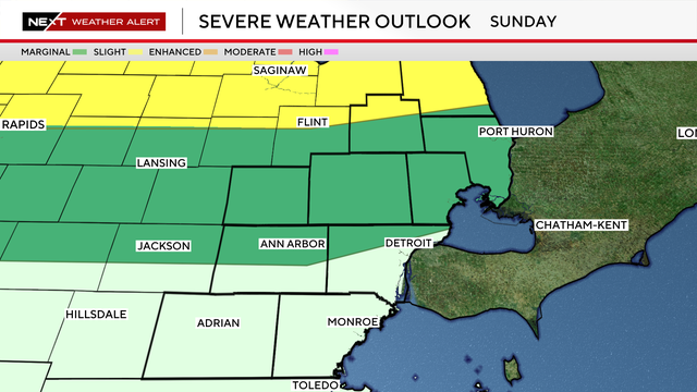
Severe storms are moving through the northern portion of Southeast Michigan on Sunday evening.
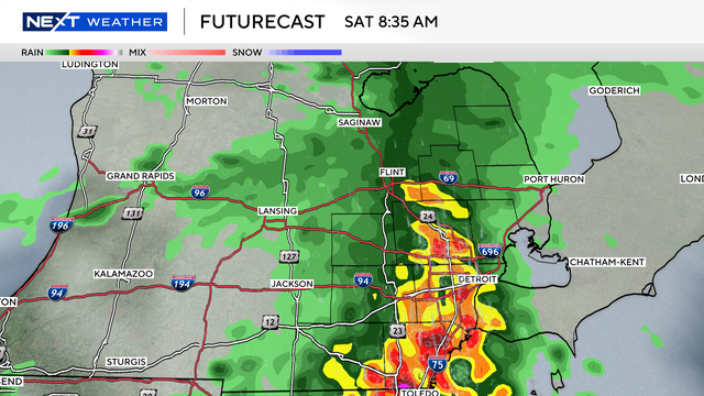
A significant weather shift is heading to Southeast Michigan over the next few days.
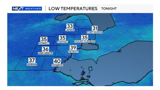
Lower Michigan will see chilly temperatures during the overnight hours on Monday.
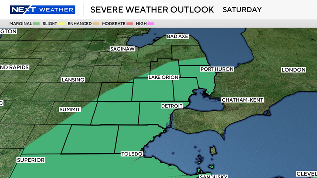
The main window for weather activity looks to open during the mid-to-late afternoon and persist through the evening hours.
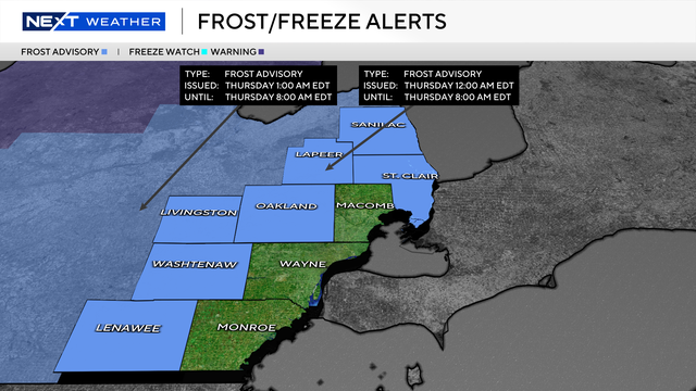
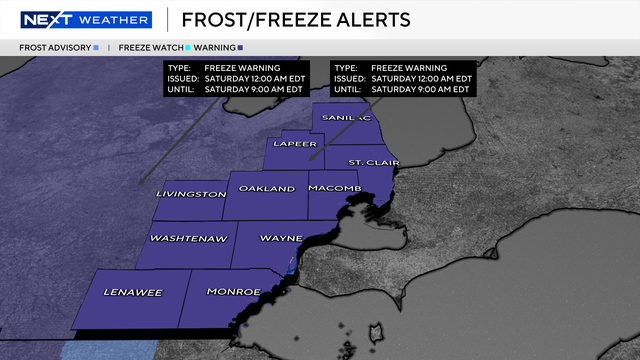
While the most recent cold front is moving out, it is leaving behind a chill that could be dangerous for sensitive vegetation.
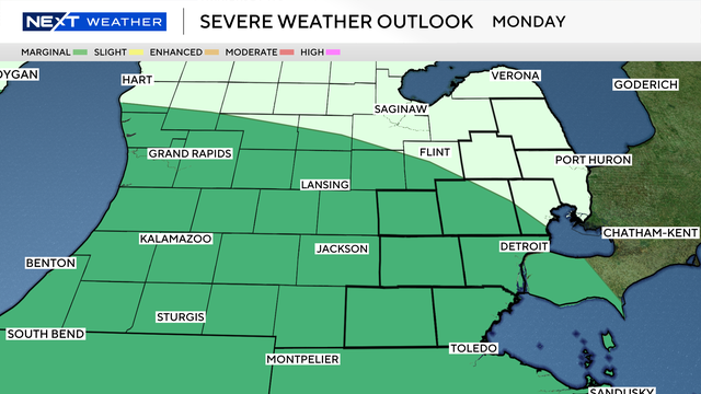
The primary weather threats for Monday evening are brief damaging wind gusts, small hail and heavy downpours.
The 8-14 day temperature outlooks show Southeast Michigan has a fair chance of below-average temperatures as we enter May.

The most chill is expected to arrive in two waves later this week and into the early weekend.
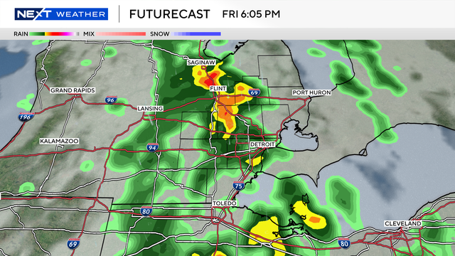
Any storms that do develop could bring brief heavy rain and gusty winds, though the overall severe threat appears limited at this time.

Large chunks of ice have rammed into homes along Michigan's Black Lake in the northeastern Lower Peninsula as constant spring rainfall and winter melt have flooded homes and threatened to overflow stressed dam systems.
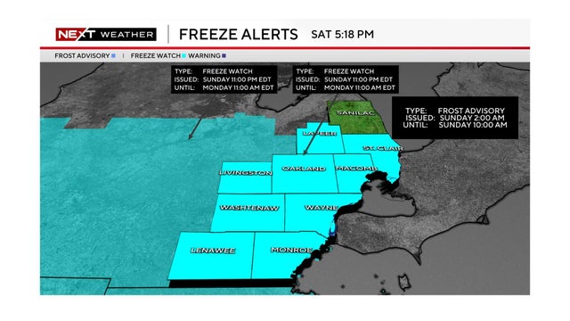
The National Weather Service issued a frost advisory for Sunday morning, and a freeze watch for Sunday night, in Southeast Michigan.
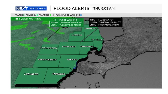
Following a tumultuous week of heavy rain and overnight severe weather, a flood watch remains in effect for all of Metro Detroit through late Thursday.
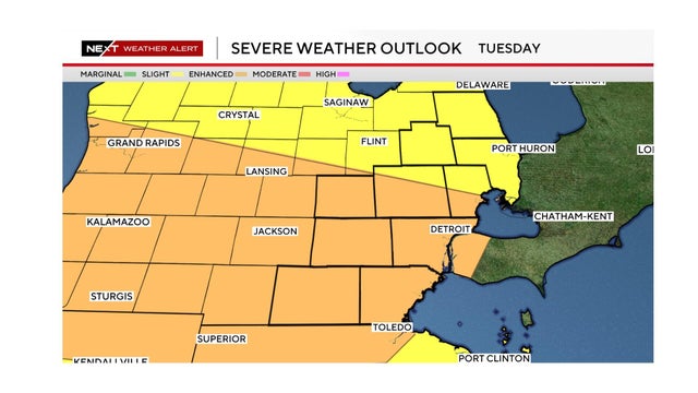
A severe weather threat with high winds, hail and the possibility of tornadoes exists for Tuesday in Southeast Michigan.
The National Weather Service has placed Southeast Michigan including Metro Detroit in the area of "enhanced risk" (3 out of 5) for severe weather for Tuesday. Here's what to look for and when.
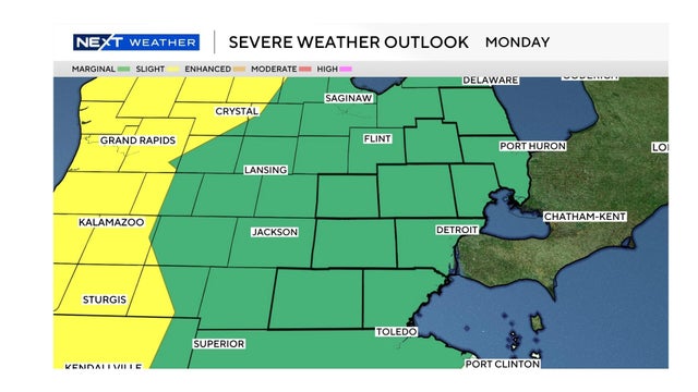
The weather conditions on Monday for Southeast Michigan could include damaging wind gusts and hail. The severe weather risk is higher on Tuesday.
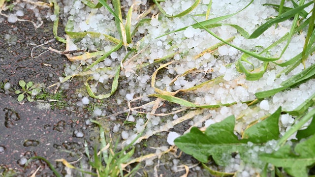
A marginal risk of severe weather exists Monday night with potential for large hail and gusty winds. Tuesday is a NEXT Weather Alert Day as the latest Storm Prediction Center Day 3 outlook shows a slight risk (2/5) for severe weather for all of lower Michigan.
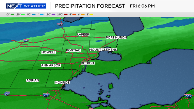
We are tracking a quick-moving spring system in Southeast Michigan that will bring some wet weather to wrap up the workweek.

Here's what to expect for the weather when the University of Michigan men's basketball team is honored with a parade and celebration on Saturday.