Southeast Michigan again at risk of severe thunderstorms for Thursday

Southeast Michigan isn't out of the woods just yet.
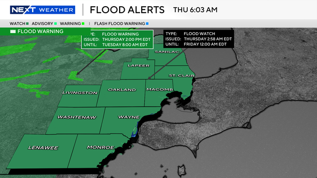
Following a tumultuous week of heavy rain and overnight severe weather, a flood watch remains in effect for all of Metro Detroit through late Thursday night. Alongside the ongoing threat of rising waters, an isolated risk for severe thunderstorms exists on Thursday as this stubborn weather pattern continues.
Most of Southeast Michigan has already been soaked with 1.5 to 4.5 inches of rain over the past week and a half. With the ground thoroughly saturated before the complete spring "green-up," the local soil simply cannot absorb much more water.
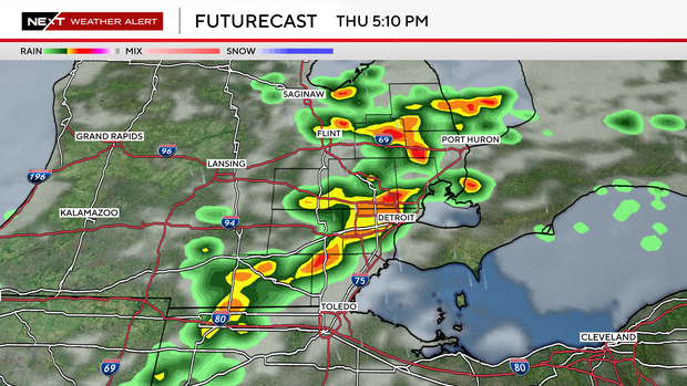
We expect an additional 1 to 2 inches of rainfall through Thursday night. However, if thunderstorms stall or "train" over the same locations, localized amounts could receive more.
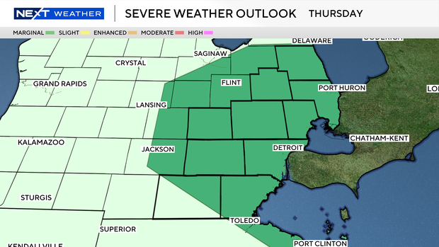
While widespread severe weather is not anticipated, the atmosphere remains conducive to strong pop-up storms. We once again have a risk for storms on Thursday, primarily in the afternoon hours.
Temperatures will remain unseasonably mild, topping out in the lower 70s, which will help fuel storms. Damaging winds and flooding remain the primary concerns for any storms that can form on Thursday.
The silver lining is that a much-needed dry spell is on the horizon. A strong cold front will finally sweep the weather out of the region by late Thursday night.
Conditions will dry out completely on Friday ahead of one final storm chance on Saturday.
Flooding safety reminders
Some quick reminders for you:
- Turn Around, Don't Drown: Never drive or walk through flooded roadways. It only takes a few inches of rapidly moving water to sweep a vehicle or person away.
- Stay Weather Aware: Ensure your phone is charged and have multiple ways to receive alerts, especially if storms escalate during the afternoon on Thursday.
- Check Your Sump Pump: Ensure your home's sump pump is functioning properly and the discharge pipe is directing water well away from your foundation.