Warm, springlike temperatures for Detroit Tigers Opening Day at Comerica Park
This year, we're heading for warmth with wind and even some sunshine breaking through the clouds.
Watch CBS News
This year, we're heading for warmth with wind and even some sunshine breaking through the clouds.
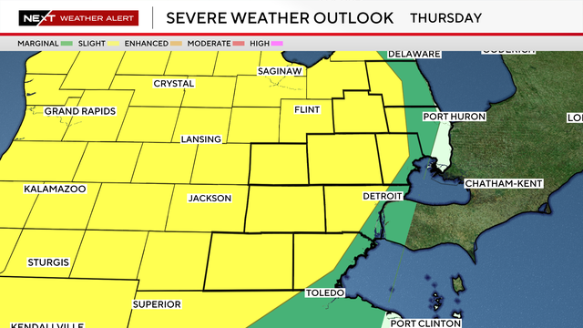
The greatest chance for storm development for Southeast Michigan will be in the evening into the late evening, when warmer air and an approaching system help fuel thunderstorm growth.
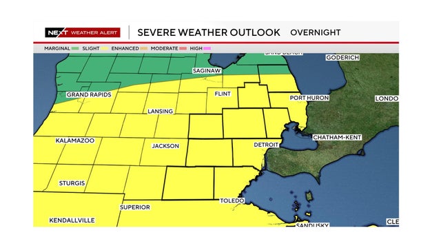
Scattered severe thunderstorms are possible Tuesday in Southeast Michigan, with damaging winds the primary concern, but also a potential for large hail and tornadoes.
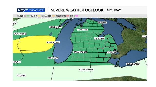
Southeast Michigan will see an increasingly severe weather threat from Monday night into Tuesday. Here's the forecast.
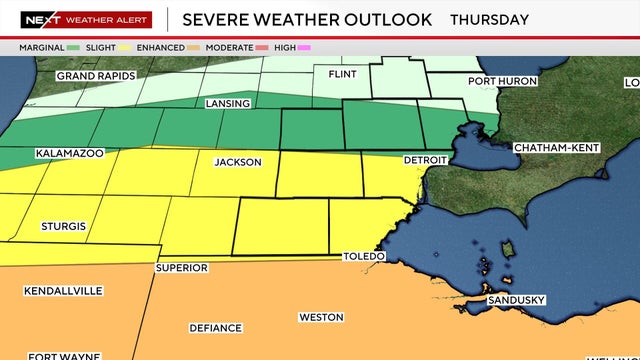
Large hail, straight-line winds and tornadoes all are possible Thursday in Southeast Michigan under a severe weather threat.
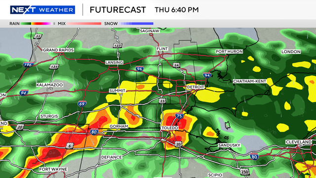
Southeast Michigan is bracing for a dramatic shift in weather on Thursday, as a strong cold front collides with unseasonably warm air, bringing the potential for severe thunderstorms to the region.

As temperatures gradually warm and plants begin to bloom, the vernal equinox symbolizes the transition from winter's dormancy to the vibrant growth of spring.
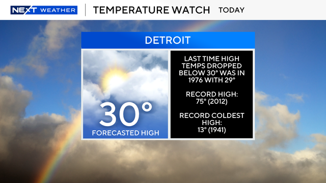
Metro Detroit can expect mostly cloudy skies on Tuesday, with a light snow shower or flurry possible.
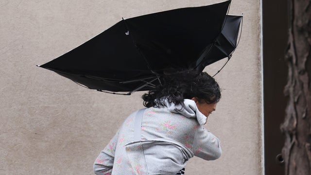
Hold onto your hats and your trash cans because Metro Detroit is in for another rough stretch of weather throughout Monday.
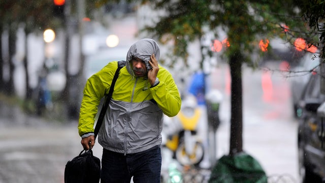
The CBS News Detroit NEXT Weather Team has declared Sunday as a NEXT Weather Alert Day due to expected high winds and thunderstorms.
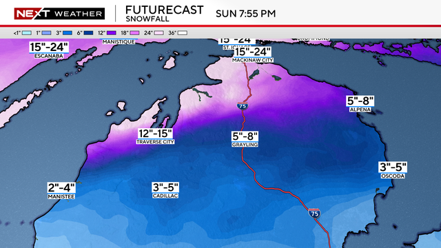
A sprawling, late-season winter storm is set to deliver a crippling blow to Michigan's Upper Peninsula and the northern Lower Peninsula starting Saturday night.
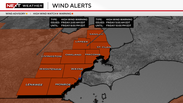
The National Weather Service in Detroit has issued a high wind warning for Friday across Southeast Michigan.
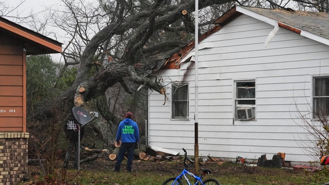
A string of tornadoes touched down in multiple states as severe weather stretched from Texas to Michigan.

A weather system that spawned tornadoes in multiple states has resulted in a flood watch for Metro Detroit on Wednesday.
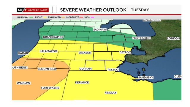
Strong to possibly severe thunderstorms are expected across Southeast Michigan, beginning Tuesday night.

Here's how to keep yourself and your family safe when tornadoes threaten Southeast Michigan.

Strong to possibly severe thunderstorms are expected across southeast Michigan Tuesday night into Wednesday as a powerful storm system moves through the Great Lakes.
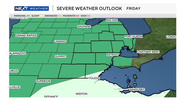
The National Weather Service has issued a marginal risk (Level 1 of 5) for severe weather across southeast Michigan for Friday night.
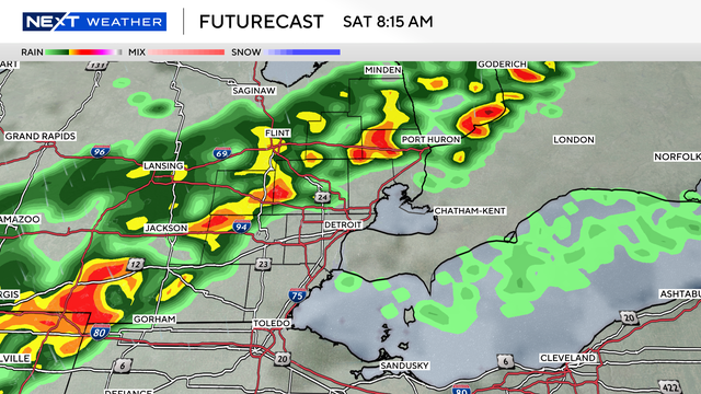
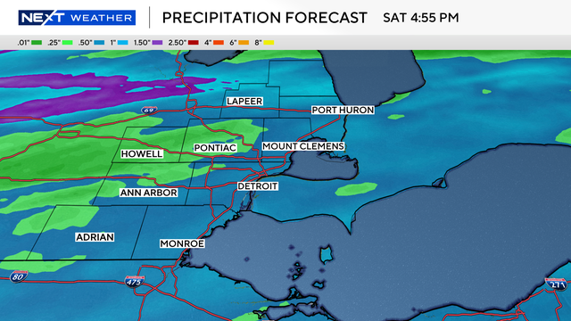
Metro Detroit is in for quite the ride as we head into the weekend.
South of the state line in Ohio, drought conditions are much stronger and more entrenched.

A dense fog advisory, with low visibility in some areas, has led to some school closings for March 4 in Southeast Michigan.

Whether Tuesday's lunar eclipse will be visible from Metro Detroit depends on the cloud cover and sunrise time.
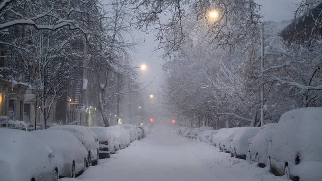
New York City, New Jersey, southern New England and coastal communities along the East Coast faced blizzard warnings and some of the biggest snowfall totals in years.
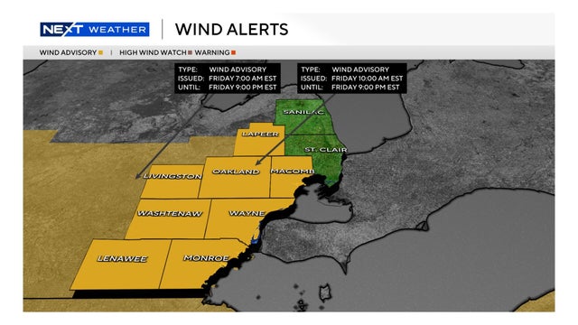
Southwest winds of 15 to 25 mph, gusting up to 45 mph, are in Metro Detroit's forecast for Friday, Feb. 20.
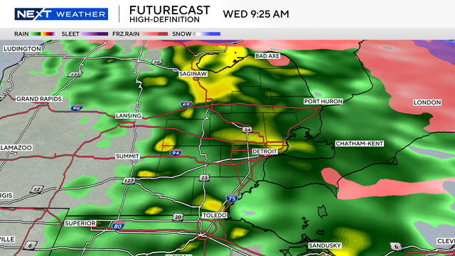
Highs are forecast to reach near 60 degrees, well above average for this time of year.